
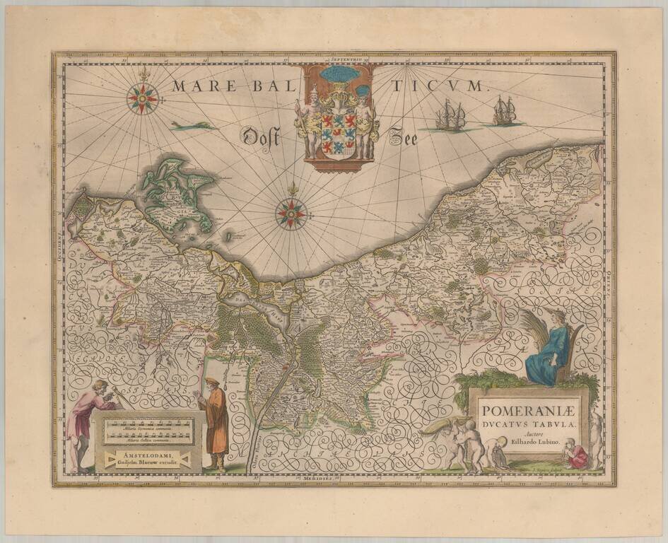
Blaeu's map of Pomerania. Decorative map of the area of Pomerania, in present day eastern Germany and Poland with considerable detail. An elaborate coat of arms of Pomerania is at the top center. A mileage scale, in German and French miles, is at the...
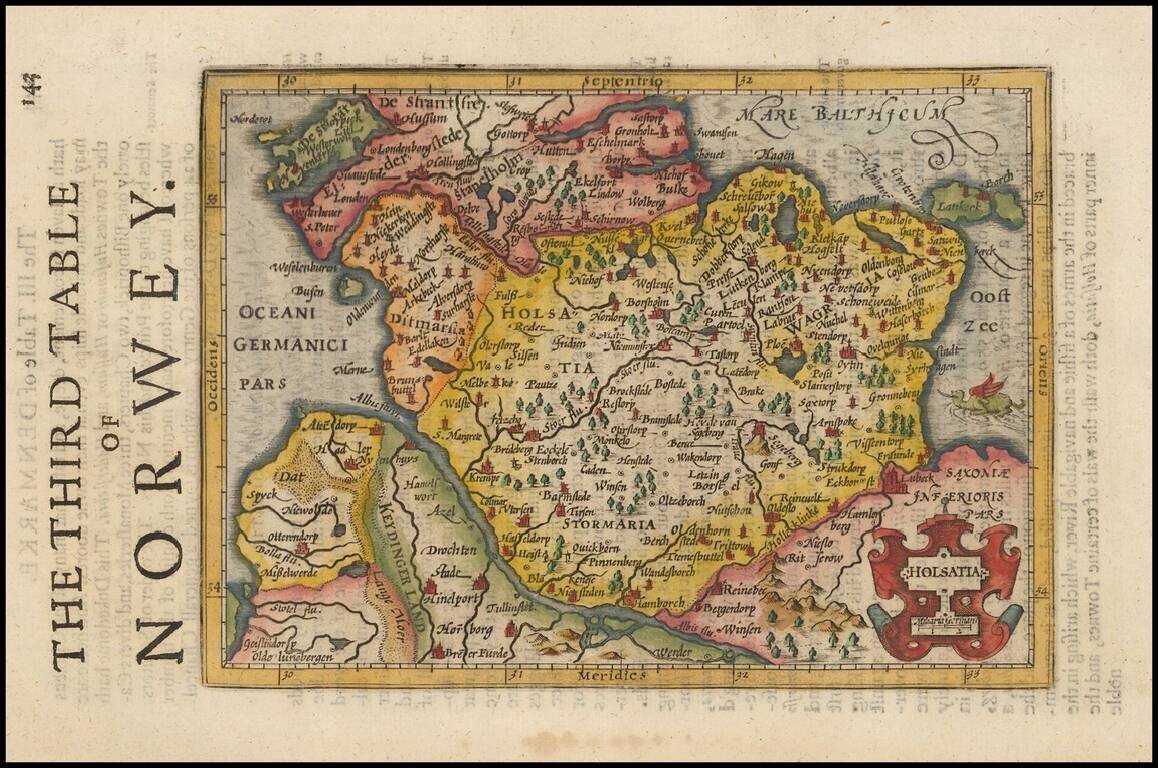
Decorative regional map of Northern Germany and part of Denmark (then Norway), showing Hamburg, Lubeck, etc. Decorative cartouche and a sea monster in the Baltic. From an English Edition of the Mercator-Hondius Atlas.
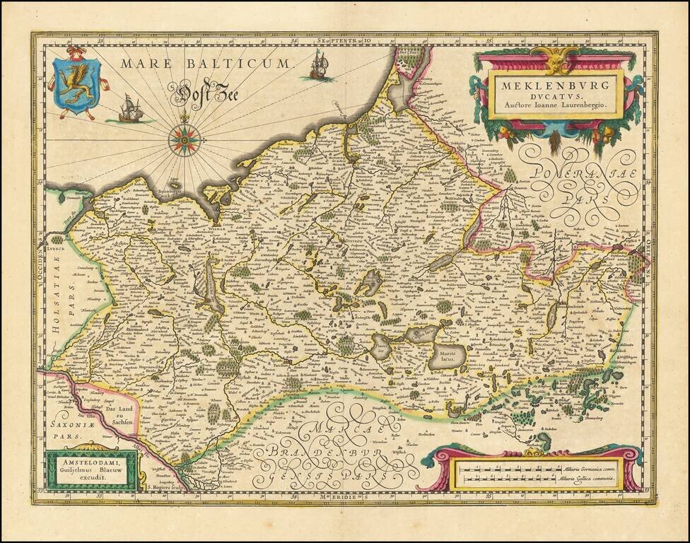
Beautiful example of Willem Janszoon Blaeu's map of the Dukedom of Mecklenburg in northern Germany on the Baltic Sea. Includes the cities of Rostock, Schwerin, Wismar, and Lake Muritz.
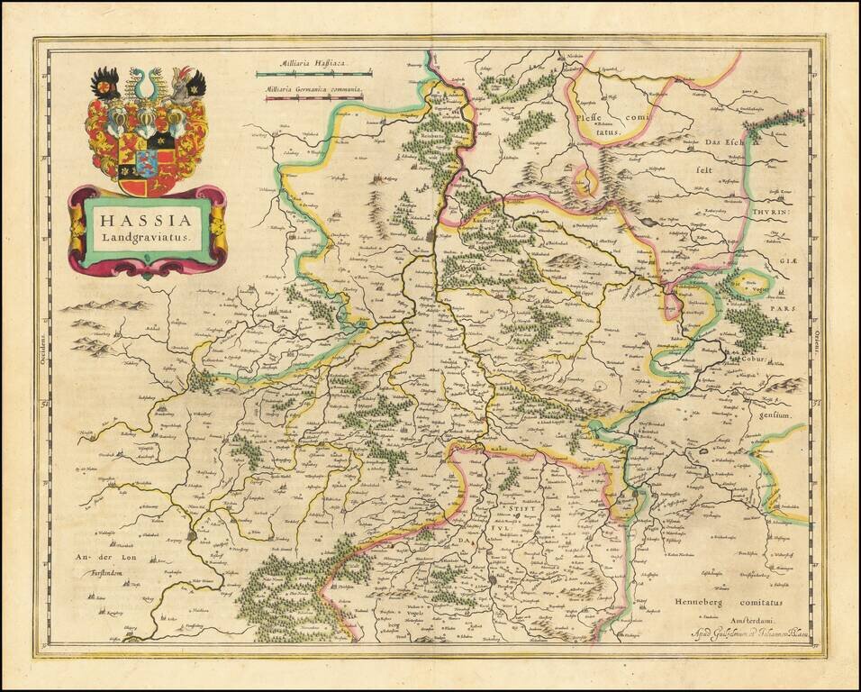
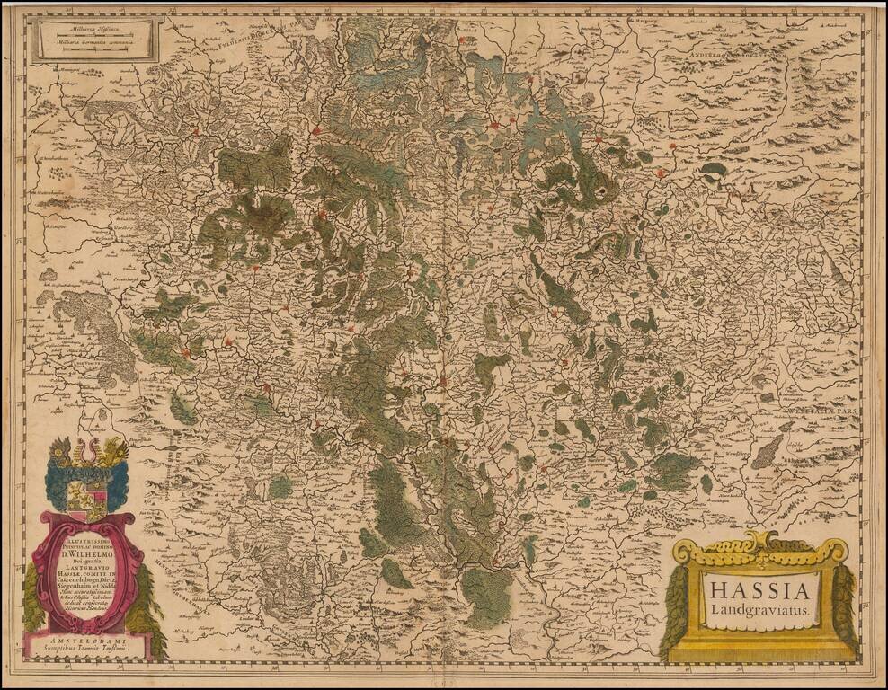
Antique engraved map of the Hesse region in Germany by Willem Janszoon Blaeu.
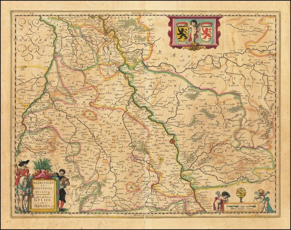
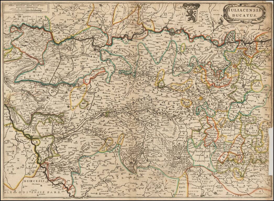
Antique engraved Blaeu map of the Duchies of Julich and Berg on the Rhine River. The city of Cologne is shown. Has the coats of arms of the two cities in the upper right corner.
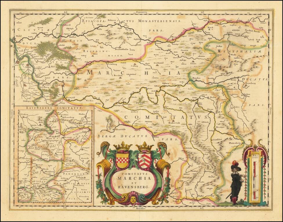
Fine old color example of Blaeu's map of Marchia and Ravensberg.
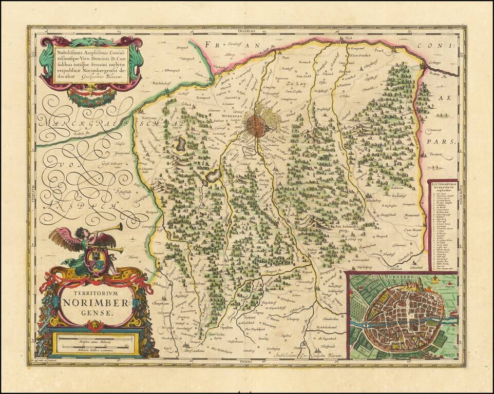
Attractive antique engraved map of the area around Nuremberg, Germany, with a nice inset of the city. Published by Blaeu in Amsterdam.
Decorative regional map of the Palatinate of Germany, from the Danube and north, including Nuremberg. Decorative cartouche with coat of arms.
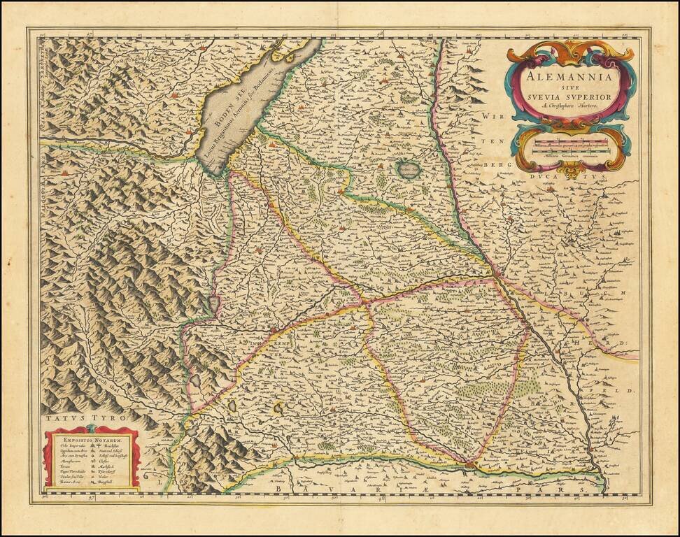
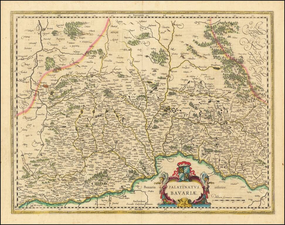
Antique engraved map of southwestern Bavaria, showing Augsburg and Ulm, as well as the Boden See. Shows the mountains of the Alps, local towns and villages, political boundaries, etc.
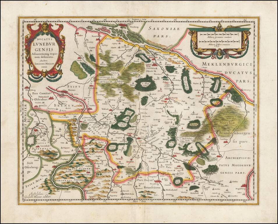
Striking full color example of Jansson's regional map. Extends from Hamburg to Wolfenbuttel, showing the lower Albis River. Bremen, Lunenborg, Nienborg, Brunswig, Magedburg and Oldenburg also appear on the map. Two decorative cartouches.
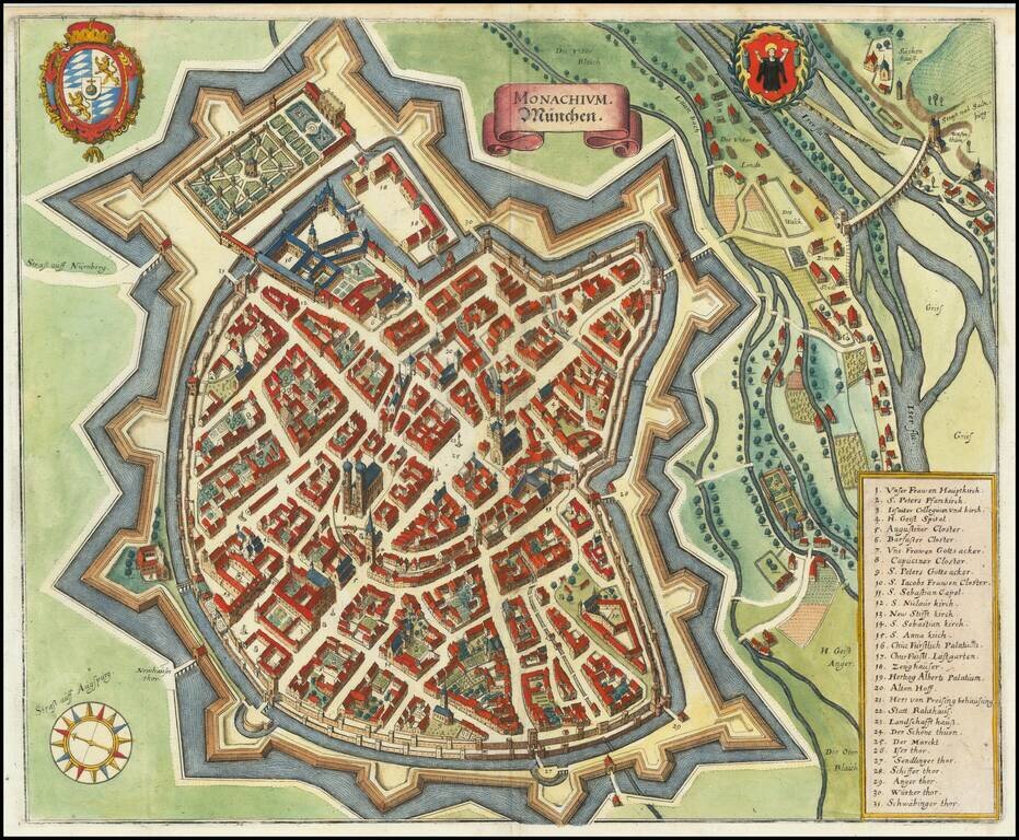
A detailed antique town plan of Munich, showing fortified walls, city gates, important public buildings, squares, and more. A key names thirty-one important places in Munich. The coats of arms of the city of Munich and of Bavaria are shown at the top...
Scarce regional map, centered on Cologne and tracking the course of the Rhine River. The map extends west to Maastricht.
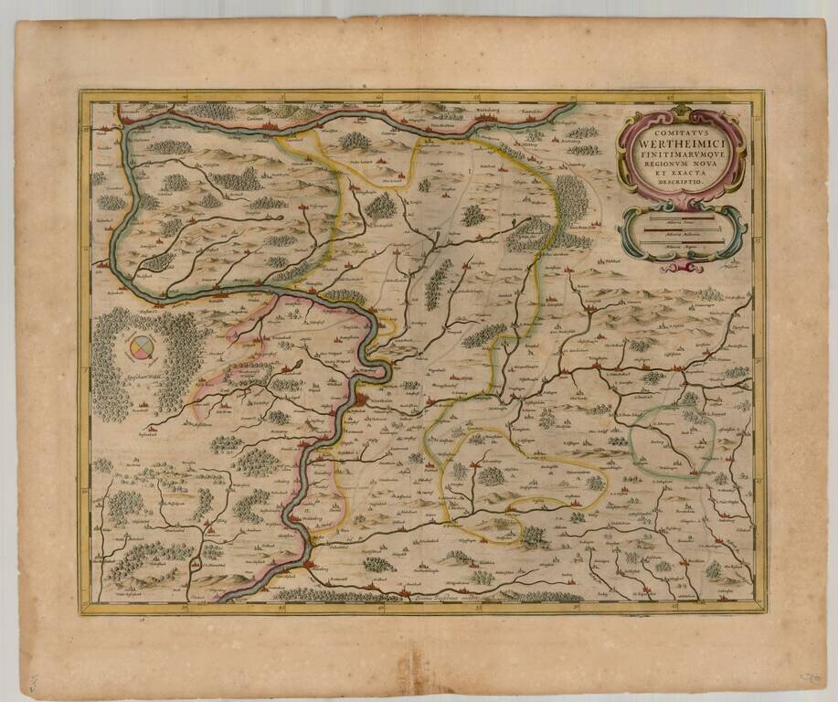
Detailed map of the Wertheim Region, publsiehd in Amsterdam. The map shows Wertheim, Wurtzberg, Carlstadt, Muhlenberg,
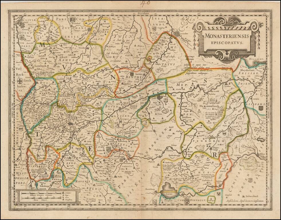
Detailed regional map of the Munster region of Germany, published by Jansson in Amsterdam. The map is centered on Munster and includes Osnabruck, Lingen, Wesel, Coevoerden (Netherlands), and Oldenberg. Includes numerous small coats of arms.
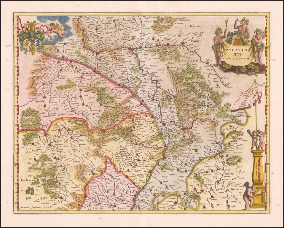
Antique map of Rheinpfalz Finely executed map of southwestern Germany and the Alsace, published by Jansson in Amsterdam. The map is centered on Heidelberg and includes Frankfurt, Mainz, Worms, Manheim, Kaiserslauten, Wiesbaden, Hannau, Offenbach,...