
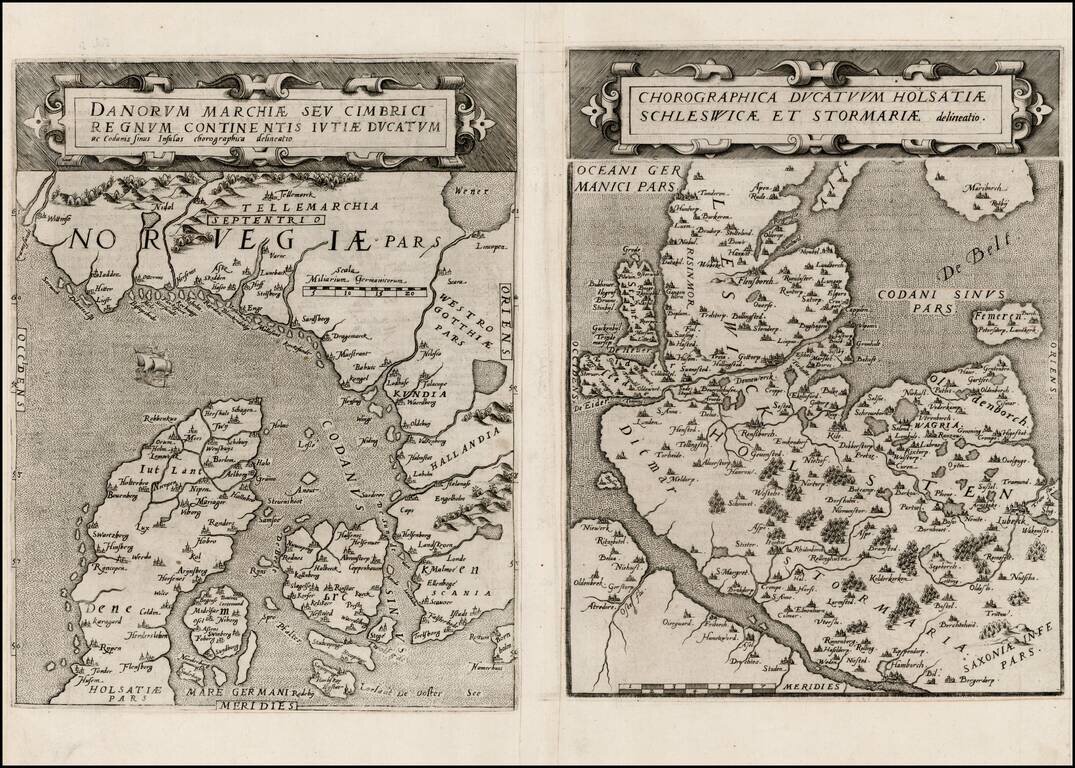
Rare pair of maps showing Norway and Denmark in one sheet and Denmark and Schleswig-Holstein in the second, from the second edition of De Jode's rare Speculum Orbis Terrae. While at first glance, the map appears somewhat similar to Ortelius's map of...
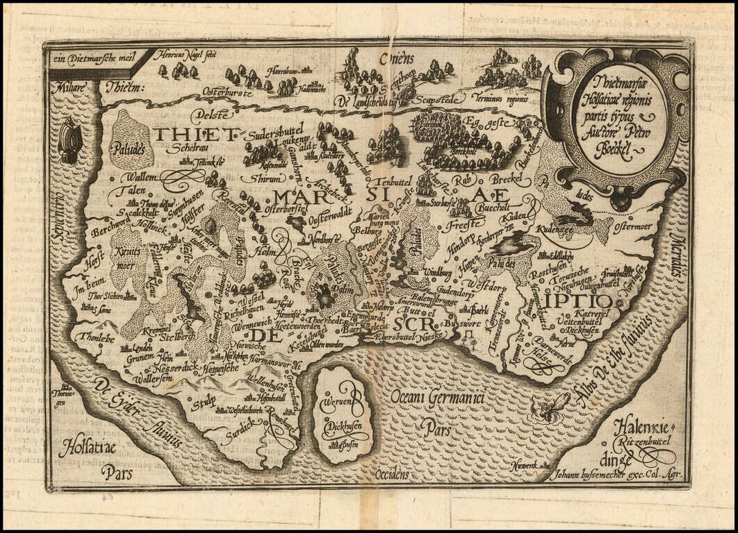
Nice example of this scarce map of part of the Holstein region in Northern Germany, published in Cologne. The present map was produced by one of the primary Cologne School mapmakers, Johann Bussemacher. The Cologne School of cartography, was perhaps...
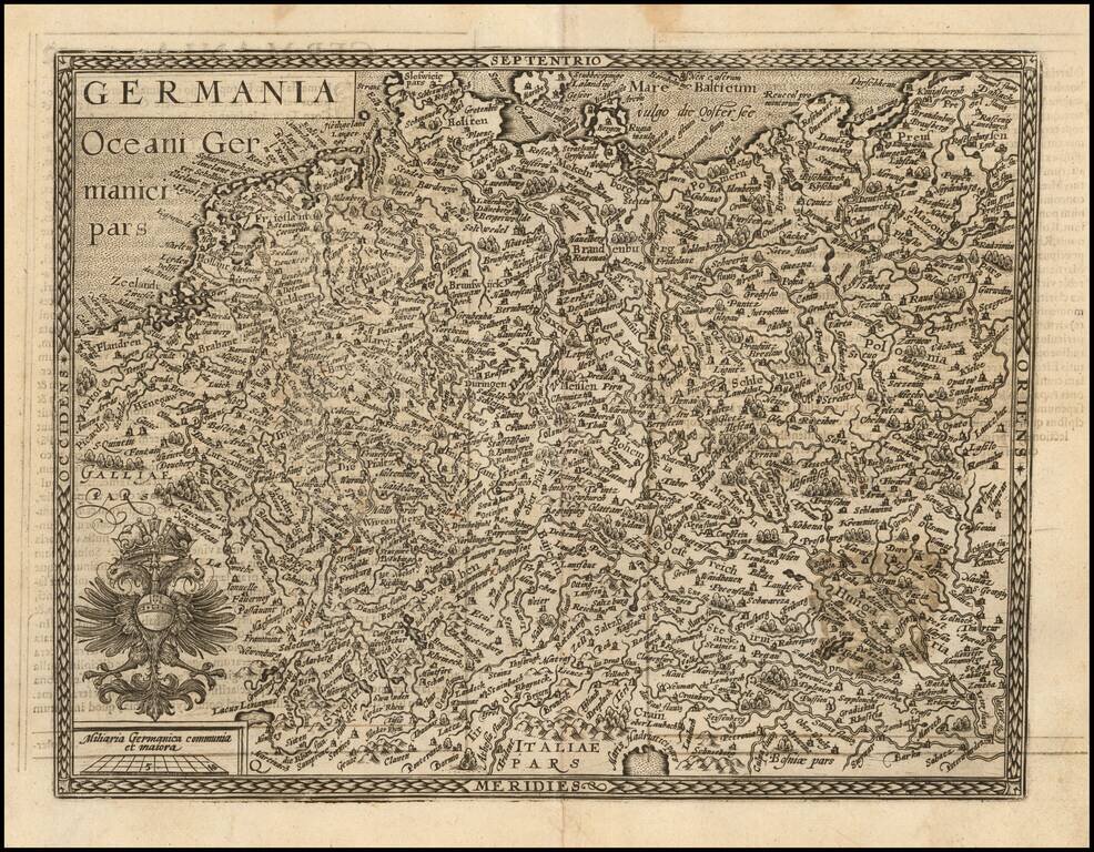
Nice example of this scarce map of the Holy Roman Empire, published in Cologne. The present map was produced by two of the primary Cologne School mapmakers, Johann Bussemacher and Matthias Quad. The Cologne School of cartography, was perhaps the only...

Nice example of this scarce map of the Palatinate of Bavaria, with vignette portrait of "Wilhemus D.G.", published in Cologne. Cities shown include Regensburg, Nuremberg, Ingolstadt, etc. The present map was produced by two of the primary Cologne...
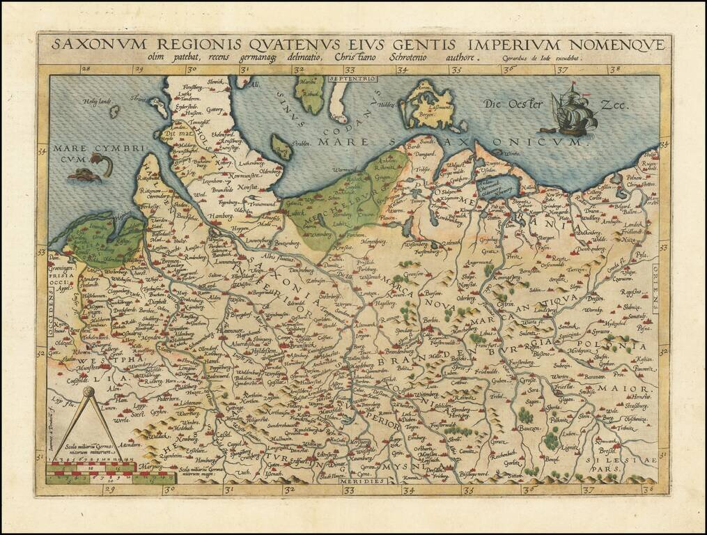
Fine old color example of Gerard de Jode's map of Northern Germany and Western Poland. The North Sea is adorned by a fish and the Baltic Sea by a sailing ship, and the borders of Schleswig-Posen-Dresden-Groningen are featured. The map is based on...

Rare first edition of Mercator's detailed regional map of Germany, originally published in the first edition (1595) of Mercator's atlas. Shows the Waldeck Region in central Germany.
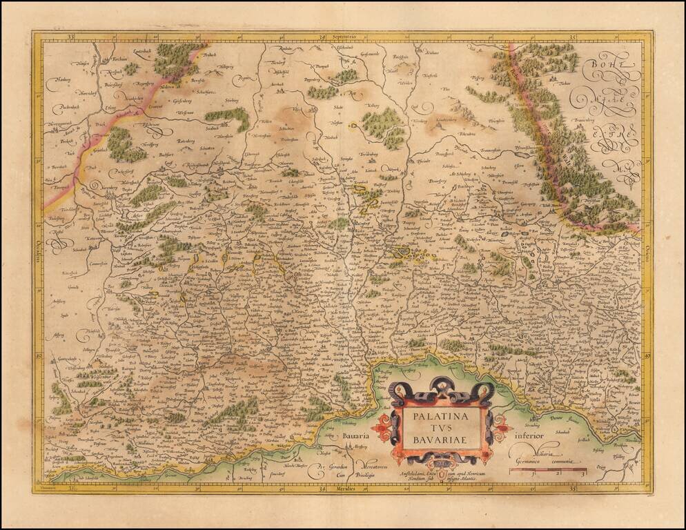
Nice example of the Mercator-Hondius map of the Bavarian Palatinate in Germany. The map follows the course of the Danube River across the bottom (centered on Regensburg). Nuremberg appears toward the upper left. Ingoldstadt is shown at the bottom...
![Turingiae Noviss Descript. Per Iohannem Mellinger Halens [with] Misniae et Lustaiae Tabula Descripta a. M Bartholomeao Sculteto Gorlit.](/map/small/61448.jpg)
Nice old color example of Ortelius' regional maps of Germany. The first map shows the regions of the Sala, Hel and Werra Rivers, from Hall, Merburg and Naumburg to Cruetzberg and Saltzungen, centered on Erfundt. The second shows the region centered...
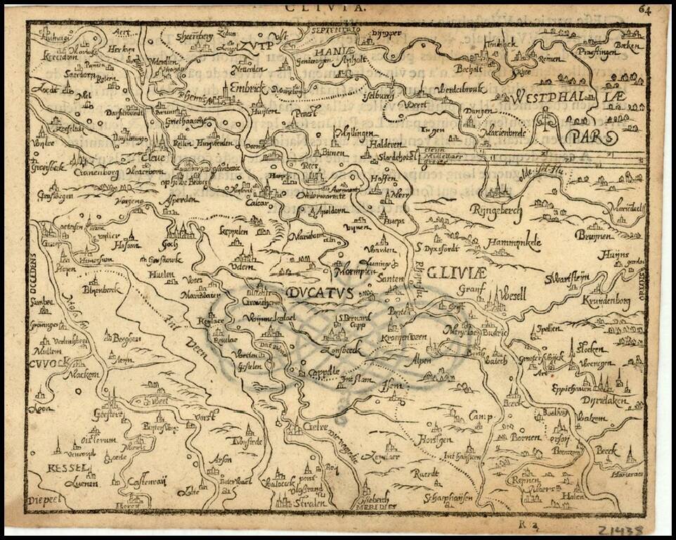
Rare 16th Century map of the Duchy of Cleve in Northwestern Germany, published by Zacharias Heyns in his rare Le Miroir du Monde, ou, Epitome du Theatre d'Abraham Ortelius, published in Amsterdam in 1598. Zacharias Heyns was the son of Peter Heyns,...
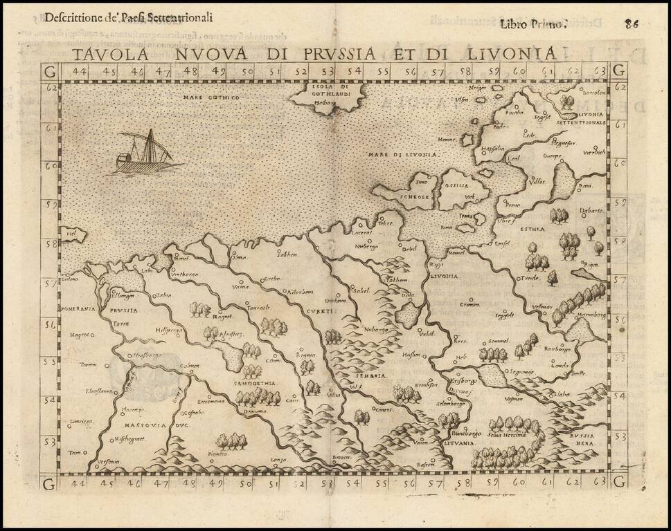
Nice example of the scarce third state Ruscelli's map of Poland, Lithuania and the Baltic Region. The map is bounded by the Vistula River and Prussia in the west, Livonia in the east, and Lithuania in the southeast. Centered on Riga and Vilna....
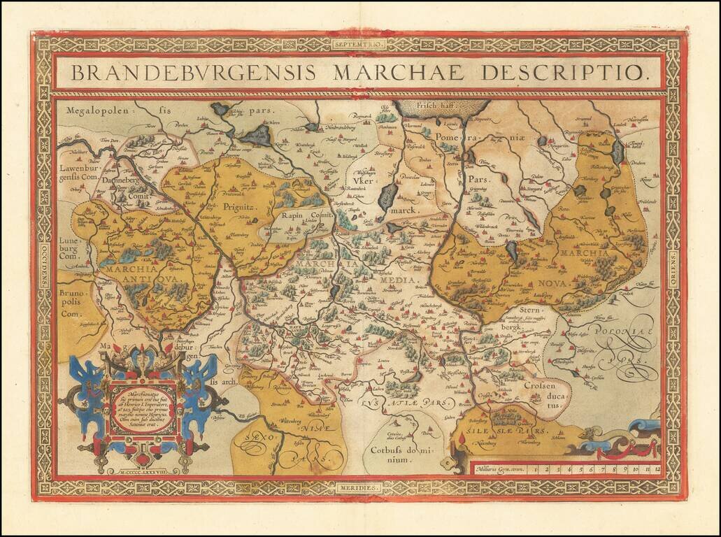
Fine old color example of Abraham Ortelius' map of the Brandenburg and Berlin regions. The map focuses on the Albis River and Oder River regions in Germany and extending to Silesia.
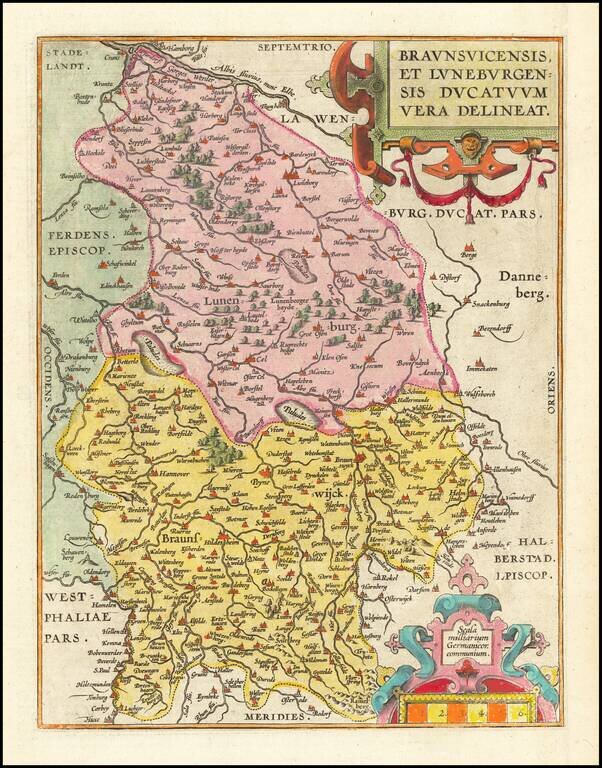
Fine old color example of Abraham Ortelius's map of the Duchies of Braunswick and Lunenburg. Large cities appearing on the map include Hanover, Luneburg, Wolfsburg, Brunswick, Peine, Wolfenbuttel and Hamburg. The map appeared in Ortelius's Theatrum...
![Thietmarsiae, Holsaticae Regionis Partis Typus [with] Oldenburg Comit.](/map/small/61510.jpg)
A nice full-color example of Ortelius' maps of a part of Schleswig-Holstein and Oldenburg, from his Theatrum Orbis Terrarum. Major towns shown include Oldenburg and Bremen. Abraham Ortelius Abraham Ortelius (1527-1598) was, along with Gerard...
![Daniae Regni Typus [with] Cimbricae Chersonese nunc Iutiae descriptio ..](/map/small/63315.jpg)
A nice full color example of Ortelius maps of Denmark and Jutland, along with Fiona, Alsen and Langeland. This is Ortelius' third map of Denmark, first issued in 1595. It shows many more details within Denmark and was improved cartographically as...
![[Mecklenburg-Vorpommern, Rugen, Bornholm, Lubeck, Sonnderborg,Svendborg, Zealand] Beschrijvinghe vant zuijder deel vande Belt, en hoemen de Custen van Mekeleborch Pomeren, met de Lande daer tegen over tusschen emeren en Bornholm geleghe besijlen en all](/map/small/61988.jpg)
Fehmarn Belt -- An Early Sailing Chart Rare sea chart of the Fehmarn Belt, a strait connecting the north coast of Germany and the island of Lolland off south coast of Denmark, oriented with south at the top, which appeared in Blaeu's Het Licht der...
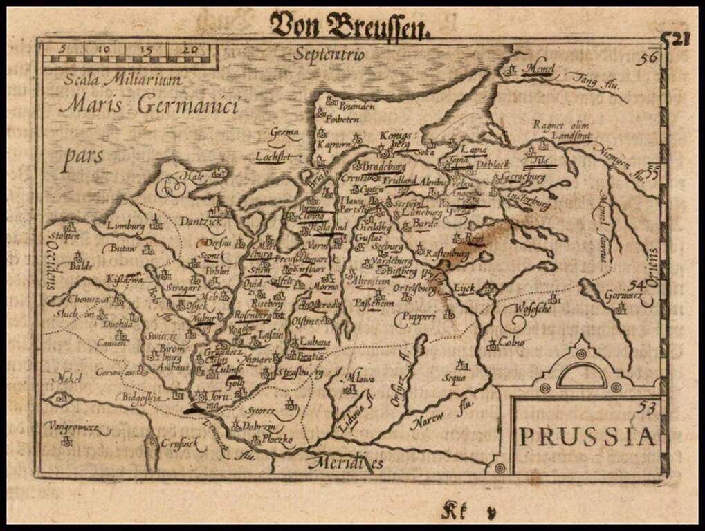
Nice example of this early state of Barent Langenes's map of Prussia, which first appeared in the 1598 edition of Langenes's Caert-Thresoor, published in Middelburg. The present map is one of the earliest obtainable maps to focus on Prussia....