
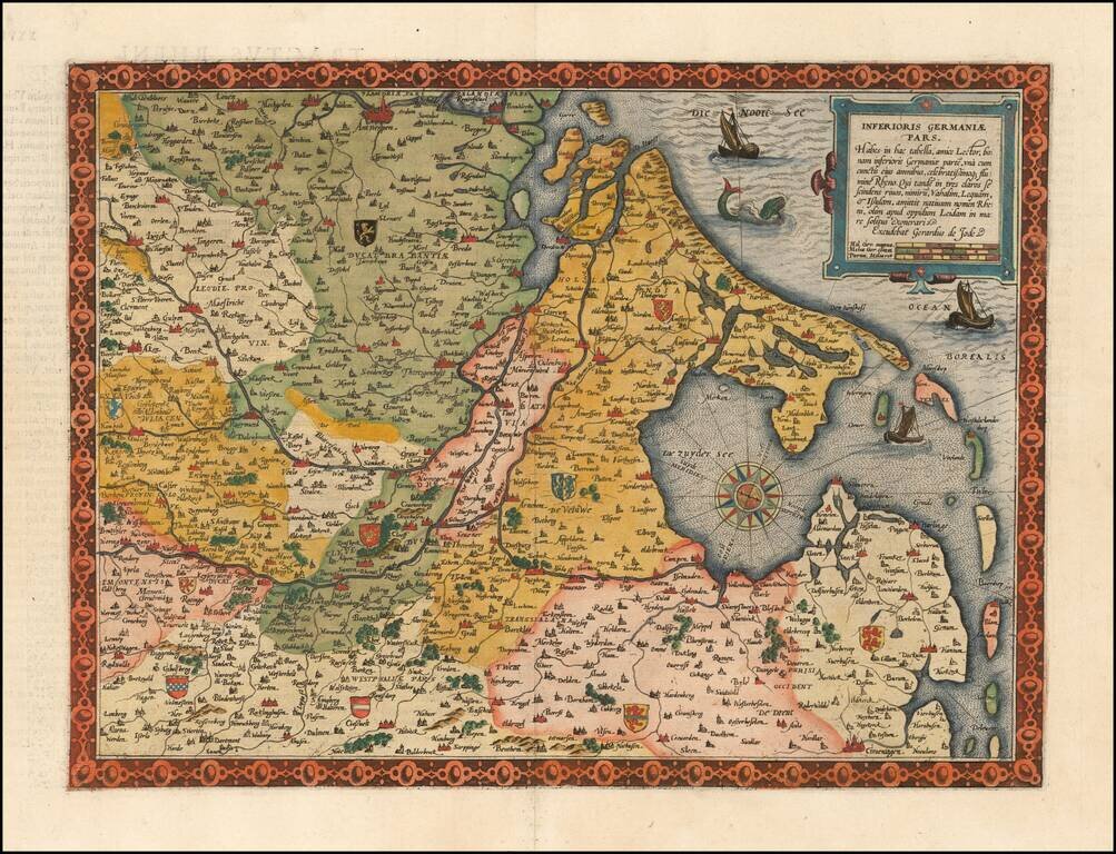
Flawless example of the first edition of De Jode's highly desirable map Germania Inferioris, from the first edition of De Jode's Speculum Orbis Terrarum. In the second, the title outside to top border was deleted. Covers the whole of the Northern...
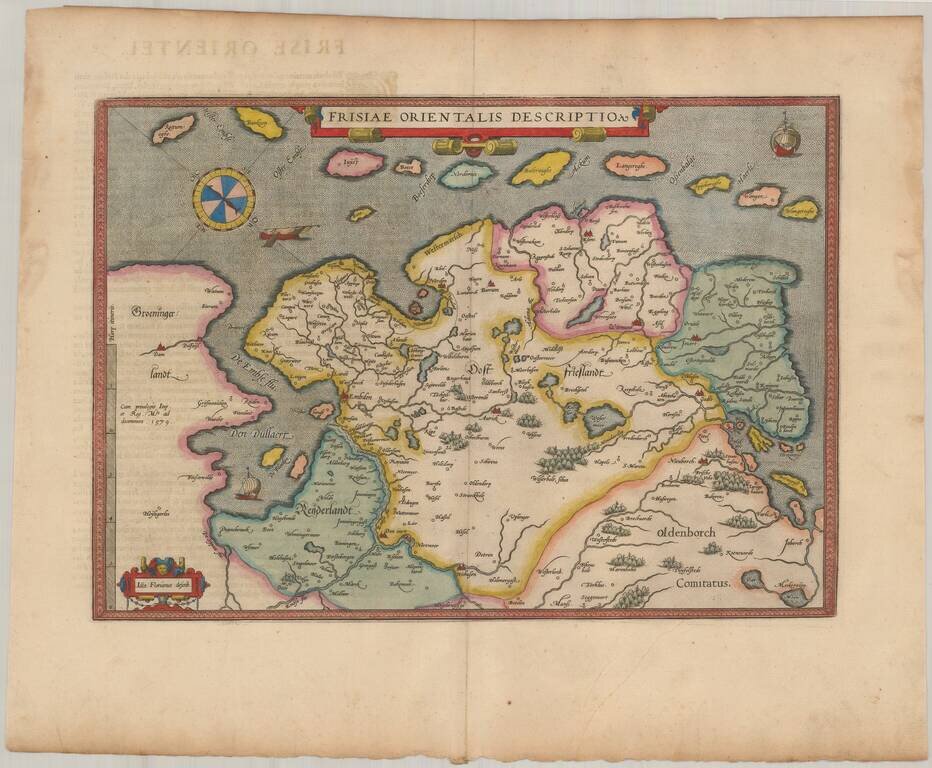
Nice example of Ortelius' map East Friesland, from his Theatrum Orbis Terrarum, the first modern atlas of the world. Includes a curious compass and three sailng vessels.
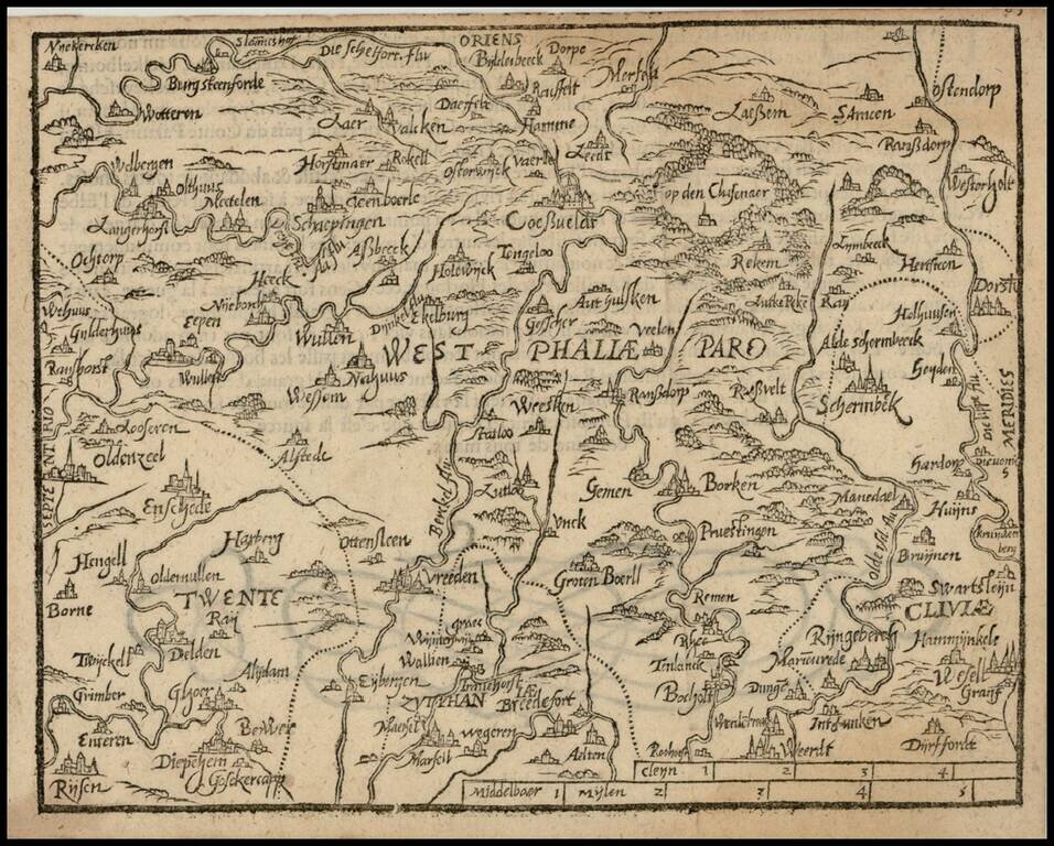
Rare 16th Century map of the region centered on Wesphalia, published by Zacharias Heyns in his rare Le Miroir du Monde, ou, Epitome du Theatre d'Abraham Ortelius, published in Amsterdam in 1598. Zacharias Heyns was the son of Peter Heyns, who wrote...
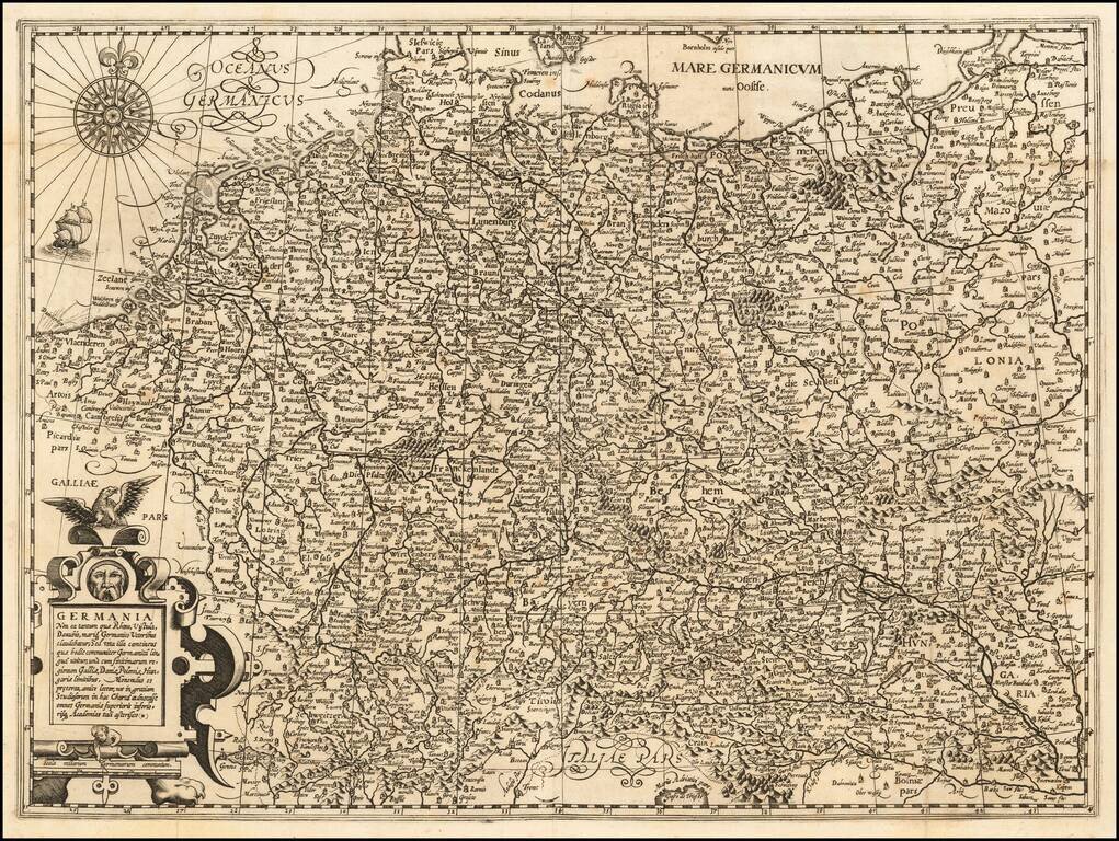
Rare map of the Holy Roman Empire, published in Paris by Jean Le Clerc. Le Clerc's map is based upon Willem Janszoon Blaeu's map of the same title, first issued in 1606, which includes town views across the top.
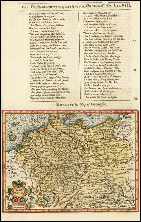
Decorative map of the German Empire, from the Low Countries to Prussia, Poland, Hungary, Austria and Switzerland. Decorative cartouche, sailing ship and coat of arms. From the 1625-26 edition of Purchas His Pilgrims, one of the seminal early 17th...
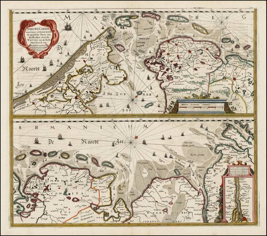
Nice example of Henricus Hondius' map of the Wadden Sea in two horizontal sections, published in Amsterdam. Interesting map of the major shipping routes between the Amsterdam and Hamburg in the Southern part of the North Sea. The map was first issued...
No Text on Verso! Rare edition of Blaeu's map of the German Empire, lacking text on the verso. The map includes the Netherlands, Germany, Switzerland, Austria, Bohemia, Moravia and Poland. This map is scarce, more so without text on the verso.
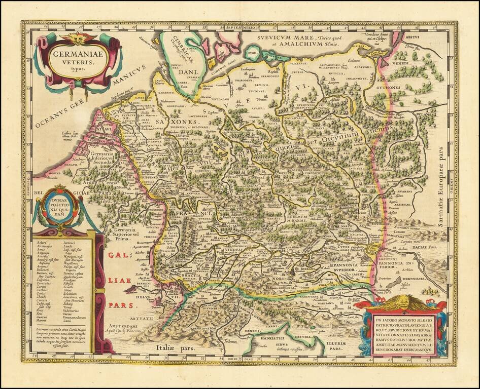
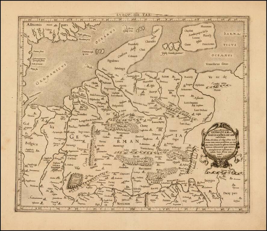
A Plethora of Anicent Place Names Striking example Blaeu's map of the Ancient German Empire in Northern Europe, based upon an earlier map by Ortelius. Extends from the Adriatic (Hadriatici Sinus) to the Baltic (Suevicum Mare) and the Vistula and...
Rare separately published map of the Rhine River, engraved by Verbiest. Originally printed in two sections, this example has been joined at an early date. As with all Verbiest maps, the map is extremely rare.
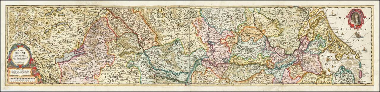
![[Course of the Rhine River] Nova Tractus Totius Rheni Oder Neue beschreibung des Rhein-Strom](/map/small/58670.jpg)
David Funck's Edition of the 1621 Wolfgang Kilian Map of the Rhine Fine old color example of David Funke's rare 2 sheet map of the course of the Rhine River, published in Nuremberg. The map extends from Basel at the far left to Dordrecht and the...
Attractive map of Denmark, Germany, Netherlands and Belgium, on the Ptolemaic model. Mercator originally published this map in his 1578 edition of Ptolemy's great Geography. The present example is the second edition of the map, first issued in 1698....
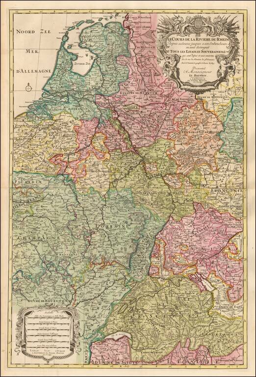
Detailed map the course of the Rhine River, extending from Switzerland to the North Sea. Fine old color and a decorative cartouche.
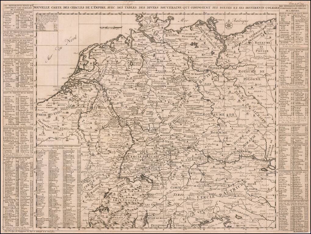
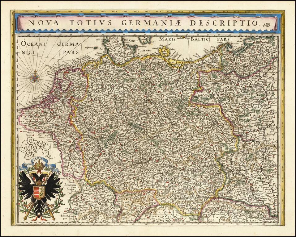
A very detailed map of the German Empire with a list of it's important cities and nobility in tables at the sides. This handsome copper engraved map includes today's Poland, Germany, Switzerland, Austria, Holland, Belgium and Luxembourg.
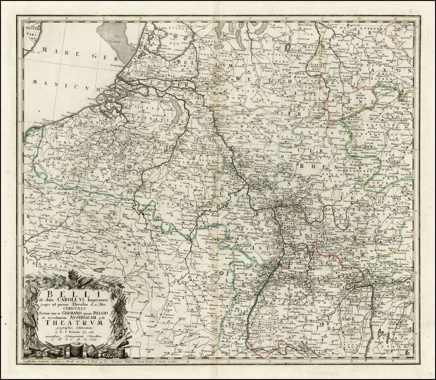
Interesting map of a part of the Theater of War in Europe, celebrating the signing of the Treaty of Dresden, on December 25, 1745. The Treaty of Dresden was signed on December 25, 1745 at the Saxon capital of Dresden between Austria, Saxony and...
![[Napoleon's Battles in France, Belgium Netherlands, Luxembourg, Germany] No. 1 Frontiere du Nord. Mesny 5.](/map/small/60727.jpg)
Finely executed manuscript map of the Theater of War in Northwestern Europe, illustrating various battles, some with dates. The maps are printed on hand made paper with a large elaborate watermark D & C Blauw, the paper of the iconic Blaeu firm,...
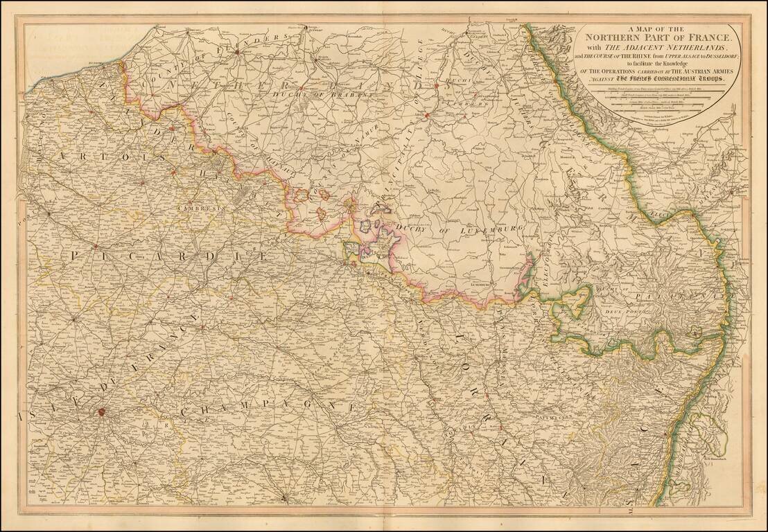
William Faden's large format map of Northern France, Luxembourg, Belgium and western Germany, showing the Theater of War between the Austrian and French Troops. A number of roads are shown. One of the most detailed English language maps of the region...