

Nice old color example of Ortelius' regional map of Germany, showing the Fuld region, with decorative cartouche, compass rose, etc. From Ortelius' Theatrum Orbis Terrarum, the first modern atlas of the World. Half of two sheet map.
![[Weimar, Erfurt, Jena, Fuld, Gotha ] Weimaria / Iena . . . / Erdfordia . . . / Gotha . . . / Fuldensis . . .](/map/small/58637mp2.jpg)
Important early views of the German Cities of Weimar, Erfurt, Jena, Fuld and Gotha, which appeared in Braun & Hogenberg's Civitatis Orbis Terrarum, the most important collection of city views and plans published in the 16th Century.
![Pomeraniae, Wandalicae Regionis Typ [with] Livoniae Nova Descriptio [with] Ducatus Oswieczensis, et Zatoriensis, Descriptio](/map/small/43172.jpg)
Finely colored example of Ortelius' maps of Pomerania, Latvia and part of Southern Poland above the Carpathian Mountains, from Ortelius Theatrum Orbis Terrarum.
![Hassiae Descriptio . . . [with] Holsatiae Descrip.](/map/small/46478.jpg)
Nice pair of regional maps of Germany, including decorative cartouches, etc. The Hassiae map extends to the Rhine and shows Frankfurt, and extends up to the Werra and Fulda Rivers. The Holsatiae map extends from Hamburg and Louwenburg in the south to...
![Thietmarsiae, Holsaticae Regionis Partis Typus Auctore Petro Boeckel [with] Prussia Descriptio ante aliquot annos ab Henrico Zellio ab coque D. Ioanni Clur. civi Gedanesi Ded:](/map/small/45904.jpg)
Ortelius’ Maps of Prussia and Holstein, from the First Modern Atlas Fine maps of Prussia and Holstein, printed on the same plate, that featured in Ortelius’ famous and groundbreaking atlas Theatrum Orbis Terrarum. The map on the right shows...
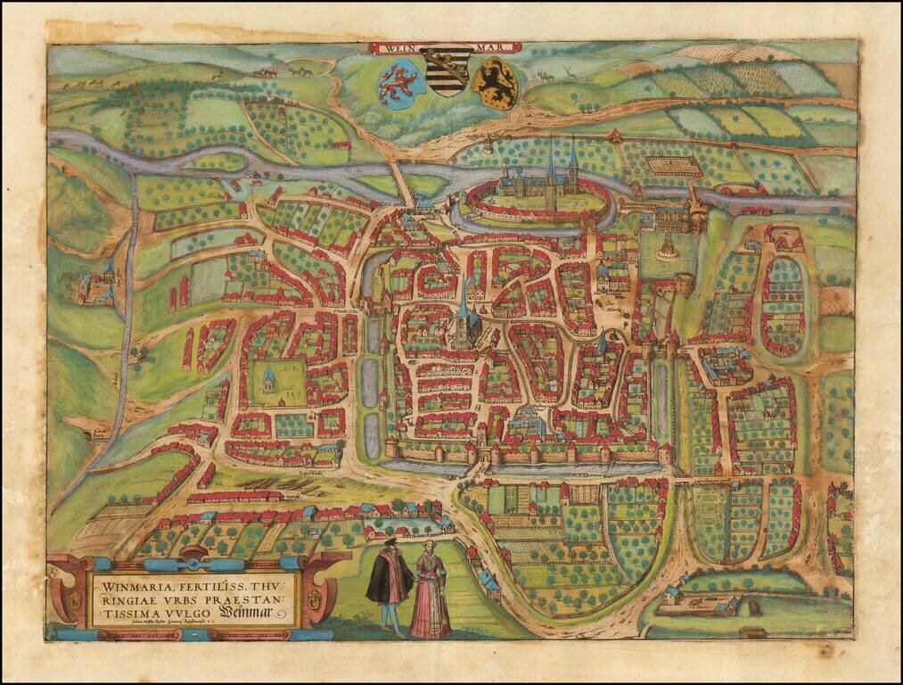
Old color example of Braun & Hogenberg's important early view of Weimar, crediting Johan Wolfius, Rector of the Gymnasium at Ratisbona (Regensburg).
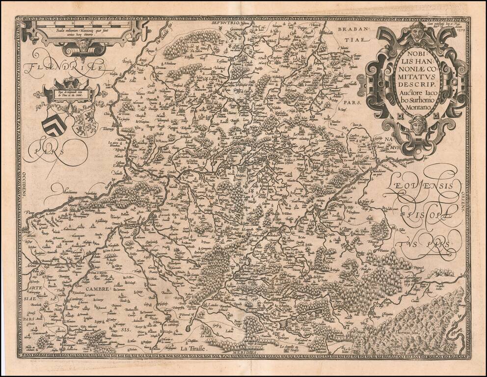
Striking example of Ortelius' map of Hannonia (Hainaut), with ornate cartouches, two coats of arms, etc. Includes the cities of Charleroi, Mons, Ath, Tournay, Valenciennes, Maubeuge, etc. Nice dark impression and wide margins.
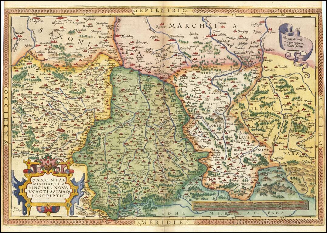
Nice example of Ortelius' regional map of Germany, extending from Prague to Berlin and Brandenberg, and from Mulhausen and Erpach to Goltberg, Sagan, Furstenberg, Leipzig and Frankfurt am Oder. Wide margins and nice old color. From the 1581 French...
![[Aachen] Aquisgranum, vulgo Aich, ad Menapiorum Fines, Perantiqua Imperii Urbs . . . MD LXXVI](/map/small/42127mp2.jpg)
Important early view of Aachen, which appeared in Braun & Hogenberg's Civitatis Orbis Terrarum, the most important collection of city views and plans published in the 16th Century. This detailed plan of Aachen shows the city surrounded by the...
![Daniae Regni Typus [with] Oldenburg Comit.](/map/small/49941.jpg)
A nice full-color example of Ortelius' maps of Denmark and Oldenburg, which first appeared in the 1584 edition of his Theatrum Orbis Terrarum. This is the second of Ortelius' maps of Denmark. It shows many more details within Denmark and was improved...
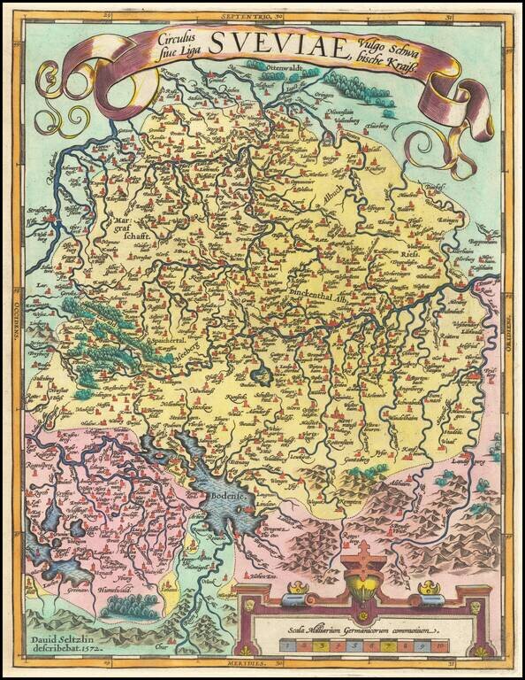
Fine old color example of Ortelius' regional map of Swabia, bounded by the Bodensee, Rhein and Augsburg, centered on the Donau (Danube) River. From Ortelius' Theatrum Orbis Terrarum, the first modern atlas of the World.
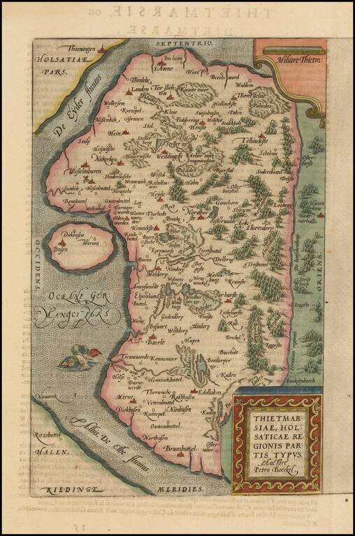
A nice full color example of Ortelius's regional map of the region known as Dietmarschen in Schleswig Holstein, at the mouths of the Elbe and Eider rivers, including Brunsbuttel and Meldorf. This map appeared in Abraham Ortelius's Theatrum Orbis...
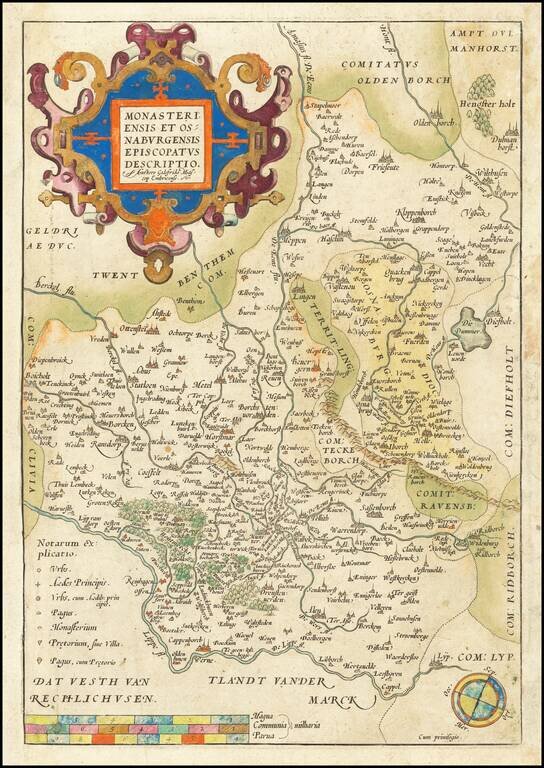
Decorative example of Ortelius' map showing the region north of the Lippe River, centered on Munster. A nice old color example.
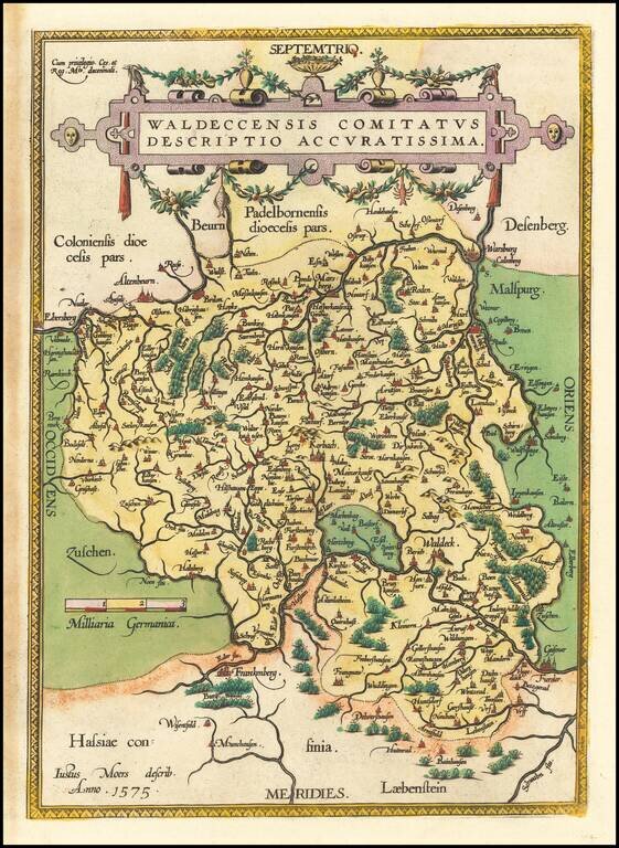
Nice example of Ortelius' regional map of the Waldeck region, with decorative cartouche, compass rose, etc. From Ortelius' Theatrum Orbis Terrarum, the first modern atlas of the World.
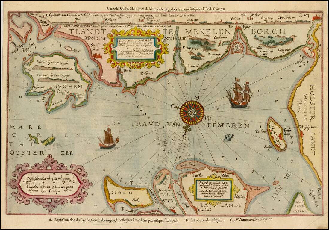
Striking example of the scarce French edition of Waghenaer's sea chart showing the coastlines of Northern Germany and Denmark. The chart includes the modern cities of Greifswald, Stalsund, the island of Rugen, Barth, Wismar, Rostock, and Lubeck and...
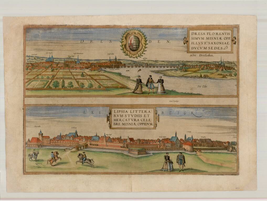
Nice old color example of Braun & Hogenberg's views of Dresden and Leipzig. From Braun & Hogenberg's Civitatus Orbis Terrarum, the most important book of town plans and views published in the 16th Century.