Map size in jpg-format: 23.3787MiB
Click to open in high resolution (open in new tab).
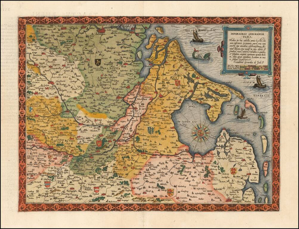
Flawless example of the first edition of De Jode's highly desirable map Germania Inferioris, from the first edition of De Jode's Speculum Orbis Terrarum. In the second, the title outside to top border was deleted.
Covers the whole of the Northern Netherlands, Belgium to the west as far as Leuven and Antwerp and part of the German Rhine area and of Westphalia. The interior of the map is embellished with a number of coats of arms, a decorative compass rose, a sea monster and 3 sailing ships.
De Jode was a contemporary of Ortelius. His Speculum Orbis did not enjoy the same commercial success as Ortelius, making his maps very scarce and highly desirable. This is one of the maps which was likely engraved by Gerard De Jode and bears his signature in the title block. The map was originally engraved in about 1569.
If you are a student, write to us in telegram: @antiquemaps and indicate what material you need and for what work you need a map in high detail. We are ready to provide material on special terms. For students only!


