
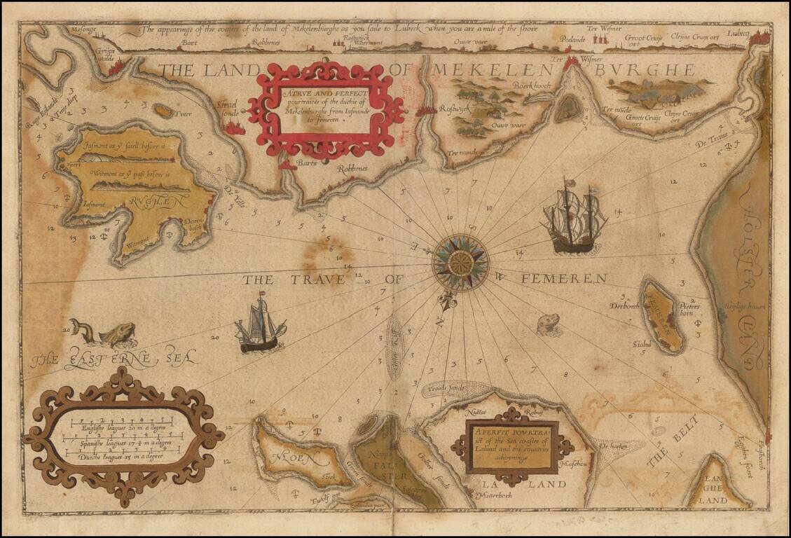
Striking example of the scarce English edition of Waghenaer's sea chart showing the coastlines of Northern Germany and Denmark. The chart includes the modern cities of Greifswald, Stalsund, the island of Rugen, Barth, Wismar, Rostock, and Lubeck and...
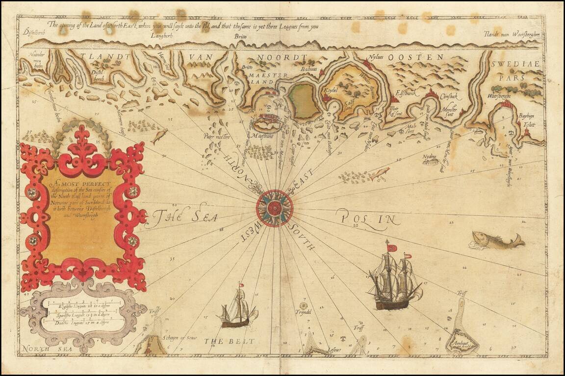
Rare English Waghenaer Map of Southwestern Swedish Coastline Old color example of this scarce English edition of Waghenaer's sea chart showing the coastlines of Sweden, centered on Marstrand and the coastline west of Gothenberg. The chart is oriented...
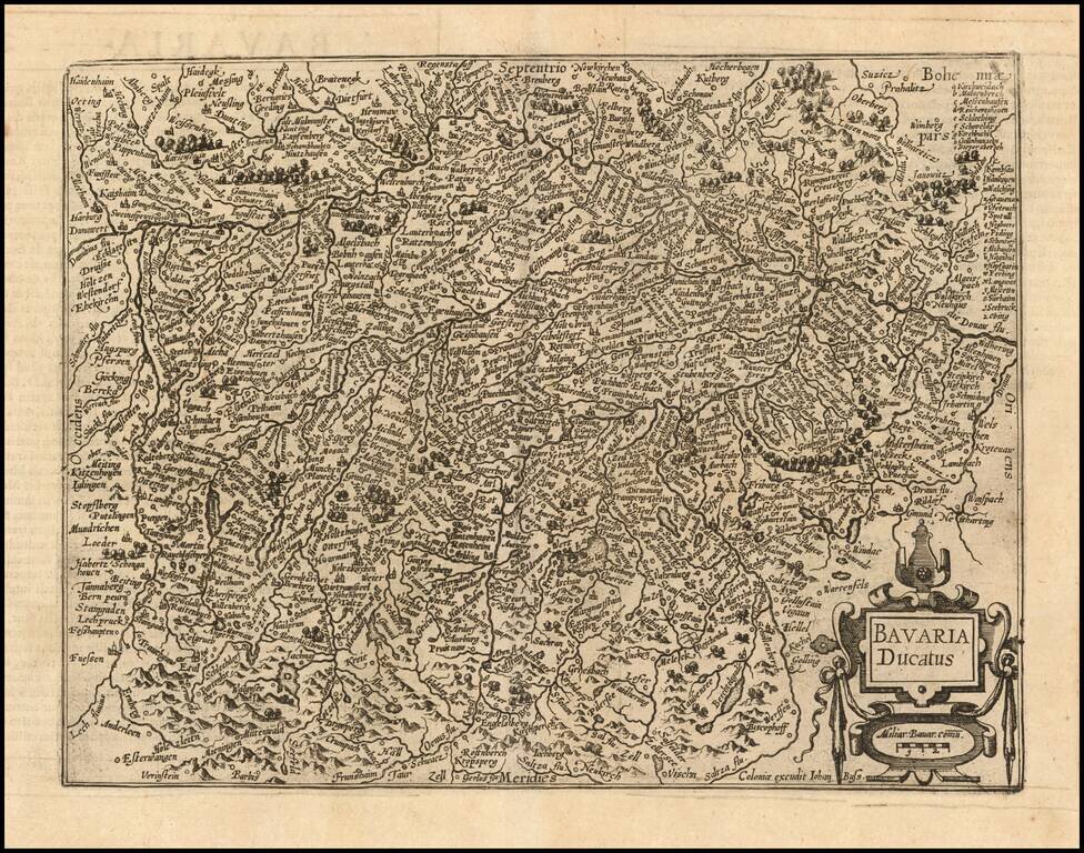
Nice example of this scarce map of the Duchy of Bavaria, published in Cologne. Cities shown include Munich, Passau, Ingolstat, Augsburg, etc. The present map was produced by two of the primary Cologne School mapmakers, Johann Bussemacher and...

Detailed map of Franconia, oriented with south at the top, published in Cologne. Cities shown include Bamberg, Nuremberg, Fulda, Frankfurt, Includes a portrait of Julius of Würzburg and heraldic shield in the lower corners. The present map was...
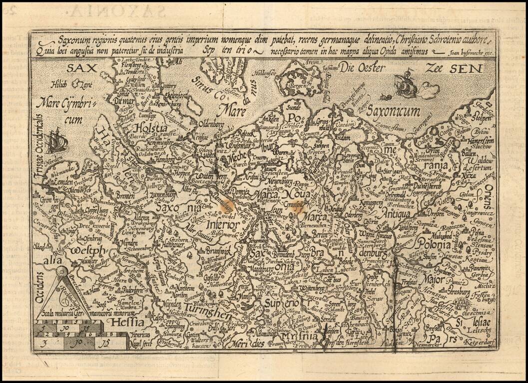
Detailed map of the north part of Germany from Westfalia to Poland. The map is centered on Saxonia Superior. Evidence of an old plate break. The present map was produced by two of the primary Cologne School mapmakers, Johann Bussemacher and...

Detailed map of the area centered on Meissen. Includes Dresden, Leipzig, Erfurt, and extending south to Prague. The present map was produced by two of the primary Cologne School mapmakers, Johann Bussemacher and Matthias Quad. The Cologne School of...

Detailed map of the north part of Germany, incluiding Brandenburg and Pomerania. Includes a portrait of Johan Georg of Brandenburg (1525 – 1598) Prince-elector of the Margraviate of Brandenburg (1571–1598) and a Duke of Prussia. The present map...

Detailed map of the Cleve region of Germany. Centered on the Maas and Rhein Rivers, Dusseldorf is at the bottom right corner and Nijmegen in the Netherlands at the top right. The present map was produced by two of the primary Cologne School...

Detailed map of the North Rhine-Westphalia region of Germany. Centered on the Maas and Rhine Rivers. Dusseldorf is at the top right corner and Cologne and Bonn are toward the bottom right, with the Maas River and the Dutch border to the left. The...
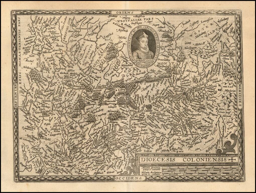
Detailed map of the Cologne region of Germany. Centered on the Rhine River with east at the top. Major cities shown included Cologne, Dusseldorf, Duisburg, and Wessel The present map was produced by two of the primary Cologne School mapmakers,...
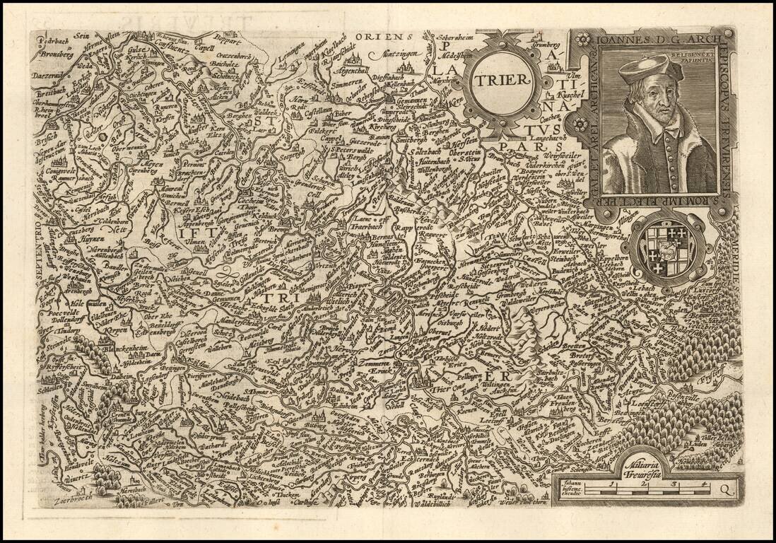
Nice example of this scarce map of Trier region, oriented with east at top of the map. The present map was produced by two of the primary Cologne School mapmakers, Johann Bussemacher and Matthias Quad. The Cologne School of cartography, was perhaps...
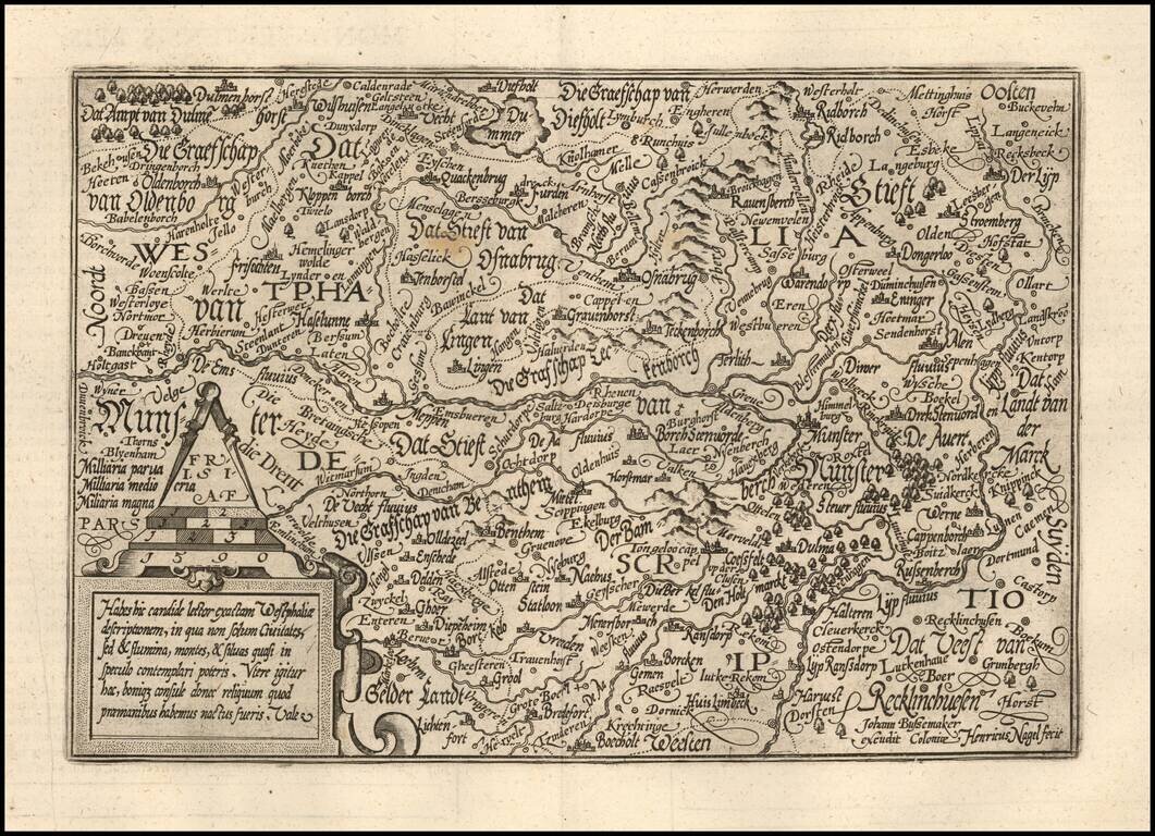
Detailed map of the Westfalia region, oriented with east at the top. Includes Munster, Osnabruck, Meppen, etc. The present map was produced by two of the primary Cologne School mapmakers, Johann Bussemacher and Matthias Quad. The Cologne School of...
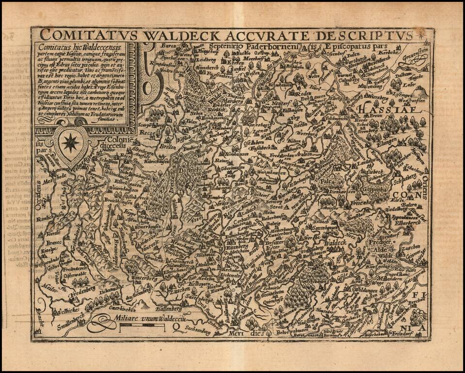
Detailed map of a part of the eastern section of Germany, centered near Mullhausen in Thuringa, with Waldeck in the southeastern corner. The present map was produced by two of the primary Cologne School mapmakers, Johann Bussemacher and Matthias Quad....
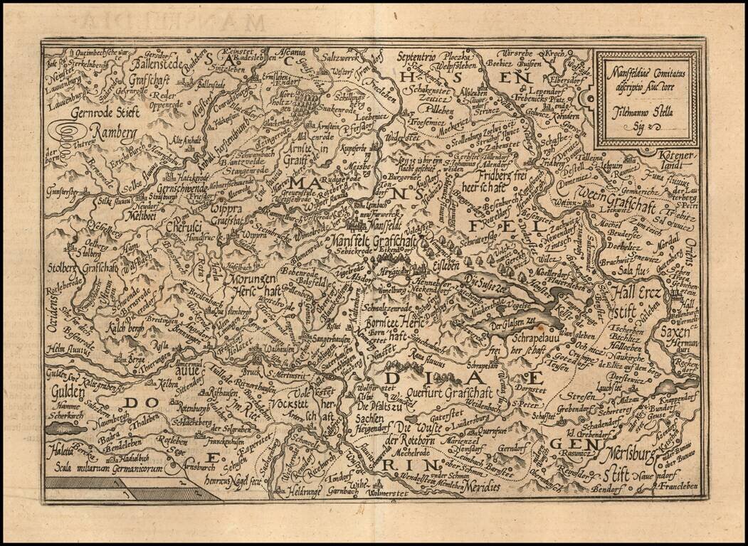
Detailed map of the region centered on Mansfeld. The present map was produced by two of the primary Cologne School mapmakers, Johann Bussemacher and Matthias Quad. The Cologne School of cartography, was perhaps the only group of mapmakers competing...
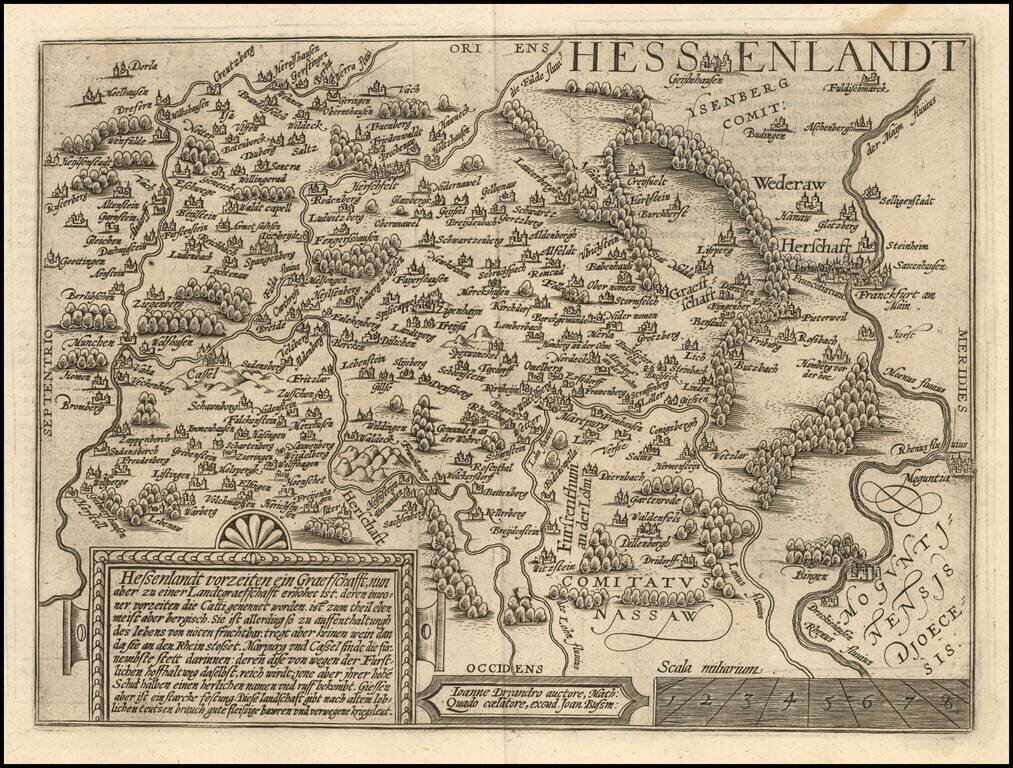
Fine map of the Hesse region of Germany, oriented with East at the top. Marburg is near the center of the map. Frankfurt on the Main River at the far right of the map. The present map was produced by two of the primary Cologne School mapmakers,...

Detailed map of the Westfalia region, oriented with east at the top. The Weser River is at the eastern (top part of the map), with the Netherlands at the west side of the map. Munster is near the center of the map. Also includes Osnabruck and...