
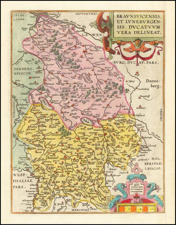
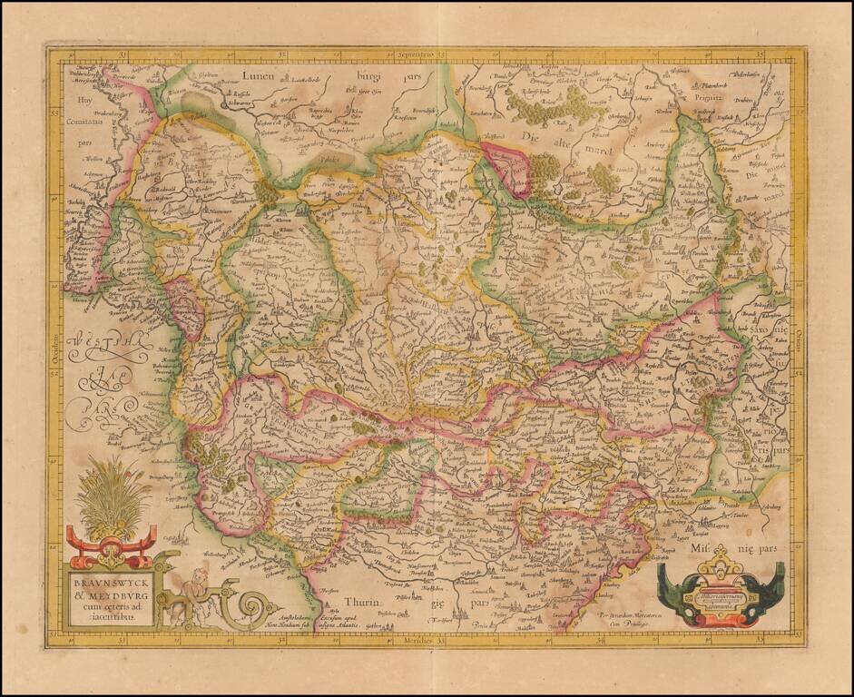
Fine old color example of Abraham Ortelius's map of the Duchies of Braunswick and Lunenburg. Large cities appearing on the map include Hanover, Luneburg, Wolfsburg, Brunswick, Peine, Wolfenbuttel and Hamburg. The map appeared in Ortelius's Theatrum...
![Thietmarsiae, Holsaticae Regionis Partis Typus [with] Oldenburg Comit.](/map/small/61510.jpg)
A nice full-color example of Ortelius' maps of a part of Schleswig-Holstein and Oldenburg, from his Theatrum Orbis Terrarum. Major towns shown include Oldenburg and Bremen. Abraham Ortelius Abraham Ortelius (1527-1598) was, along with Gerard...
![Daniae Regni Typus [with] Cimbricae Chersonese nunc Iutiae descriptio ..](/map/small/63315.jpg)
A nice full color example of Ortelius maps of Denmark and Jutland, along with Fiona, Alsen and Langeland. This is Ortelius' third map of Denmark, first issued in 1595. It shows many more details within Denmark and was improved cartographically as...
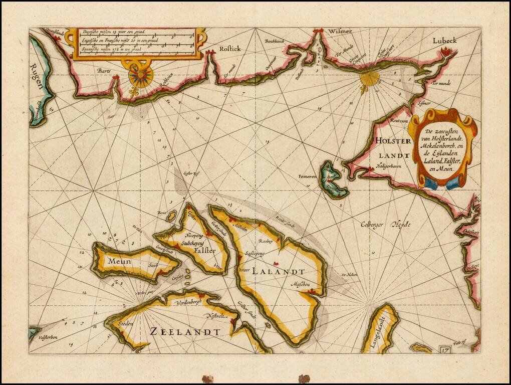
![[Mecklenburg-Vorpommern, Rugen, Bornholm, Lubeck, Sonnderborg,Svendborg, Zealand] Beschrijvinghe vant zuijder deel vande Belt, en hoemen de Custen van Mekeleborch Pomeren, met de Lande daer tegen over tusschen emeren en Bornholm geleghe besijlen en all](/map/small/61988.jpg)
Fehmarn Belt -- An Early Sailing Chart Rare sea chart of the Fehmarn Belt, a strait connecting the north coast of Germany and the island of Lolland off south coast of Denmark, oriented with south at the top, which appeared in Blaeu's Het Licht der...
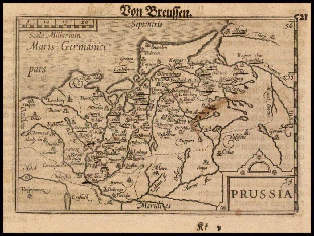
Nice example of this early state of Barent Langenes's map of Prussia, which first appeared in the 1598 edition of Langenes's Caert-Thresoor, published in Middelburg. The present map is one of the earliest obtainable maps to focus on Prussia....
Nice old color example of Mercator's detailed regional map of Germany. The map map shows the course of the Danube in the north, flowing through Ingolstadt, Strassburg, and Passau and extending to the Alpine cities of Fussen, Partenkirchen, Innsburck...
Mercator's double-page engraved German regional map, here in old hand. The map shows Frankfurt am Main, Heidelberg, Wurzburg and the course of the upper Main River, extending east to Regensburg and Eger in Bohemia.
Old color example of Mercator's regional map of a part of Germany from an early edition of the Mercator-Hondius Atas.
Nice old color example of Mercator's detailed regional map of a portion of Northwestern Germany. Includes Hamburg, Luneburg, etc.
Nice example of Mercator's detailed regional map of Germany. The map extend north to Frankfurt, Bingen and Bachrach and south to the Alsace Region of France, following the Upper Rhine. Heidelberg is near the center of the map.

Detailed map of Holstein, extending south to include Hamburg and Lubeck. From an early edition of Mercator's Atlas.
Scarce map of Prussia, published by Gerard Mercator in Amsterdam. Covers most of the North of Poland and parts of Kalingrad and Southern Lithuania.
Fine example of this rare sea chart of part of the coastlines of Germany and Denmark, published by Blaeu in his Zeespiegel, first published in 1623. The present chart is oriented with South at the top and includes Lubeck, Wismer and Rostock, along the...
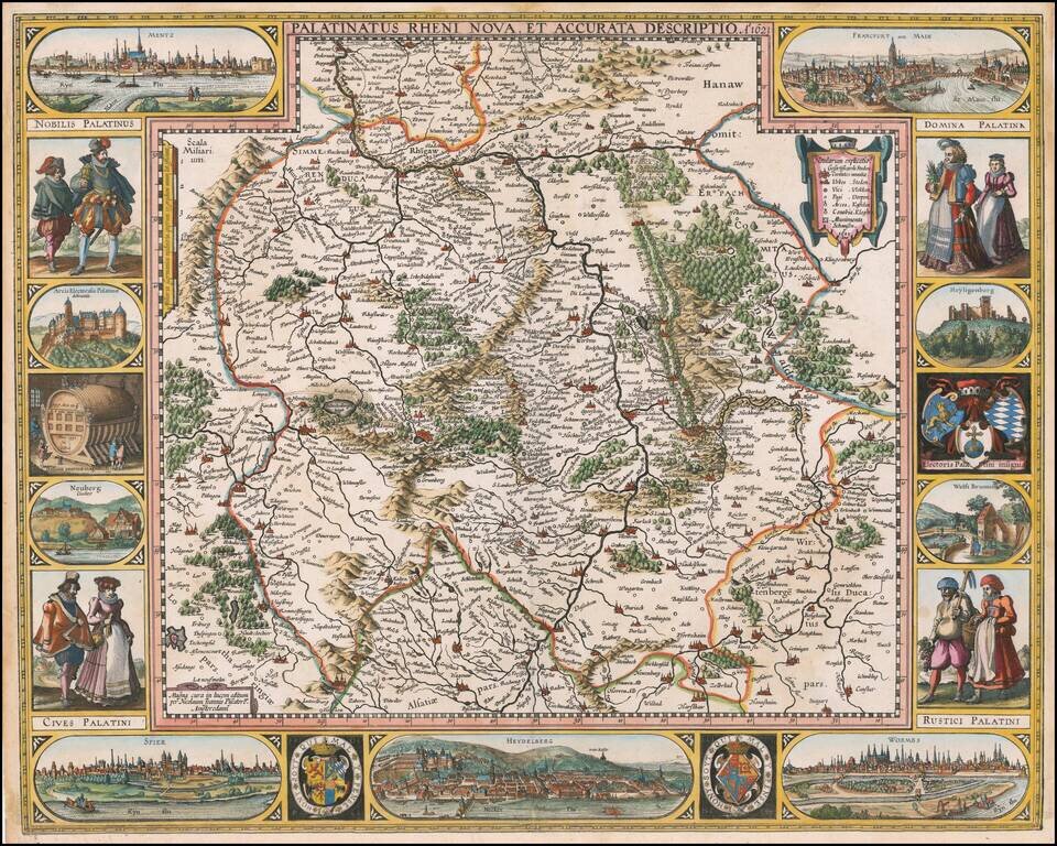
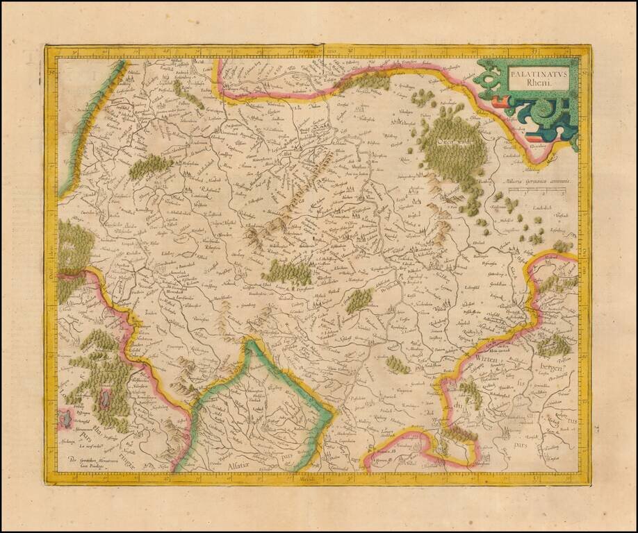
First State of Visscher's Map of the Rhine Valley Finely colored example of Nicholaus Visscher's decorative map of the German Rhine River Valley. The map follows the course of the Rhine River from the area near Baden-Baden in the south to just south...
![[Untitled Map of Central Westphalia]](/map/small/51478.jpg)
Nice example of the Mercator-Hondius regional map of Westphalia, in modern-day Germany.
Old color example of Hondius' regional map of Germany, from the Atlas Sive Cosmograhia. The map is centered on Erfurt, Weimar and Gotha.