
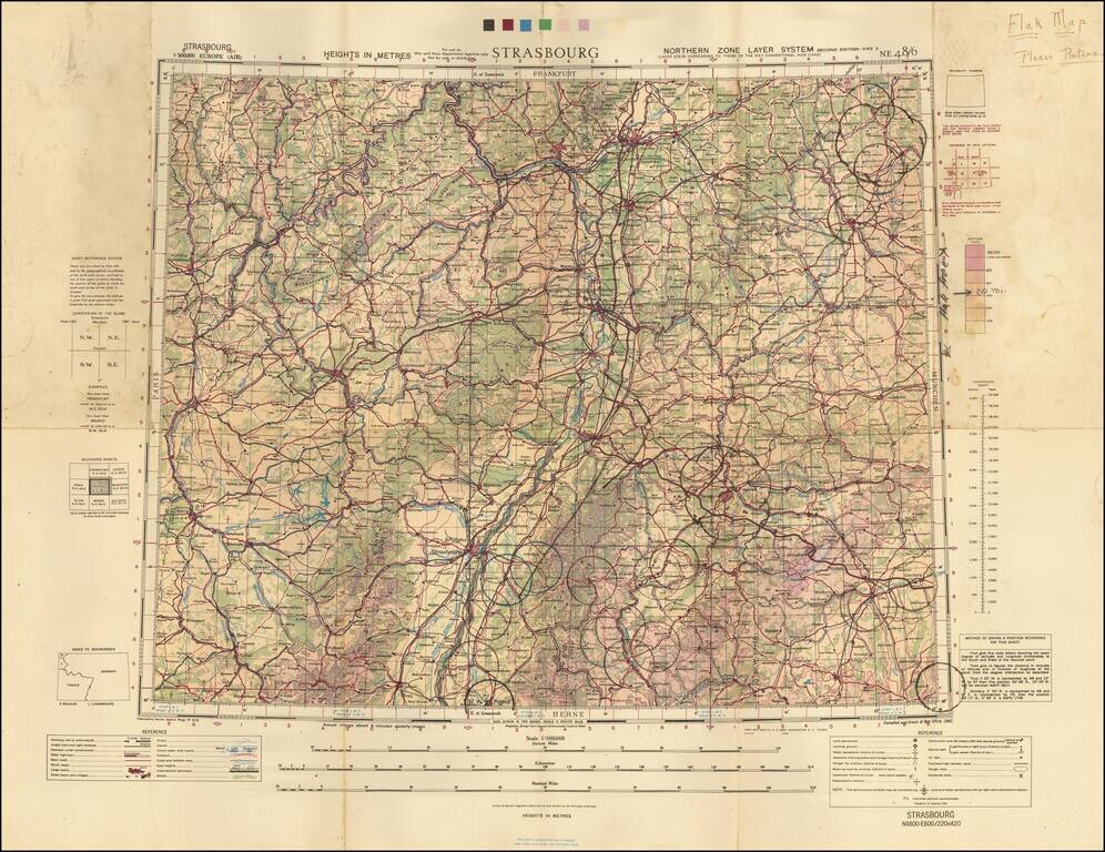
A Wall of Flak Batteries Leading into Germany. Detailed WWII air navigation map of the area around Strasbourg, published by the British War Office. The map is noteworthy for the manuscript circles highlighting the flak batteries stationed in major...
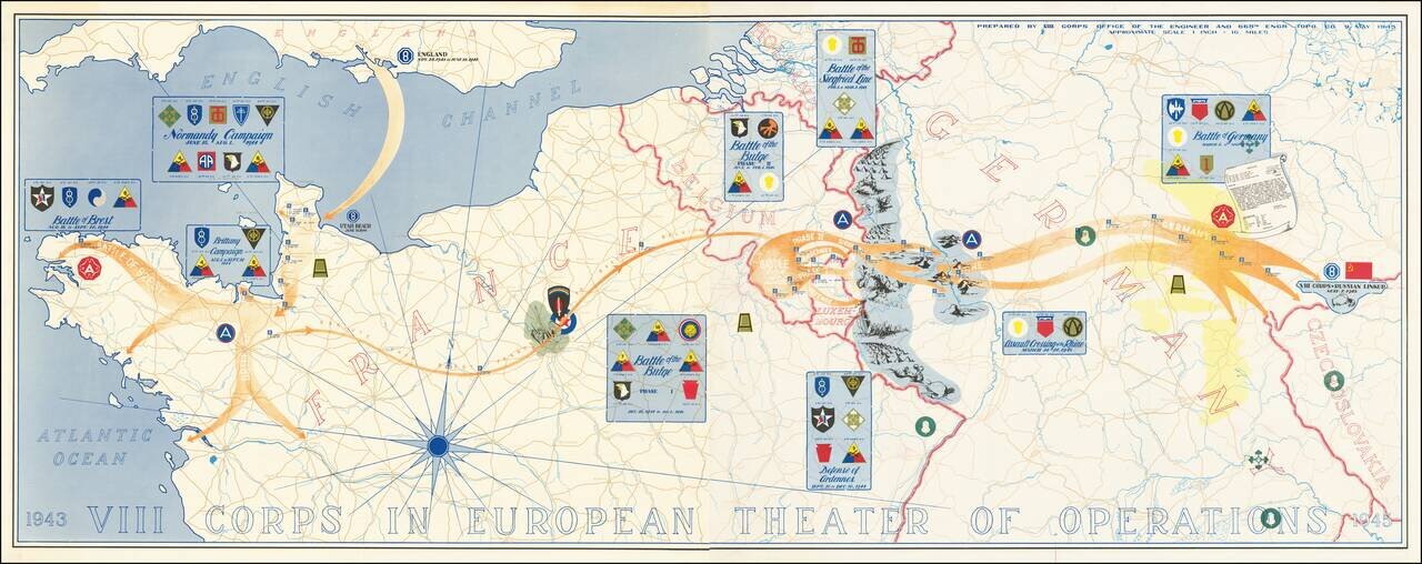
Superb map of the actions of VIII Corps, US Army, from 1943 to 1945. The map was prepared by VIII Corps Office of the Engineer and 665th Engr. Topo. Co. on the 9th of May 1945. The map, which stretches from Normandy to Czechoslovakia, lists the...
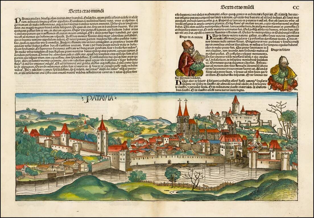
Gorgeous example of Hartmann Schedel's incunable view of Passau from the Latin edition of Schedel's Liber Chronicum, perhaps the single most influential secular illustrated book of the 15th Century and one of the landmark printed works of the 15th...
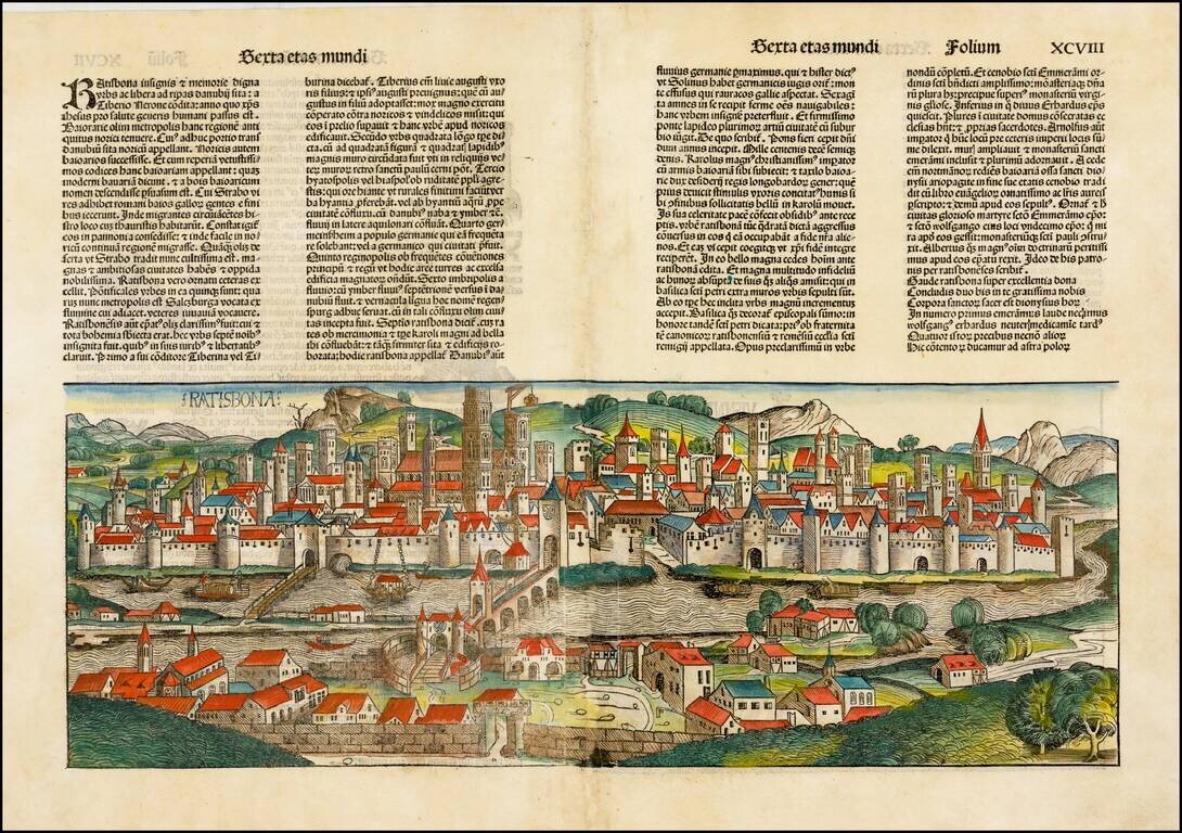
Decorative early view of the City of Regensberg, from the Latin edition of Schedel's Liber Chronicum (Nuremberg Chronicle), a landmark work of the 15th Century....
![[Magdeburg] Madeburga](/map/small/48397.jpg)
Decorative early view of the City of Magdeburg, from the Latin edition of Schedel's Liber Chronicum (Nuremberg Chronicle), a landmark work of the 15th Century. Hartmann Schedel's Liber Chronicarum: Das Buch der Croniken und Geschichten (loosely...
This is Sylvanus's scarce map of northern Europe, depicting the region encircled by the Rhine in the west, the Danube in the south, and the Vistula in the east. One of the earliest obtainable maps of the region, and the first printed in two colors,...
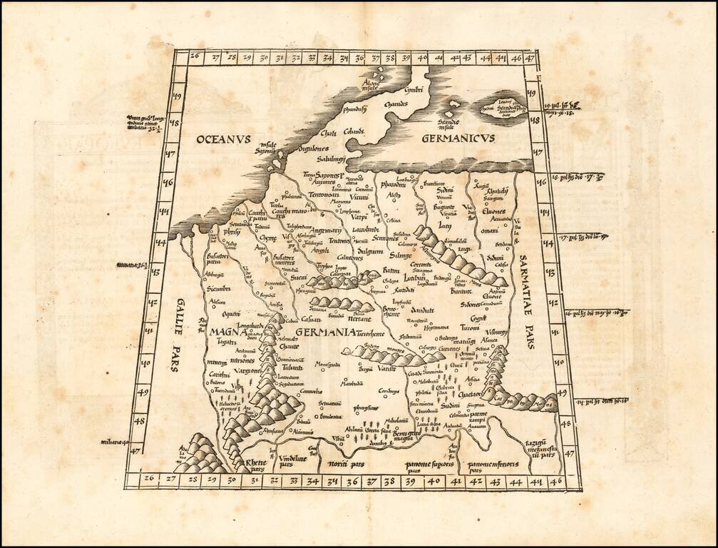
Rare early map of the region between northwestern Europe, extending south to the Danube River and east to the Vistula River, from the 1525 edition of Fries Geographia.
![Tabula Europae IIII [German Empire & Baltic]](/map/small/60226.jpg)
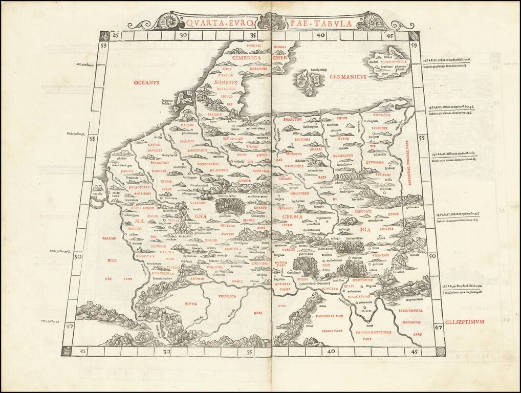
Detailed map of the German Empire, Baltic and part of the Balkans, extending to the Carpathian Mountains and the Danube. Shows are remarkable depiction of the region, as known in Ptolemy's time. This is the 1st edition, second state of Munster's map,...
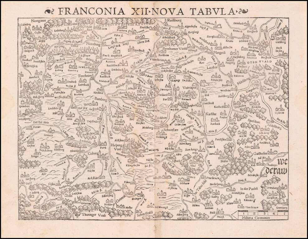
Munster's important early regional map of Germany, centered on Bamberg and the Mein River. One of the earliest obtainable modern maps of the region. From the 1542 edition of Munster's Geographia, one of the most important 16th Century geographical...
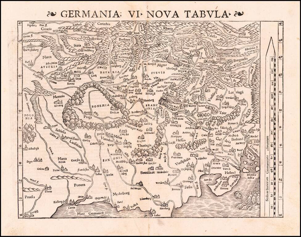
Excellent modern map of German Europe, with South oriented at the top of the map. The map extends from the Baltic (Danzig, Kolberg, Rostok and Lubec) and Vistula to the Low Countries (Amsterdam, Rotterdam, Selandie Insulae, and Ghent) in the North to...
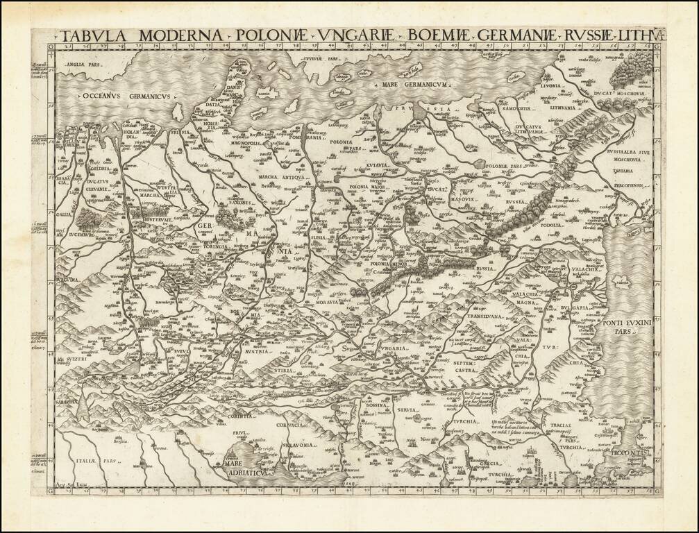
First State of one of the Earliest Modern Maps of Central and Eastern Europe A fine example of this rare and important map of Central and Eastern Europe, published by Antonio Salamanca in Rome. The map is derived from the iconic manuscript map of...
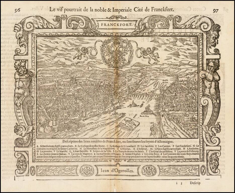
Scarce and higly decorative 16th Century view of Frankfurt by Guillaume Guéroult, printed in Lyon. This engaging view depicts Frankfurt, one of Europe's most vibrant cities, along the Main River. The scene assumes an eastward perspective, with...
![[Kempten] Campidonia](/map/small/16386.jpg)
Rare early view of Kempten, Germany by Melchior Lorck, a famous Danish Artist and Engraver. The following is taken from the British Museum website biography on Lorck: Danish painter and printmaker, architect, cartographer and diplomat. Born to an...
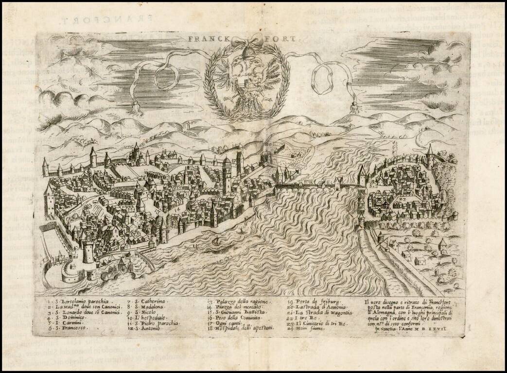
Rare example of the Forlani-Zenoi view of Frankfurt am Main, published in Venice in 1567. The map includes a decorative coat of arms with the double headed Eagle and a key at the bottom locating 24 major places within the City. The map is quite rare...
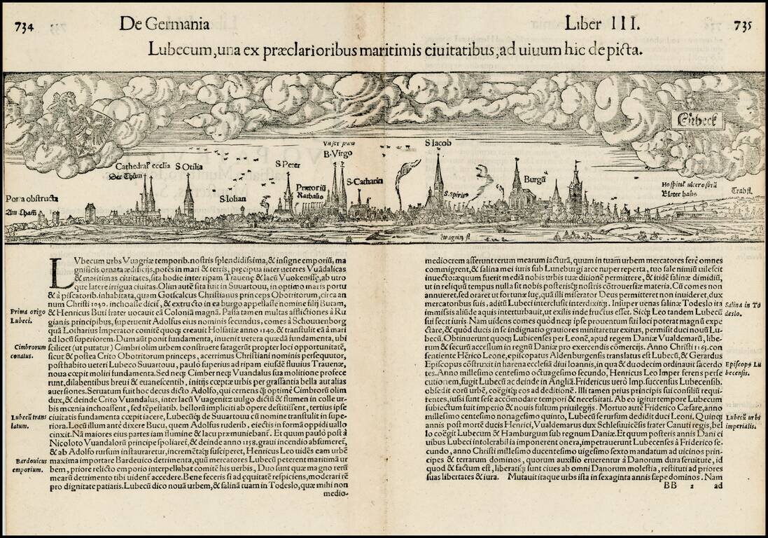
Early double page birdseye view of the city of Lubeck, with Heraldic images in the sky. Munster's Cosmography was one of the most influential georgraphical works of the 16th Century. It was published in a number of editions over a half century and was...
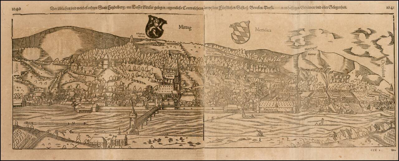
Early decorative birdseye view from a German edition of Munster's Cosmography. One of the most influential geographical works of the 16th Century. The Heidelberg view is one of the largest and most decorative of all of Munster's views.