
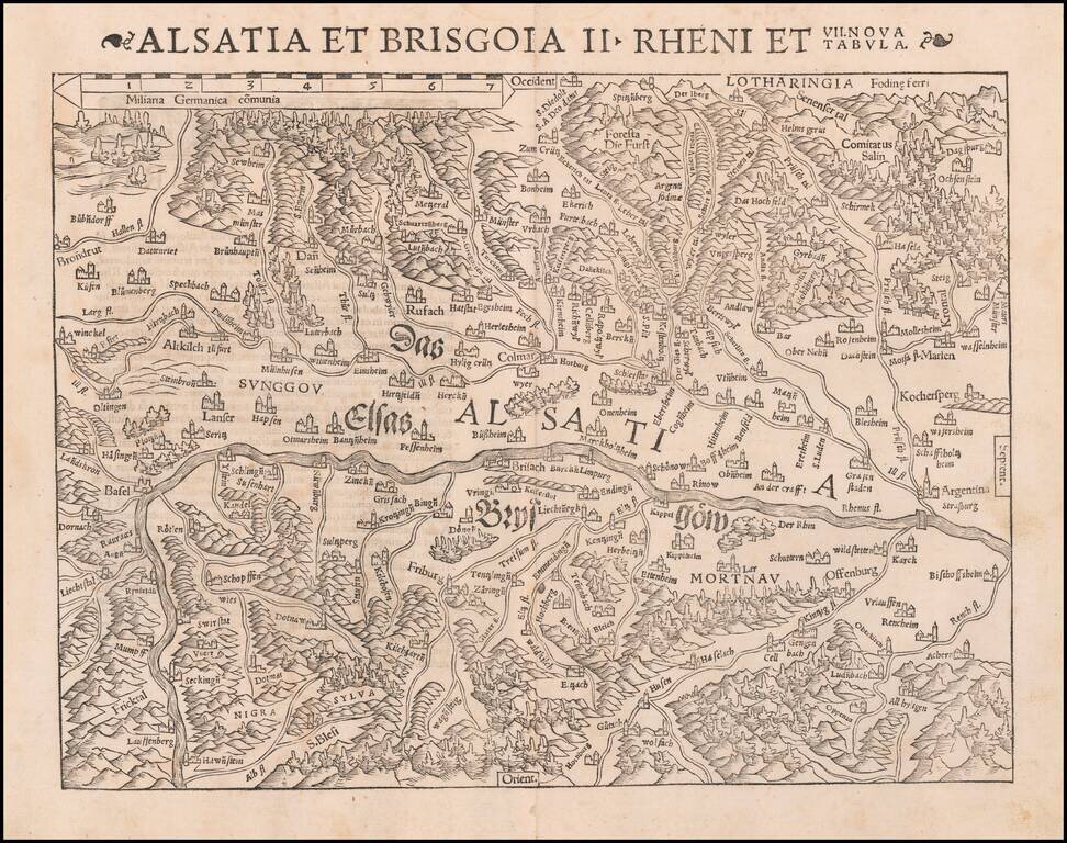
One of the earliest Modern Maps of the Rhine River Valley Detailed map of the Rhine River Valley, from Strasbourg and Argentina to Basel and Laufenberg, centered on Brisach and Kappel and showing Colmar. West is at the top of the map. The map is...
![Basiliensis Territorii Descriptio Nova [with] Circulus Sive Liga Suevia Vulgo Schwabische Kraiss](/map/small/65392.jpg)
Two detailed regional maps by Ortelius, from his Theatrum Orbis Terrarum, the first modern atlas. The first map shows the region around Basel, in Switzerland, based upon the work of Sebastian Munster. The second map shows the region bounded by the...
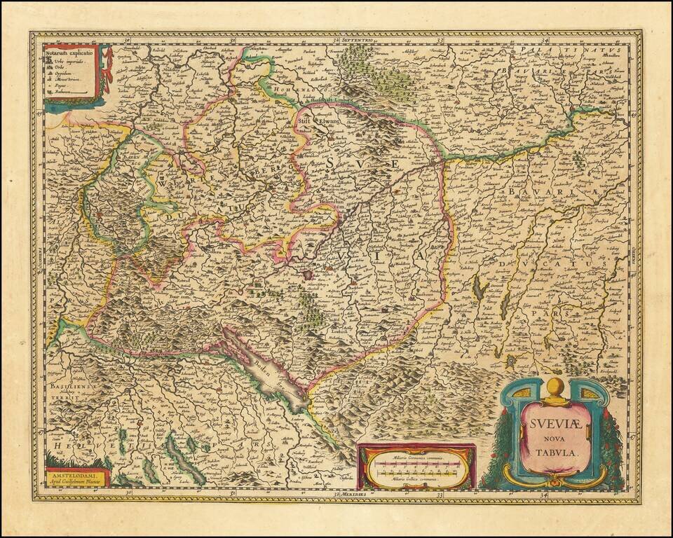
Antique engraved map of the area south of Heidelberg, showing Stuttgart, Ulm, Augsburg, and the River Danube. It also covers some of northern Switzerland including Basel and Zurich. The map was made by Willem Janszoon Blaeu in Amsterdam. The map...

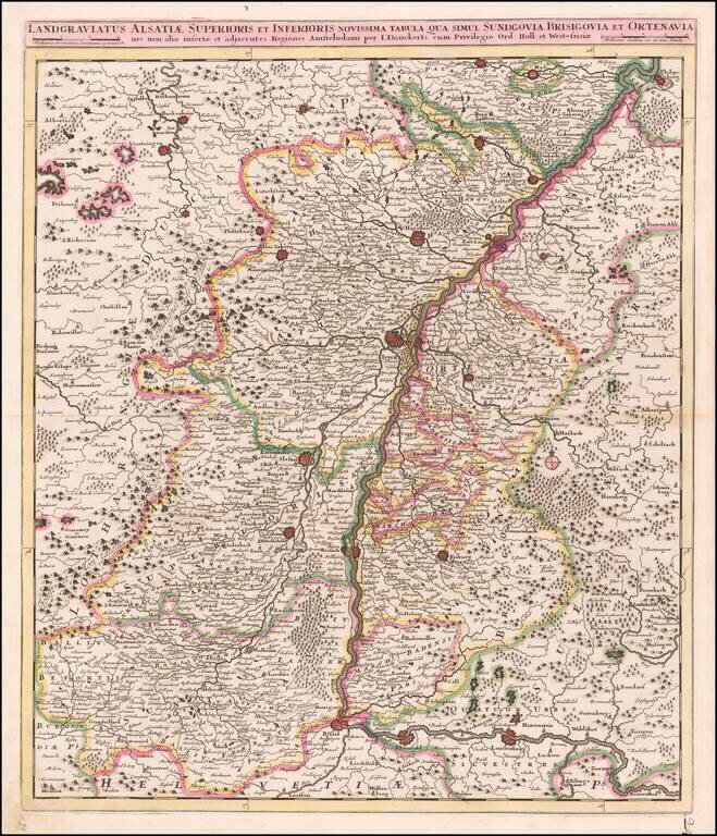
Fine old color example of Theodore Danckerts rare map of the Upper Rhine Region, published in Amsterdam. Cartouche surrounded by cherubs.

De L'Isle's map of the Rhine River and neighboring regions, from Strassbourg in the north to the Swiss Alps.
![Palatinatus Bavariae Descriptio . . . [with] Wirtenbergensis Ducatus...](/map/small/65838.jpg)
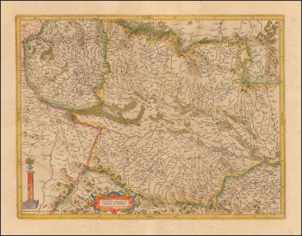
Fine pair of maps, published by Abraham Ortelius. Ortelius' map of Bayern is based on the map by Erhart Reich. The map includes Regensberg, Nuremberg and Bamberg. The map of the Rhine, both south and north of Strassbourg is based on Daniel Specklin's...
Fine old color example of this map of the Rhine, both south and north of Strasbourg, based on Daniel Specklin's three-sheet map of the Elzas of 1576. From edition of Ortelius' Theatrum Orbis Terrarum, the first modern atlas of the World.
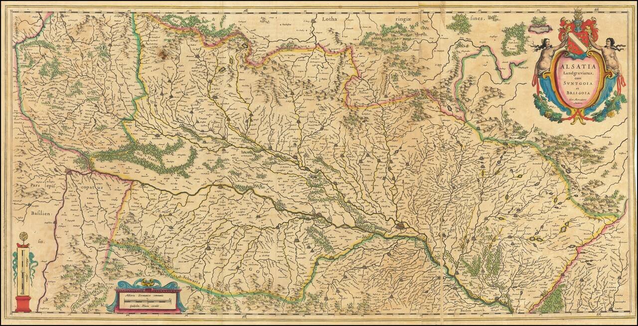
Nice old color example of the Mercator-Hondius map of part of Alsatia. West is oriented on the top. The map is centered on the course of the Rhine River, from Strasbourg in the north (right side of ma) to Basle.
Large antique engraved map of the Alsace Region, focusing on the cities of Basel and Strasbourg. The map was published by Willem Janszoon Blaeu, based on a map by Gerard Mercator. This folding map is larger than the typical double-page folio map that...
![Territorium Argentoratense [engraved by Petrus Kaerius]](/map/small/12164.jpg)
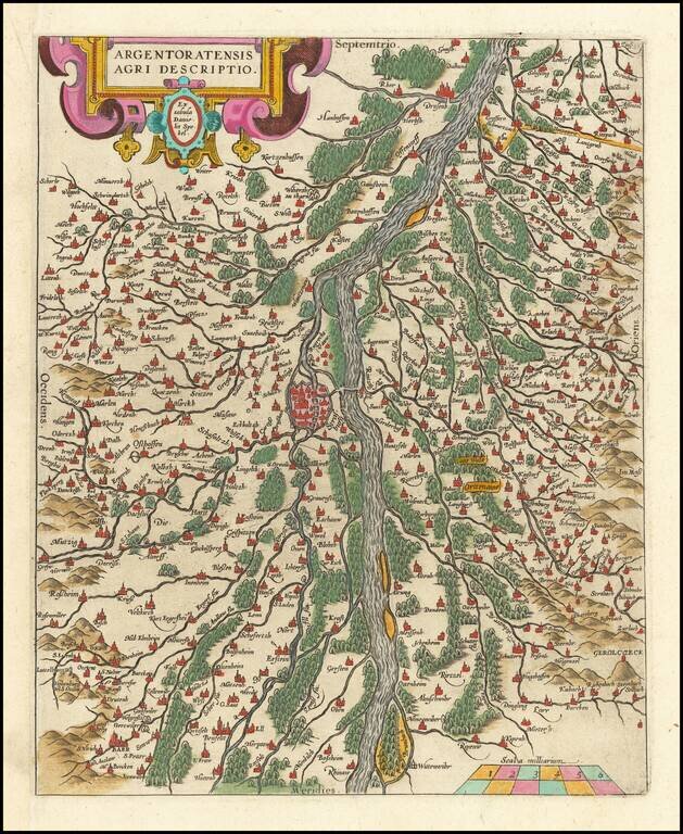
Striking full color example of Jansson's map of the area around Strassbourg, with a plan of the town, decorative cartouche and two coats of arms. One of the view maps engraved by Petrus Kaerius (Peter Van Den Keere) to be offered by Jansson. French...
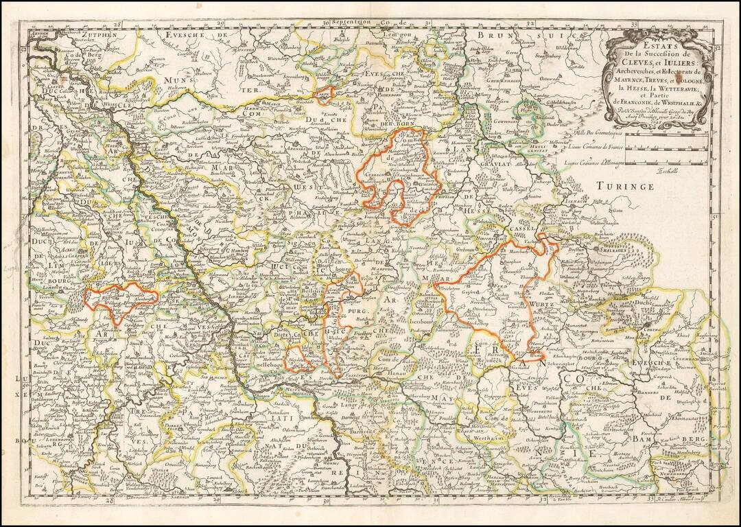
Nice old hand-color example of Sanson's 1641 double-page engraved map of the Duchy of Cleves. Nicolas Sanson (1600-1667) sometimes called Nicolas Sanson d'Abbeville or Sanson d'Abbeville, was the most important French cartographer of the 17th century....
Antique Map of the Upper Rhine Region, Alsace, etc. Detailed map of the Upper Rhine River region, published in Amsterdam. The map extends from Basel, Rheinfeld and Lauffenburg in the south, to Philipsburg and Landau, centered on Landau.
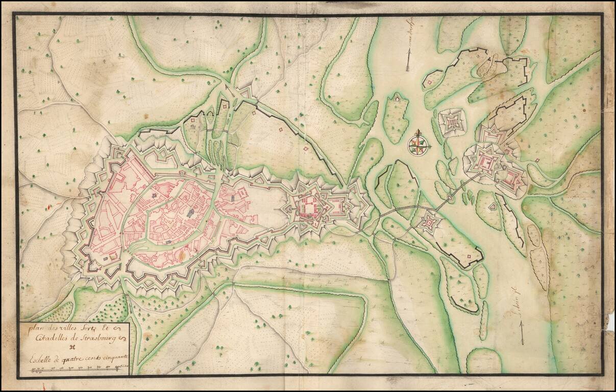
Manuscript Plan of Strasbourg and Environs, including the fortifications at Kehl. Detailed hand drawn plan of Strasbourg, focusing on its fortifications in the Vauban style.
![[Kehl, Riverfront Fortifications in 1726]](/map/small/59629.jpg)
Fortifying Kehl on the Rhine River Finely executed plan of the fortifications at Kehl by G. Drescheribe, Captain of the Artillery and Engineer, in 1726. The fortifications at Kehl were originally constructed by Vauban in 1688. Its strategic...
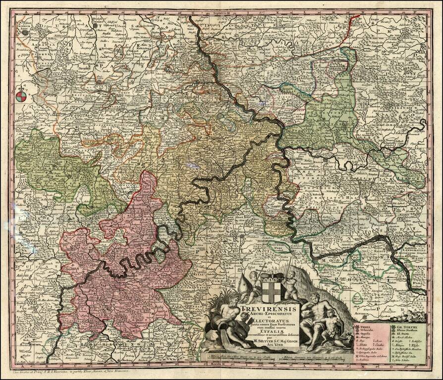
Decorative map of the Moselle & Rhine River Valleys. Includes a decorative cartouche.

Highly detailed map of the Alsace region, tracking the course of the Rhein from the Strassbourg area to just east of Landau. Large decorative cartouche.