logo

1778. South America Agreeable to the most approved Maps and Charts including the latest Discoveries of the most Eminent Navigators . . .

  • South America Agreeable to the most approved Maps and Charts including the latest Discoveries of the most Eminent Navigators . . .

South America Agreeable to the most approved Maps and Charts including the latest Discoveries of the most Eminent Navigators . . . information:

Year of creation: 
Resolution size (pixels): 
 1508x1006 px
Disk Size: 
 418760B
Number of pages: 
 1
Place: 
 London

Print information. Print size (Width x height in inches):
Printing at 72 dpi 
  20.94 х 13.97
Printing at 150 dpi 
 10.05 х 6.71
Printing at 300 dpi 
 5.03 х 3.35

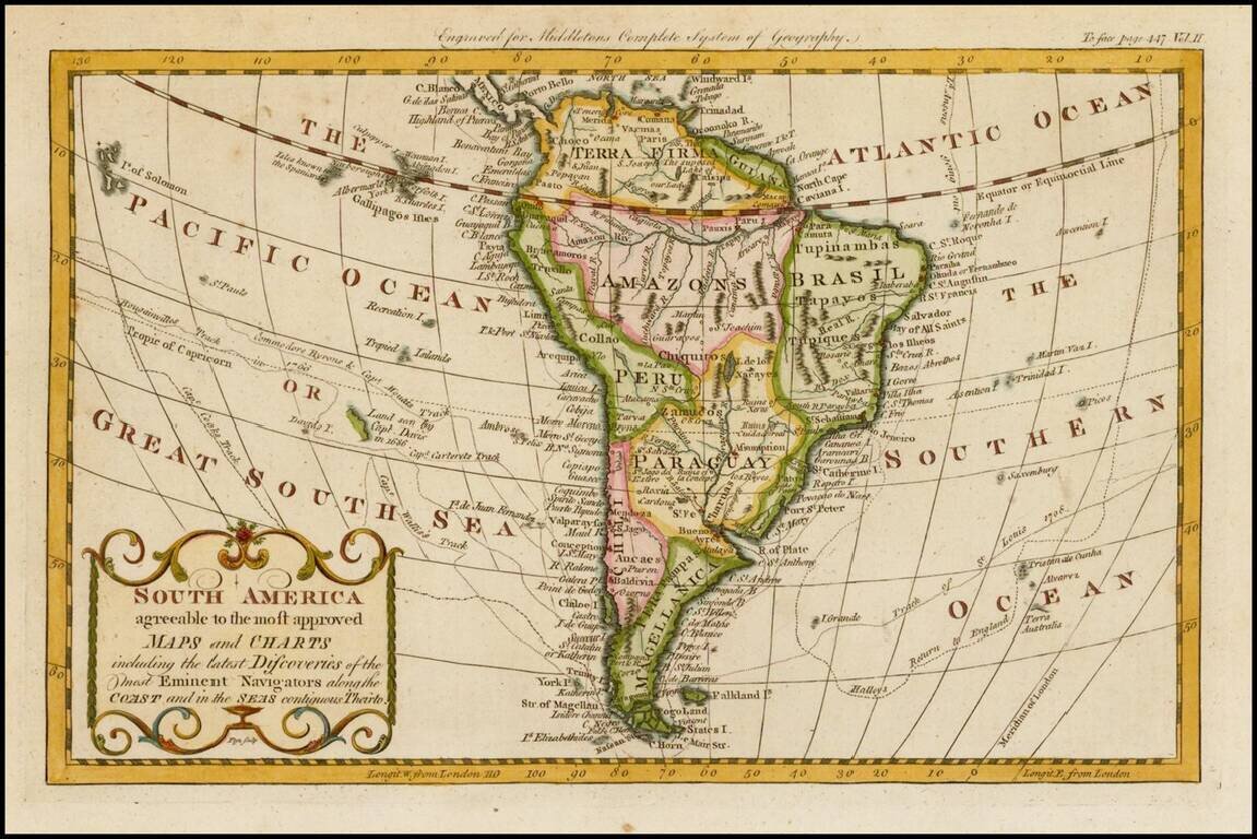
Detailed map of South America, published in London by Middleton.

The map shows the exploration tracks of a number of major voyages of exploration, including:

  • James Cook
  • Sir Edmund Halley
  • Philip Carteret
  • Samuel Wallis
  • John Byron
  • Louis Antoine de Bougainville
  • George Anson

Special conditions for students!

If you are a student, write to us in telegram: @antiquemaps and indicate what material you need and for what work you need a map in high detail. We are ready to provide material on special terms. For students only!

Item information:

Year of creation:
Size:
1508x1006 px
Disk:
418760B
Number of pages:
1
Place:
London
Author:
Christopher T. Middleton.
$9.99

Related item