Map size in jpg-format: 11.2933MiB
Click to open in high resolution (open in new tab).
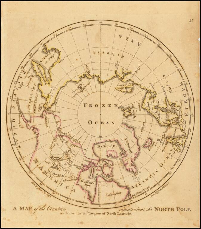
Early American map showing the extent of explorations in the North Pole, with emphasis on the efforts to find a Northwest passage and Hearne's and MacKenzies' routes.
If you are a student, write to us in telegram: @antiquemaps and indicate what material you need and for what work you need a map in high detail. We are ready to provide material on special terms. For students only!
![[Eastern Hemisphere Globe Gores] (Nova et integra universi Orbis descriptio)](/map/small/54480.jpg)

