logo

1824. Chart of the Northern Shore of Hudson's Strait, with the Route of His Majesty's Ships Fury and Hecla, in search of a North West Passage under the Command of Captn. W.E. Parry in the Year 1821 . . .

  • Chart of the Northern Shore of Hudson's Strait, with the Route of His Majesty's Ships Fury and Hecla, in search of a North West Passage under the Command of Captn. W.E. Parry in the Year 1821 . . .

Chart of the Northern Shore of Hudson's Strait, with the Route of His Majesty's Ships Fury and Hecla, in search of a North West Passage under the Command of Captn. W.E. Parry in the Year 1821 . . . information:

Year of creation: 
Resolution size (pixels): 
 14541x10387 px
Disk Size: 
 25.4914MiB
Number of pages: 
 1
Place: 
 London
Author: 

Print information. Print size (Width x height in inches):
Printing at 72 dpi 
  201.96 х 144.26
Printing at 150 dpi 
 96.94 х 69.25
Printing at 300 dpi 
 48.47 х 34.62

An example of detailing the file of this map of in a printable high-resolution:

Click to open in high resolution (open in new tab).
Attention! this is just the central piece (central area 960x960 px) of the map file!
This is an example, so that you can see and study the level of detail of a given map. The entire Map will be fully available after payment!

Chart of the Northern Shore of Hudson's Strait, with the Route of His Majesty's Ships Fury and Hecla, in search of a North West Passage under the Command of Captn. W.E. Parry in the Year 1821 . . .

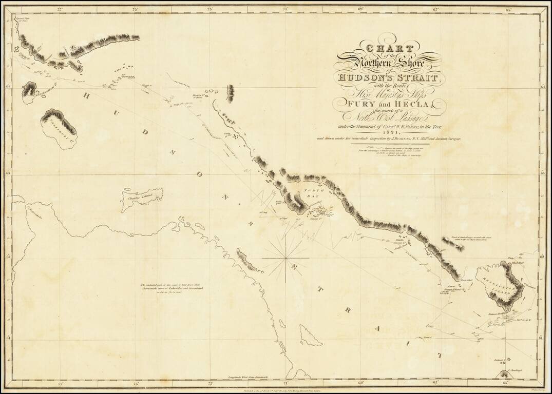
A nice example of Parry's map of Hudson's Strait, showing a portion of his expedtiion in search for the Northwest Passage.

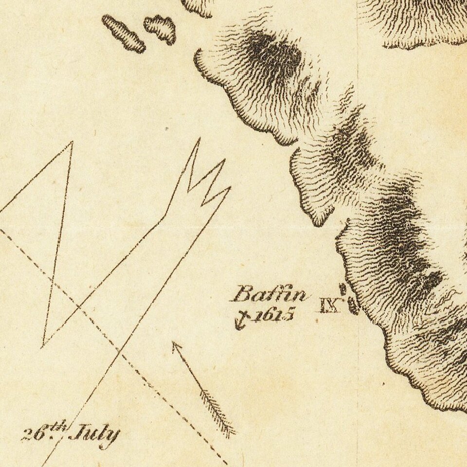
Shows Parry's tracts in marvelous detail, including a day by day account of his route and a number of annotations.

After standing by while his predecessor and former commander, the irascible John Ross, was lambasted by the Admiralty for turning back too soon during his first voyage to the Arctic, Parry was grateful to inherit command of the next major expedition. Dedicated to both the physical and mental health of his men, Parry succeeded in reaching Melville Island, being the first to penetrate so far into the hypothetical passage. The voyage made Parry a hero in England, where he was promoted to commander, elected to the Royal Society, and presented with numerous awards, all before his thirtieth birthday.

While the map can be acquired as part of Parry's Journal, it rarely appears as a loose map on the market. A nice example, with just a bit of offsetting, as usual.


Special conditions for students!

If you are a student, write to us in telegram: @antiquemaps and indicate what material you need and for what work you need a map in high detail. We are ready to provide material on special terms. For students only!

Item information:

Year of creation:
Size:
14541x10387 px
Disk:
25.4914MiB
Number of pages:
1
Place:
London
Author:
William Edward Parry.
$14.99

Related item