Map size in jpg-format: 3242610B
Click to open in high resolution (open in new tab).
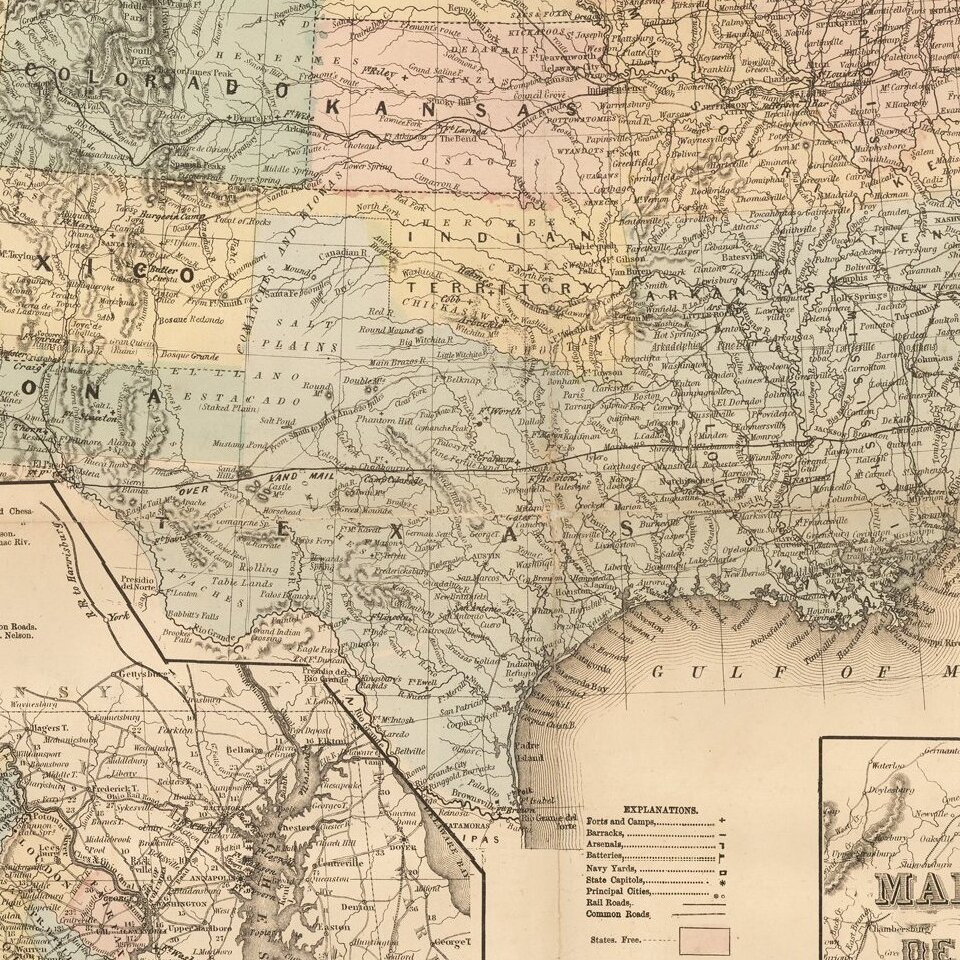
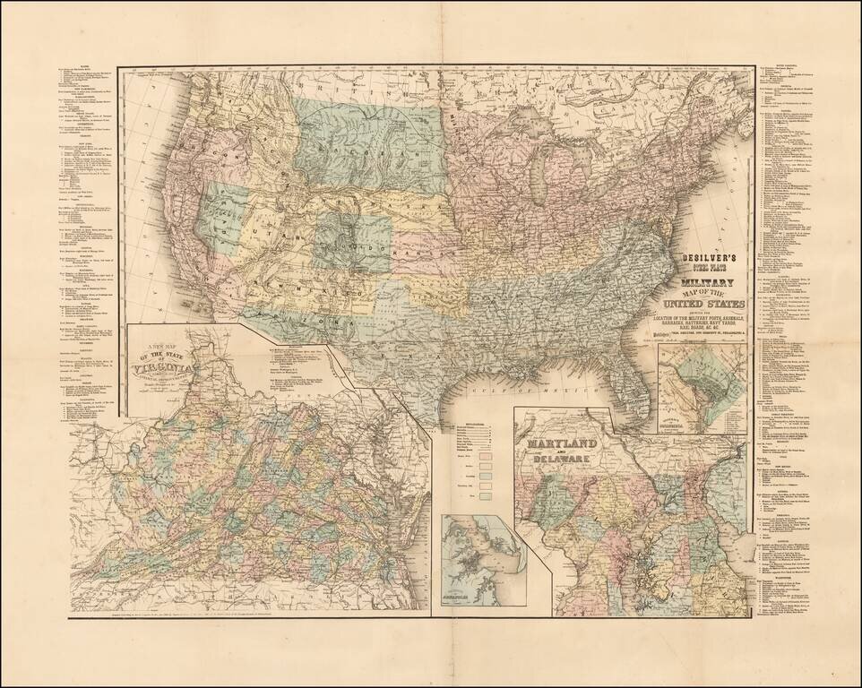
Rare Civil War era map of the United States, published in Philadelphia by Charles Desilver.
The map includes inset maps of Washington D.C., Virginia, Maryland and Delaware, and the Vicinity of Annapolis.
Includes a list of all the Military Forts and other installations in each state and territory, including those in the western territories and Texas.
The map is apparently very rare. OCLC locates only 2 examples, State Library of Virginia and Cleveland Public Library.
If you are a student, write to us in telegram: @antiquemaps and indicate what material you need and for what work you need a map in high detail. We are ready to provide material on special terms. For students only!

![[Signed Political Satire Artwork] Vietnam ... Vietnam ... Vietnam ...](/map/small/68726.jpg)
