Map size in jpg-format: 1.37575MiB
Click to open in high resolution (open in new tab).
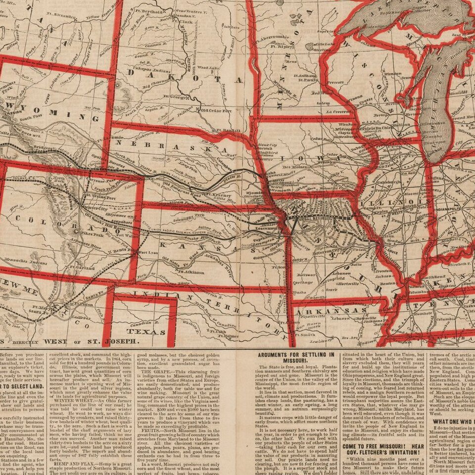
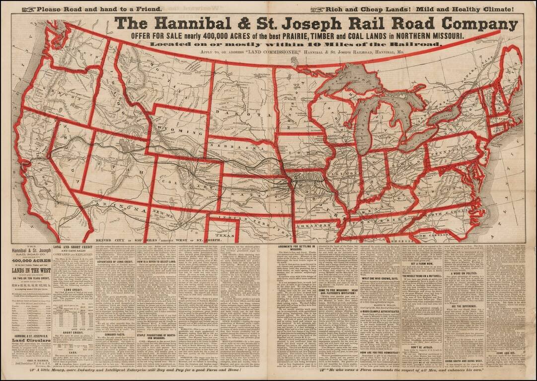
Advertising broadsheet map published by the Hannibal & St. Joseph Railroad, promoting land in Northern Missouri.
The map notes the Railroad offering more than 400,000 acres of land for sale along the Hannibal & St. Joseph Railroad in Missouri.
Map detail includes the routes of the incomplete Central Pacific and Union Pacific Railroads. It lists the number of acres of railroad land available in each county. The sheet is filled with marketing 'facts' and information, including the stability of post-Civil War Missouri.
The Hannibal & St. Joseph railroad was the first to cross Missouri, running between Hannibal and St. Joseph. It is famous for delivering the first letter to the Pony Express on April 3rd, 1860.
Promotional broadside for sale of railroad lands, with the printed notice in top margin:
Please Read and Hand to a Friend. Rich and Cheap Lands! Mild and Healthy Climate!Warren Heckrote offers his description:
...U.S. from east to west coast north of Texas. Boundaries colored in red. Text beneath map and on verso. Text extolls land and region. There is also interesting social commentary on the society of Missouri in the aftermath of the Civil War. Apparently rare... The Central Pacific is shown developed just beyond Pyramid Lake and the Union Pacific is still in Nebraska. Many railroads, existing and projected are shown. Areas in California, Idaho, Wyoming and Colorado are labeled Gold Region. The Oregon Trail is shown, though not named as such, and is named in one stretch, New Worked Emigrant Rd - curious. Construction of the Hannibal and St. Joseph RR began in 1851 from both cities and was completed in Feb, 1859. On the map it appears that all the towns on the line are located and named. In 1860 the RR met the Pony Express. The railroad was acquired by the Chicago, Burlington and Quincy RR in 1883."The verso includes 2 full pages of promotional text.
The map is very rare--OCLC does not locate any other examples. This is the only example we can locate.
Provenance: Warren Heckrotte Collection, March 2016; Old World Auctions May 2007.
If you are a student, write to us in telegram: @antiquemaps and indicate what material you need and for what work you need a map in high detail. We are ready to provide material on special terms. For students only!

![[Signed Political Satire Artwork] Vietnam ... Vietnam ... Vietnam ...](/map/small/68726.jpg)
