Map size in jpg-format: 26.1599MiB
Click to open in high resolution (open in new tab).
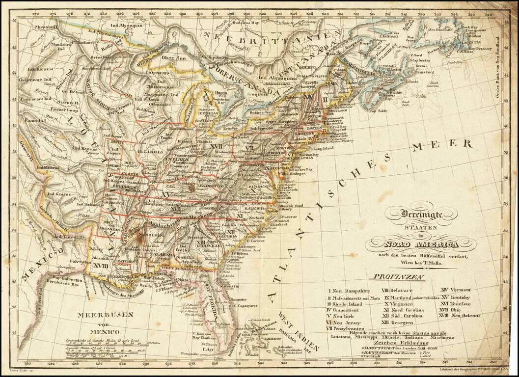
Scarce & interesting map of the United States, published in the decade following the Louisiana purchase.
Among the more notable features of the map are the many interesting mountain ranges in the Plains regions, the early appearance of Michigan Territory, a distorted Indiana and Illinois pushed far to the west, the districts west of the Mississippi River, including New Orleans, Abcansas, Lawrence, Girardeau and St. Louis, and the profusion of Indian Tribes shown.
An early appearance of the city of Galveston.
Mollo collaborated with several French and English map makers to sell maps in Vienna and published Dirwald's atlas and separate maps, but his work rarely appears on the market.
If you are a student, write to us in telegram: @antiquemaps and indicate what material you need and for what work you need a map in high detail. We are ready to provide material on special terms. For students only!

![[Signed Political Satire Artwork] Vietnam ... Vietnam ... Vietnam ...](/map/small/68726.jpg)
