Map size in jpg-format: 3.03718MiB
Click to open in high resolution (open in new tab).
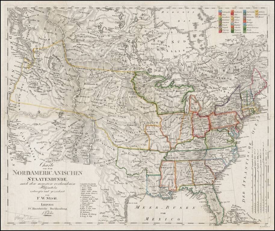
Scarce early coast to coast map of the United States, issued by F.W. Streit, in Leipzig, featuring excellent post-Lewis & Clark details.
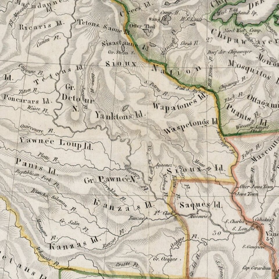
The map is study in the cartographic details of the Western United States following the expeditions of Lewis & Clark, Zebullon Pike and Stephen Long. The topography and watershed of the northwest draw extensively from the Lewis & Clark Journal, with many Indian tribes listed. In the west, the cartography pre-dates the earliest influences of Jedidiah Smith, which would creep into printed maps in the 1830s, and John Fremont's discoveries in the 1840s.
AA river connects SF Bay with the two Salt Lakes. The map includes a double wide Arkansas, oddly misshaped Michigan, Indiana, Ohio and Illinois, which is pushed off the Lake, as was the norm in the 1810s and 20s. Striking engraving style. One of the most detailed listings of western Indian Tribes of the period.
FW Streit, who served as an engineer in the Prussian artillery, was a mathematician and military cartographer.
If you are a student, write to us in telegram: @antiquemaps and indicate what material you need and for what work you need a map in high detail. We are ready to provide material on special terms. For students only!

![[Signed Political Satire Artwork] Vietnam ... Vietnam ... Vietnam ...](/map/small/68726.jpg)
