logo

1798. Gli Stati Uniti dell' America Il Canada, e la Florida. Carta Generale delineata sulle ultime Observanzni.

  • Gli Stati Uniti dell' America Il Canada, e la Florida. Carta Generale delineata sulle ultime Observanzni.

Gli Stati Uniti dell' America Il Canada, e la Florida. Carta Generale delineata sulle ultime Observanzni. information:

Year of creation: 
Resolution size (pixels): 
 13083x9754 px
Disk Size: 
 28.6075MiB
Number of pages: 
 1
Place: 
 Rome

Print information. Print size (Width x height in inches):
Printing at 72 dpi 
  181.71 х 135.47
Printing at 150 dpi 
 87.22 х 65.03
Printing at 300 dpi 
 43.61 х 32.51

An example of detailing the file of this map of in a printable high-resolution:

Click to open in high resolution (open in new tab).
Attention! this is just the central piece (central area 960x960 px) of the map file!
This is an example, so that you can see and study the level of detail of a given map. The entire Map will be fully available after payment!

Gli Stati Uniti dell' America Il Canada, e la Florida. Carta Generale delineata sulle ultime Observanzni.

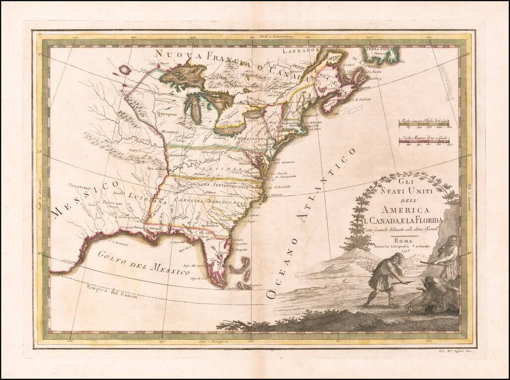
Scarce map of the United States, published in Rome by Giovanni Maria Cassini.

Virginia and the Carolinas extend to the Mississippi River.

Florida is shown as an archipelago.


Special conditions for students!

If you are a student, write to us in telegram: @antiquemaps and indicate what material you need and for what work you need a map in high detail. We are ready to provide material on special terms. For students only!

Item information:

Year of creation:
Size:
13083x9754 px
Disk:
28.6075MiB
Number of pages:
1
Place:
Rome
Author:
Giovanni Maria Cassini.
$14.99

Related item