Map size in jpg-format: 47.1705MiB
Click to open in high resolution (open in new tab).
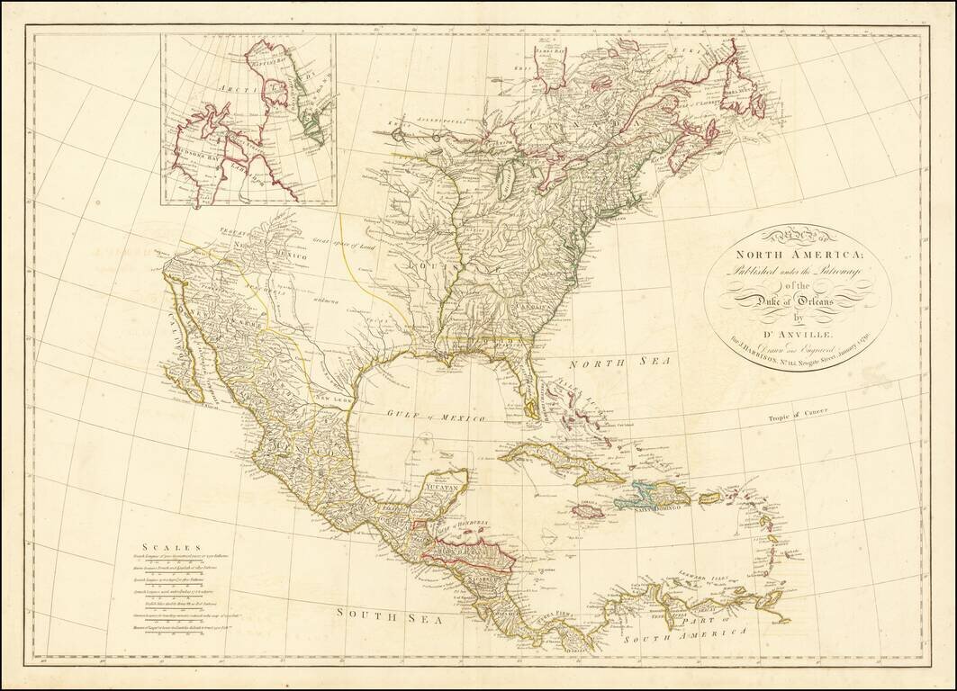
A marvelous map of North America, based upon D'Anville's 4 sheet map.
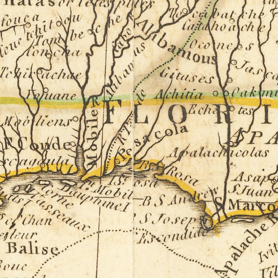
The map names Tecas, but the entire Northwest is noted as parts unknown. Many place names, Indian tribes, and forts located. Good detail of watershed: the Colorado is here called the R. Colorado of Martyes. The map nomenclature has been translated into English from D'Anville's original in French. Excellent detail in the Southwest.
Florida is an archipelago. Numerous French forts are shown along the Mississippi. Large inset of the Hudson Bay region.
This map is based on the work of D'Anville who was Royal Geographer and Cartographer to the King of France, and produced under the patronage of his brother. D'Anville followed Delisle as the chief proponent of scientific cartography, and his influence on his contemporaries was profound. Because he had direct access to the many official French records of North America his maps are known for their excellent detail and clearly presented information.
If you are a student, write to us in telegram: @antiquemaps and indicate what material you need and for what work you need a map in high detail. We are ready to provide material on special terms. For students only!

![[Signed Political Satire Artwork] Vietnam ... Vietnam ... Vietnam ...](/map/small/68726.jpg)
