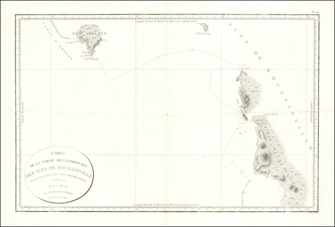
Fine early sea chart showin New Ireland and the Bougainville Islands. This chart spans from the southern tip of Latangai Island (here called New Ireland) to the northwest coastline of Bougainville Island. Bruni d'Entrecasteaux's route is traced and...
Papua New Guinea The chart appeared in Atlas du voyage de Bruny-Dentrecasteaux, contre-amiral de France, commandant les fregates la Recherche et l'Esperance, fait par ordre du gouvernement en 1791, 1792 et 1793 : publie par ordre de sa majeste...
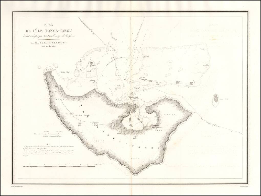
One of the earliest obtainable maps of Tonga. Rear Admiral Jules Sébastien César Dumont d'Urville (1790-1842) was a French explorer and naval officer, who explored the south and western Pacific, Australia, New Zealand, and Antarctica. Dumont...
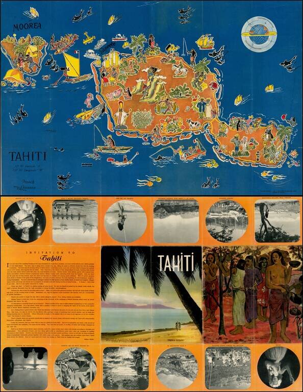
Decorative pictorial map of Tahiti, drawn by Jean Rousaute for Le Syndicat d'Initiative de Tahiti in Paris. The map shows a colorful look at the peoples, wildlife, and tourists found around Tahiti.
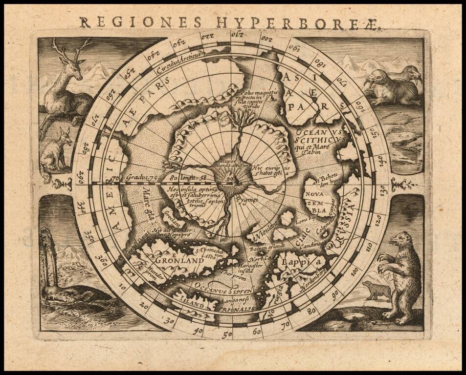
Fine example of Bertius' reduced size version of Gerhard Mercator's highly important and influential map of the North Pole, first published in 1595. Gerard Mercator was the first cartographer to create a polar projection of the earth. His map, the...
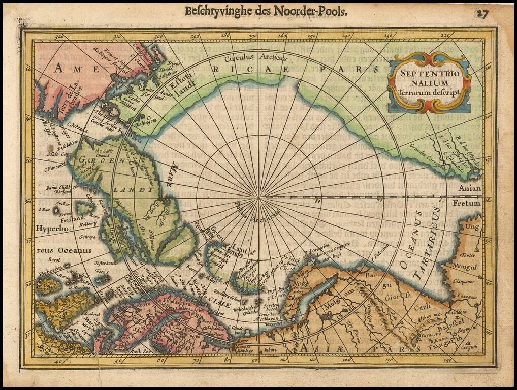
Excellent early map of the North Polar regions, based upon early maps by Mercator and Hondius. Shows the mythical land masses near the pole, the clearly navigable NW and NE passages, a massive California, as discovered by the Spanish, the Davis...
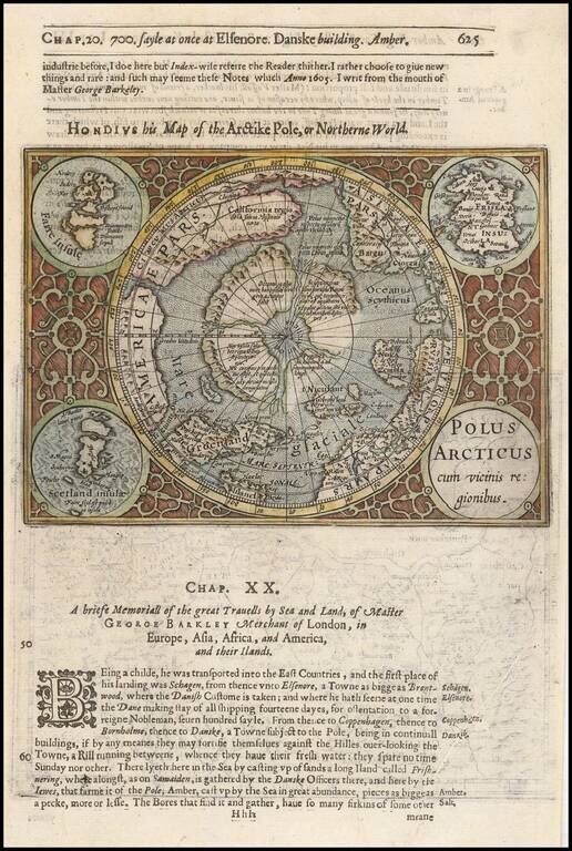
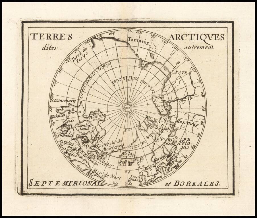
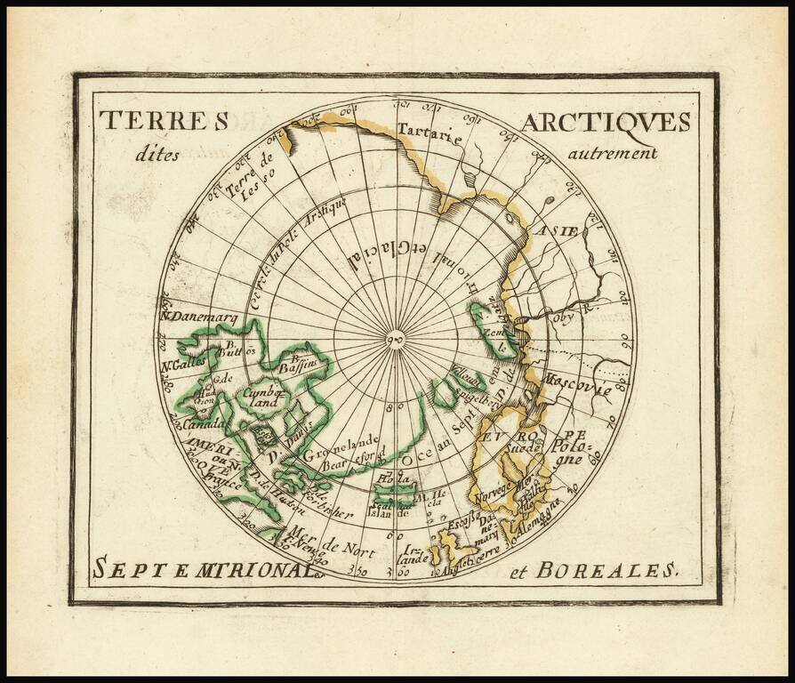
Nice example of this fine miniature map of the North Polar regions, being a reduced copy of the first separate map of the North Polar Regions. The map is extended to 60 degrees, to incorporate the recent explorations in search of the North West and...
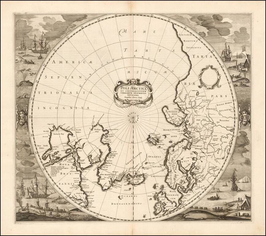
Striking example of Henricus Hondius' map of the North Polar Regions, first issued in 1636. With the advances in the knowledge of the Arctic, Mercator's map of 1595 had become obsolete by the 1630s. Hondius drew on the cartography of Henry Briggs for...
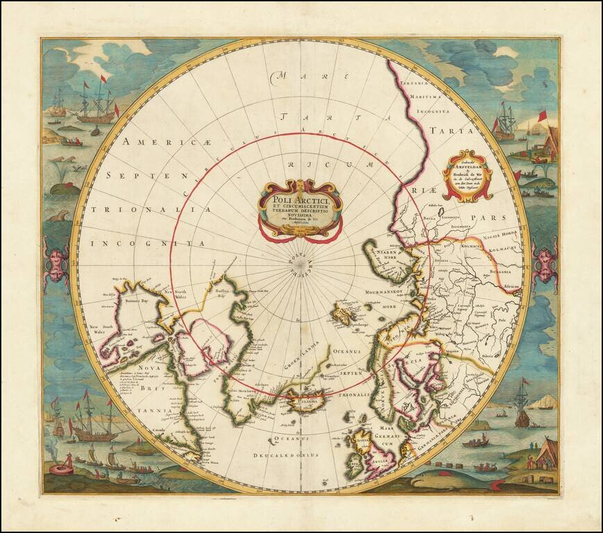
Old color example of Jansson's map of the North Polar regions, newly revised by Frederick De Wit. The map shows Baffin's Bay, Button's Bay and James Bay, Greenland, Iceland, Spitsberge (with incomplete coastline), Lappland, Russian and European Asia,...
![[North Polar Regions, Globe Calotte]](/map/small/67030.jpg)
Fine, Illustrated North Polar Globe Calotte Polar calotte that depicts coastlines and islands in far northern waters, as well as noting significant Arctic expeditions from the sixteenth and seventeenth centuries. The calotte—a cap that covers the...

English North Polar Rarity Rare English map of the North Polar regions, published by Jonas Moore. The map appeared in Moore's A New Geography. Many of the plates in the work were engraved by Herman Moll, who had moved to London in 1678 and had not...
Rare map of the Northern Hemisphere, illustrating the known and imagined lands of the North Polar regions. The map provides a fine accounting of the lands of the North Polar regions, much of which were fictional.
Du Val's Map of the Arctic Rare map of the north polar regions. The map provides a fine accounting of the lands of the Polar regions, which remained largely unexplored.
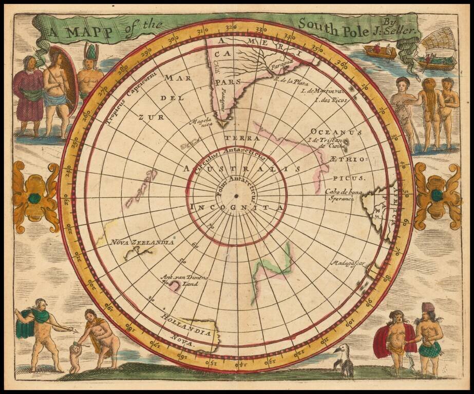
A 17th Century English South Polar Rarity Rare miniature map of the South Polar region, from Seller's Atlas Maritimus. Both the cartographic detail and embellishments are based upon the Hondius/Jansson map of the South Polar regions.
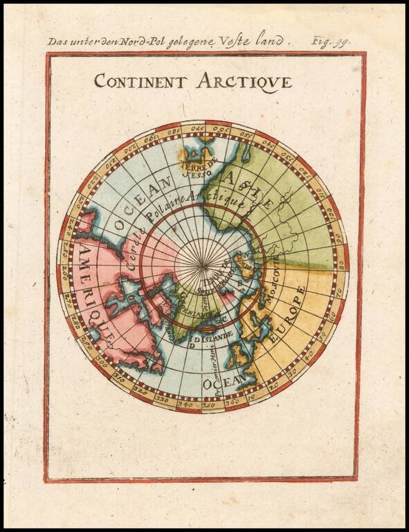
Interesting map of the South Polar Regions, including mythical coastlines and the known coastal regions in New Zealand, Australia, South America and Africa. From Mallet's monumental work.
![[South Polar Globe Gore] Fernando Magaglianes Poco Contento del Re di Portogallo suo Signore . . .](/map/small/70828.jpg)
A Celebration of Magellan's Circumnavigation for the King of Portugal Finely engraved polar gore, or calotte, created for one of Coronelli's largest globes. Coronelli is well known for making a concerted effort to delineate only verified discoveries...