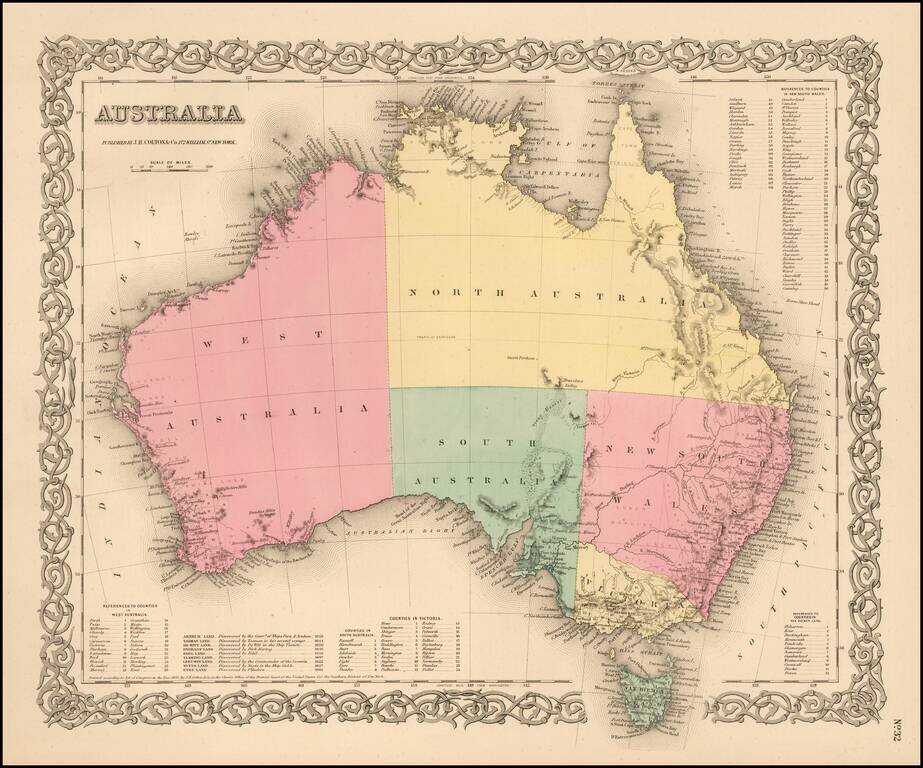
Highly detailed map of Australia, colored by provinces. Includes a key showing the various counties in each of the provinces. Shows towns, rivers, lakes, mountains, islands, etc. The interior is still highly primitive and unknown. Decorative border. A...
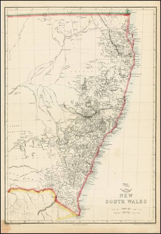
Highly detailed map of New South Wales, from the Weekly Dispatch Atlas. Includes nice early detail in the interior of NSW and fine detail along the coas. 'The Weekly Dispatch' newspaper between the years 1856 and 1862 included in each edition a map...
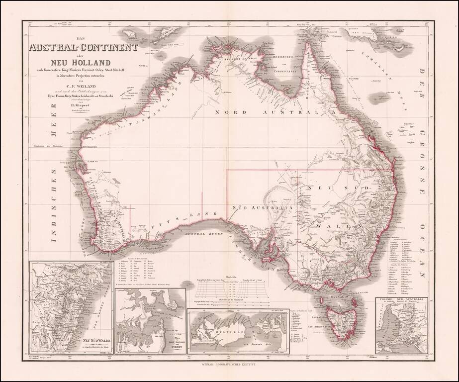
Nice example of Kiepert's fine early map of Australia, incorporating the recent explorations of Eyre, Frome, Grey, Stokes, Leichardt, und Strzeliecki.
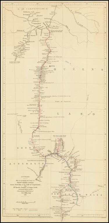
Route Map of the Burke and Wills Expedition Across Australia Detailed map showcasing the route of the Burke and Wills Expedition, which appeared in the Journal of the Royal Geographical Society to accompany an account of the expedition. The map shows...
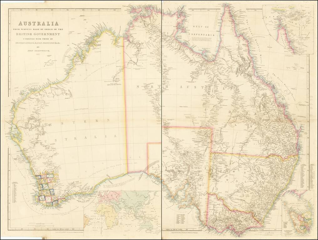
A Comprehensive Compilation of Australian Exploration Routes Into The Interior Parts of the Continent. Fine 2 sheet map of Australia, published by John Arrowsmith in London, shown in the midst of the decade of Australia's gold rushes and rapid...
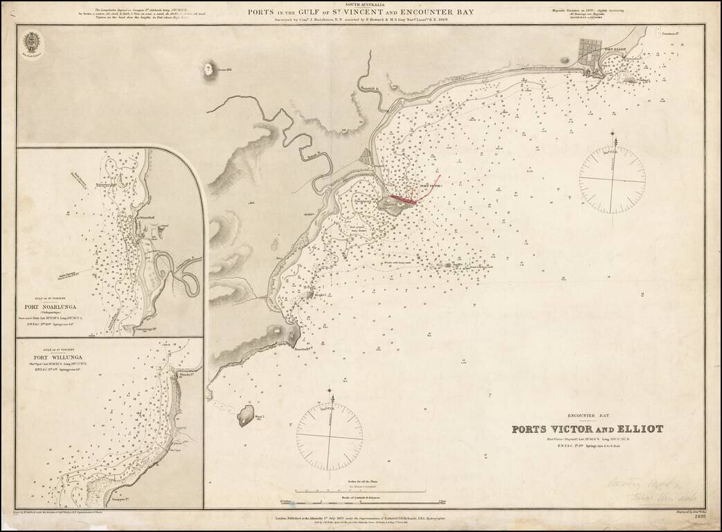
Fine example of the first edition of this early Admiralty Chart showing the ports in the Gulf of St. Vincent and Encounter Bay, published by the Admiralty in 1870. Detailed chart of the coastal region just south of Adelaide and east of Kangaroo...
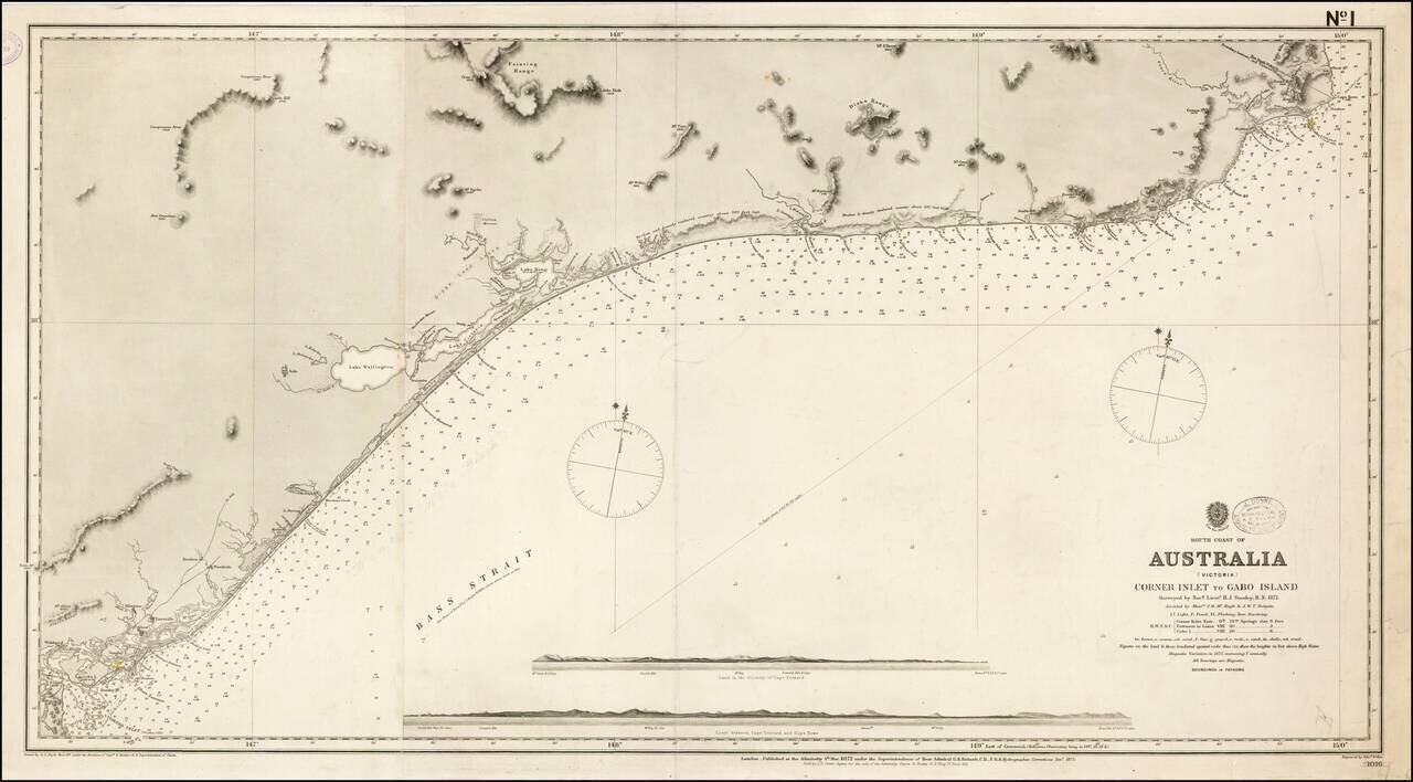
First State of this scarce working sea chart of the Victoria Coastline, to the northeast of Melbourne, published by the British Admiralty. The chart starts at the border between New South Wales and Victoria, near Cape Howe and Gabo Island, and extends...
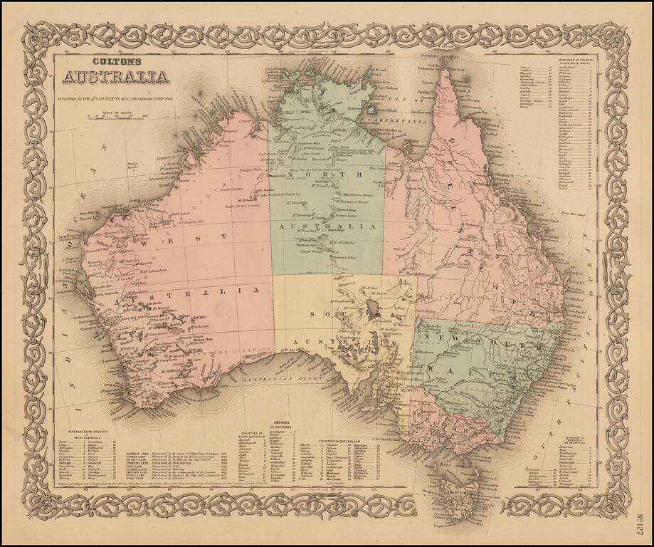
Highly detailed map of Australia, colored by provinces. Includes a key showing the various counties in each of the provinces. Shows towns, rivers, lakes, mountains, islands, etc. The interior is still highly primitive and unknown. Decorative border....
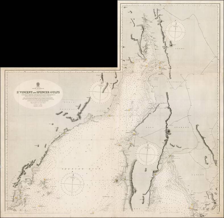
Northern sheet of this scarce working sea chart of St. Vincent and Spencer Gulfs on South Australia, published by the British Admiralty. The chart starts near Port Augusta and extends southeast to Adelaide and southwest to Port Lincoln. It includes...
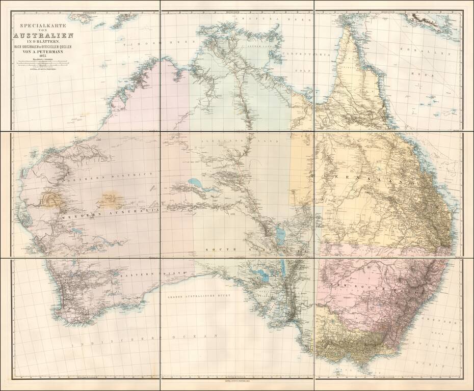
Scarce 9 sheet map of Australia, published by Augustus Petermann. Large map of Australia showing towns, river system, railways and telegraph lines and county boundaries. The map features the routes taken by a number of important overland explorers,...
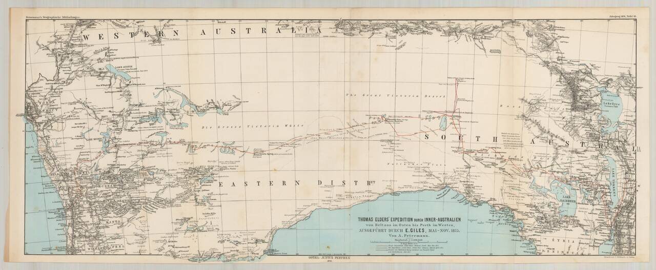
Ernest Giles Crossing From South to Western Australia in 1875. Detailed map illustrating the route taken by Ernest Giles second expedition across Australia between May 1875 and November 1875, between Perth and Beltana. Sir Thomas Elder was a...
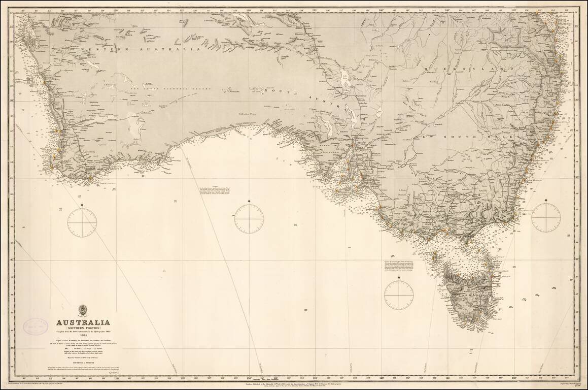
Fine rare format chart of the Southern part of Australia, published by the British Admiralty. Includes Brisbane, Syndey, Melbourne, Adelaide, Perth, and Tasmania.
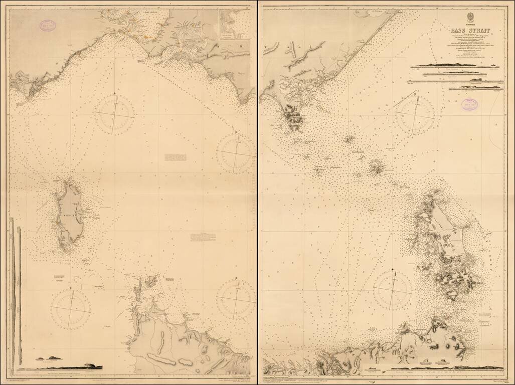
Fine two sheet chart of the Bass Straits published by the British Admiralty. The chart is based on the original surveys of John Lort Stokes and was periodically updated by the Admiralty over the next 40 years. John Lort Stokes (1811-1885) joined the...
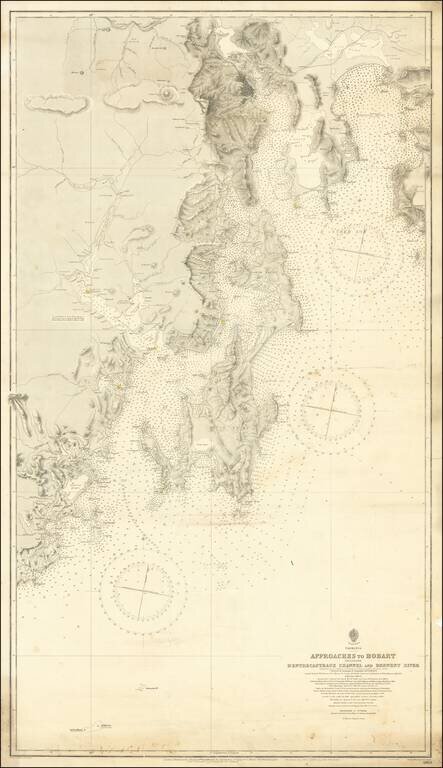
Detailed sea chart of the approaches to Hobart, first published by the British Admiralty in 1889. The present example is corrected to 1912 and presents a highly detailed look at the Tasmanian Coastlilne between Recherche Bay and the Tasman Peninsula,...
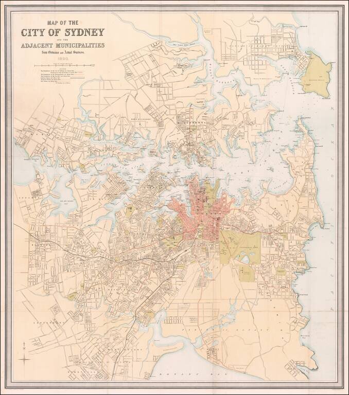
Striking, Detailed Map of Sydney at the Turn of the Twentieth Century Fine large-format map of Sydney and its environs printed and published by John Scott & Co. in Sydney. This map captures Sydney at a vibrant moment in its development....
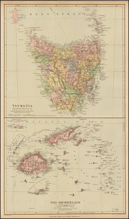
Fine and highly detailed map of Fiji and Tasmania, from Stanford's London Atlas. The map is meticulously colored by counties and shows fine detail throughout.