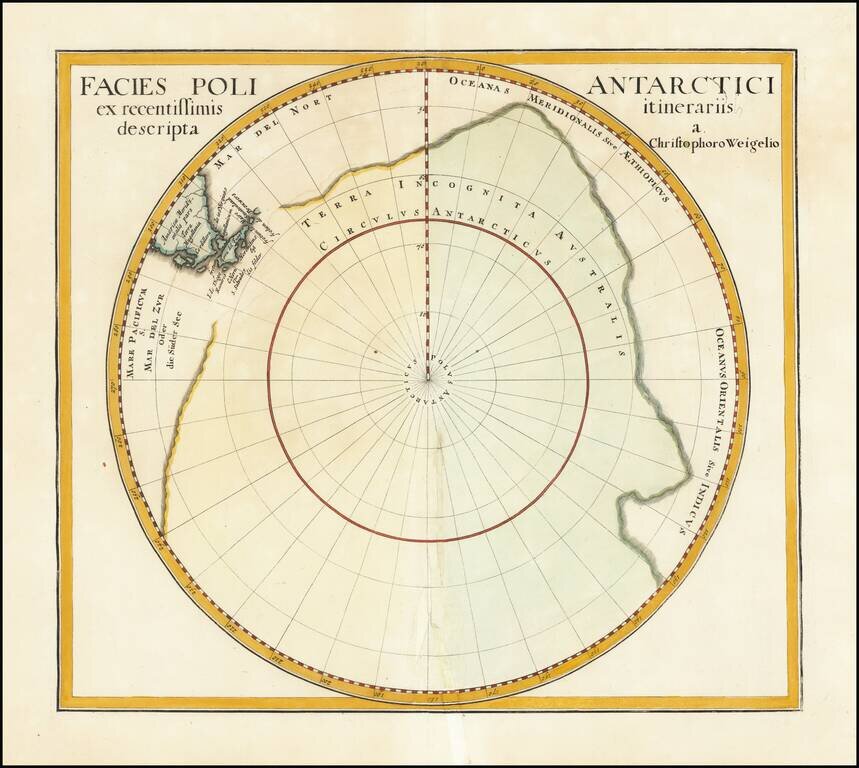
Interesting and nearly completely conjectural map of the South Pole from Davide Kohler's Descriptio Orbis Antiqui…published by Weigel in 1720. The map shows the prevailing belief in a massive southern hemisphere, which extended to just south of the...
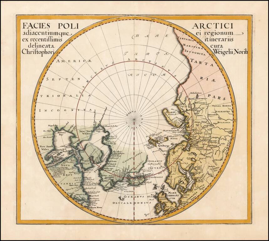
Interesting map of the North Pole from Davide Kohler's Descriptio Orbis Antiqui…published by Weigel in 1720. The map shows the prevailing belief in a massive northern hemisphere, extending to Alaska, Canada, the British Isles, Scandinavia and...
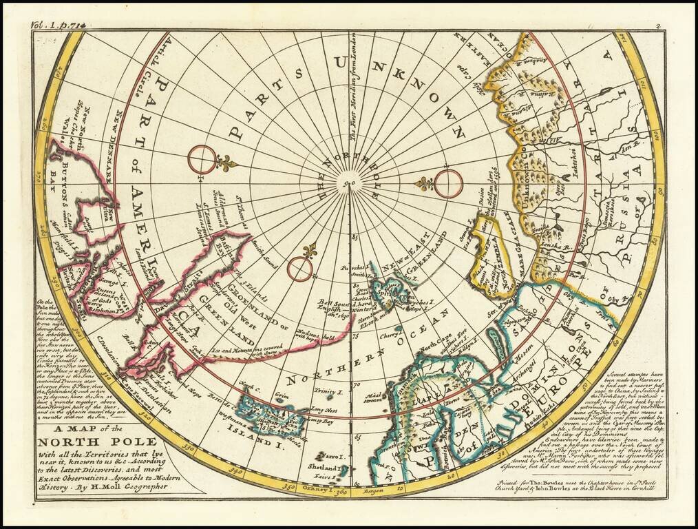
A fine example of Moll's map of the polar regions, known and unknown. The western part of North America is conspicuously absent, as is northeast Asia. A lengthy narrative note along the bottom describes the best contemporary knowledge. The body of...
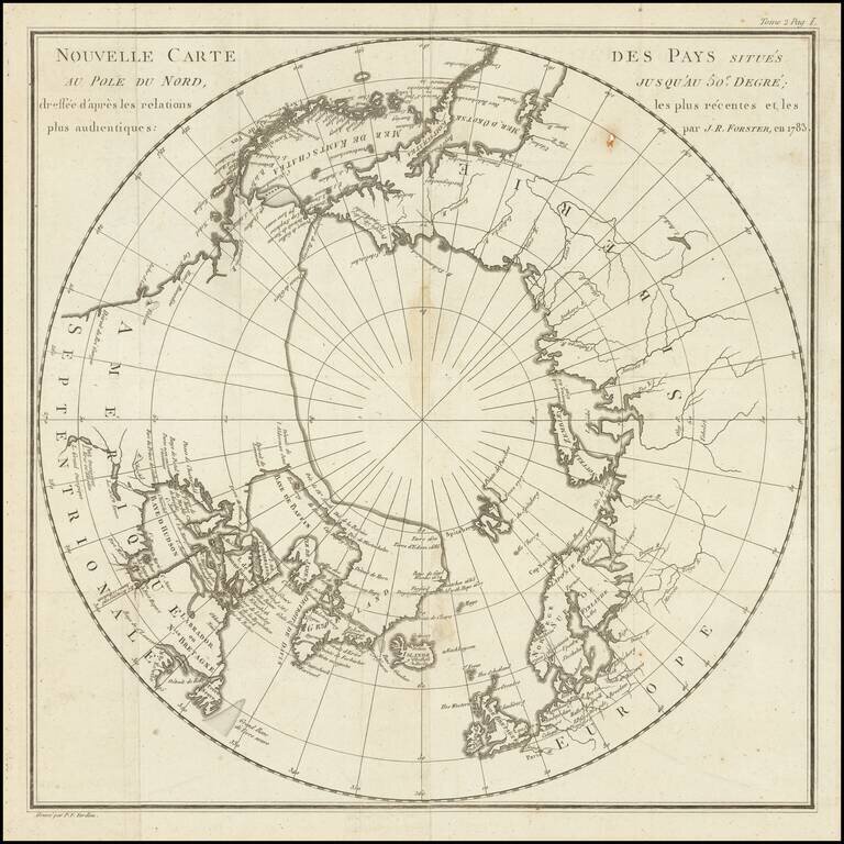
Fine map of the polar regions, which illustrated the French edition Johann Reinhold Forster's Geschichte der Entdeckungen und Schiffahrten im Norden, first published in 1784. The map translates as follows: New map of the countries situated fifty...
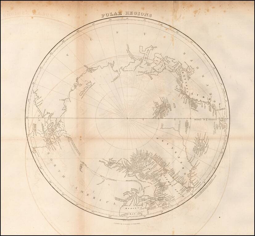
Scarce map of the Polar regions of the Arctic, published in 1822 in Edinburgh. This fascinating map of the North Pole shows a region still in the process of being discovered. There is little detail in western Canada beyond a few notes such as The Sea...

An Important British Admiralty Polar Chart Rare separately published map of the Polar regions, published on June 29, 1835 in London by the British Admiralty. The present example is updated to 1849, which seems to be the the edition ordered for...
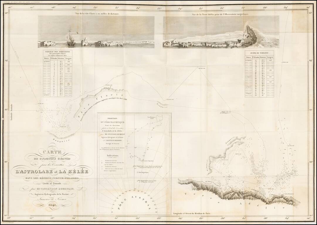
Reporting the Correct Location of the Southern Magnetic Pole -- Among the Very First Maps to Report Sighting of the Antarctic Landmass. Large engraved folding map of the Antarctic coast south of Van Diemen's Land. The map documents the leg of the...
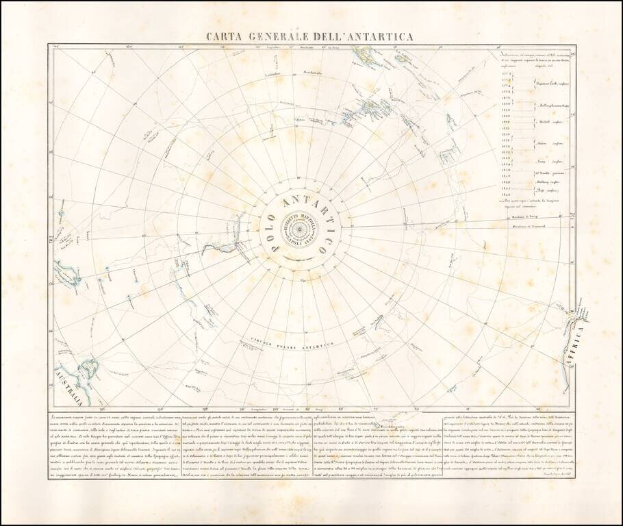
Rare map of the Antarctic regions, by Neapolitan mapmaker, Benedetto Marzolla. The map shows the tracks of South Polar Explorers, from Captain James Cook, in 1772, to Ross, in 1842. Voyages depicted are: Captain James Cook 1772-1775 Fabian Gottlieb...

Scarce map of the South Pole, showing the most recent discoveries and some conjectural regions. Includes annotations with dates of discoveries from 1820 to about 1840 (Charles Wilkes), with some earlier notes regarding Cook's contact with the region...
Rare separately published map of the Polar regions, published in December 1855 in London by the British Admiralty. Oriented with Greenwich meridian at the bottom, the map covers the Arctic Ocean and Arctic landmasses adjacent to it. On the verso are...
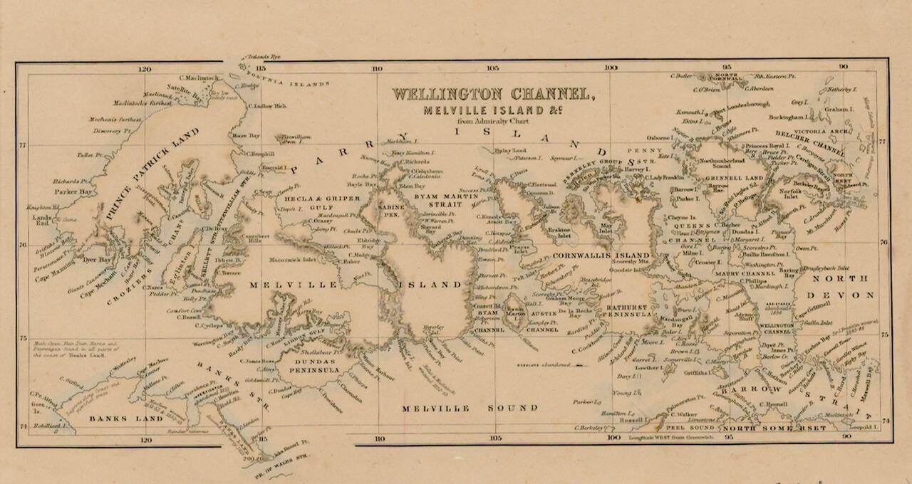
Interesting map of the Region being explored by the British in the second half of the 18th Century, with many up to date discoveries and place names.
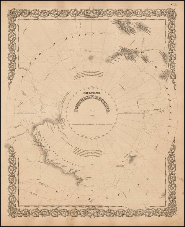
Detailed map of the South Polar Region, published by GW & CB Colton. The map shows in detail the land masses discovered to date, along with the Tracts of the Wilkes, Bellinghausen, Kemp, Ross and Cook Voyages, landfalls, etc.
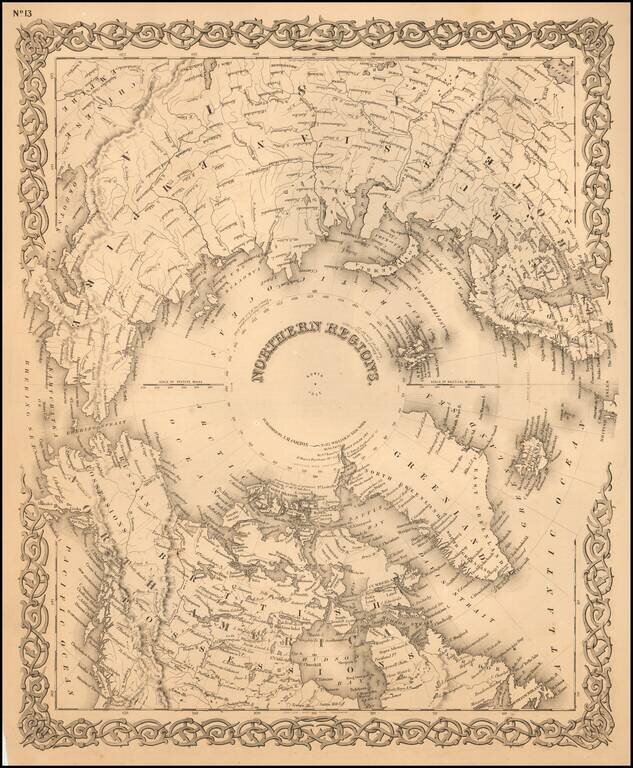
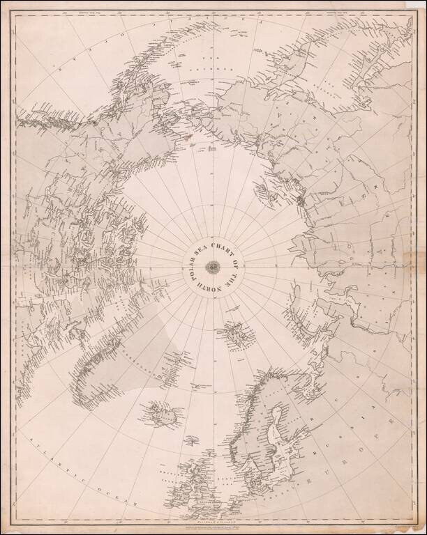
Detailed map of the regions around the North Pole. The Northwest and Northeast Passages are delineated and most of the coastlines of North America, Europe and Asia are shown with relative accuracy.

First Site of Stanford's Rare Map of the Polar Regions Fine example of Edward Stanford's map of the North Polar Regions, featuring the furthest most points reached by numerous exploring expeditions. Published on December 2, 1878, the map notes the...
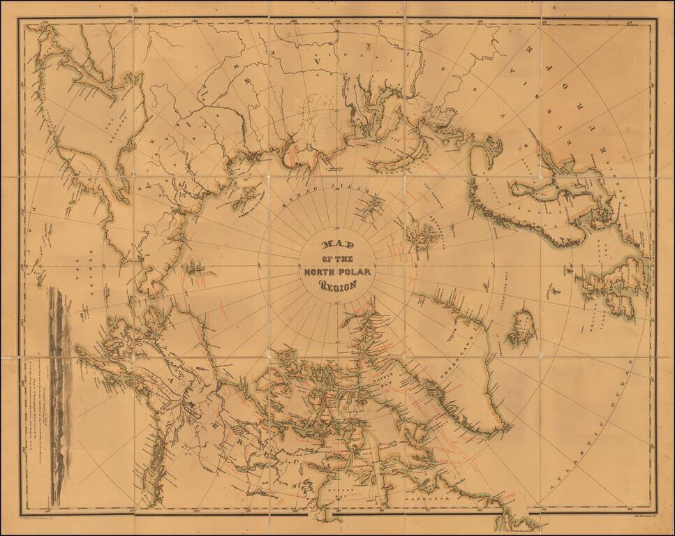
Interesting map of the North Polar regions. The map provides a remarkable overview of Polar Exploration up to the mid-1870s. Approximately 70 explorers spanning four centuries are noted on the map, including the dates of voyages and coastlines...

Rare Map of the Polar Regions, Updated To Show Adolf Erik Nordenskold's Progress in 1878 Toward Completion of the First Northeast Passage. Fine example of Edward Stanford's map of the North Polar Regions, featuring the furthest most points reached by...