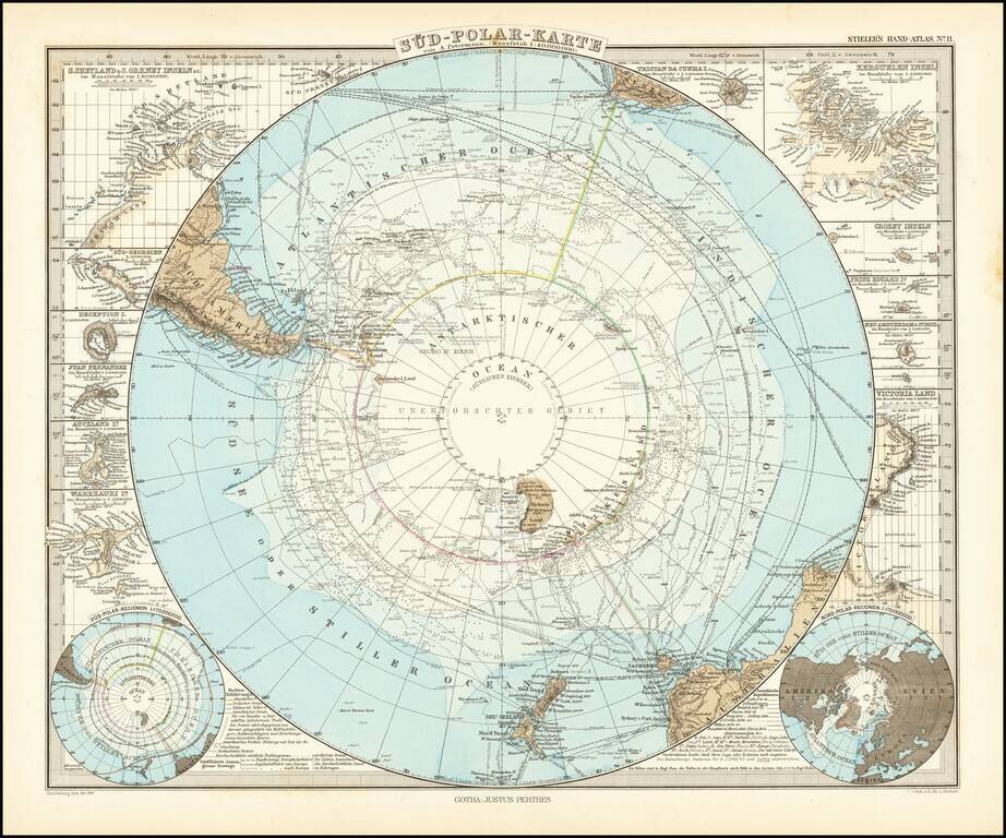
Very detailed map of the south polar regions, illustrating the great precision of Stieler's work. Remarkable amount of explorer details, including: Cook 1772-75 Bellinghausen 1819-21 Wedell 1822-23 Biscoe 1830-32 Kemp 1834 Ballen 1839...
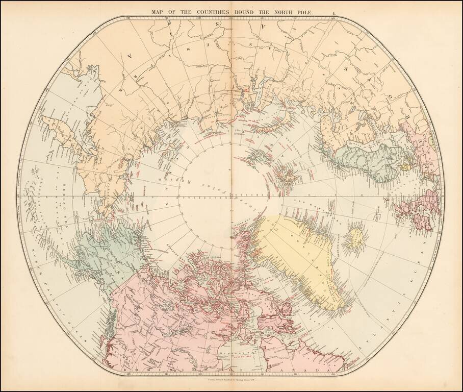
Fine early edition of Edward Stanford's map depicting the entire Arctic Region, featuring the furthest-most points reached by numerous exploring expeditions. This fascinating map embraces the entire Arctic regions of the World, within a unique ovoid...
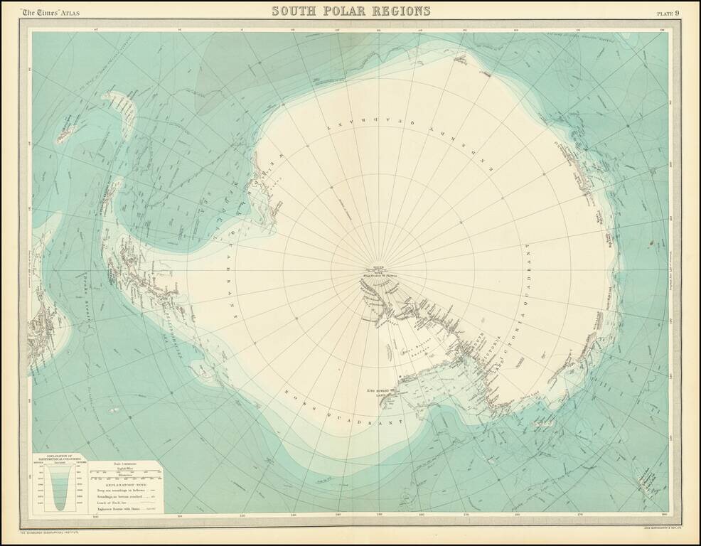
Detailed accounting of the recent explorations in the South Polar Regions. The map identifies the explorations of: Cook 1772-75 Bellingshausen 1819-21 Wedell 1822-23 Biscoe 1830-32 Kemp 1834 d'Urville 1838-40 Balleny 1839 Wilkes 1839-40...

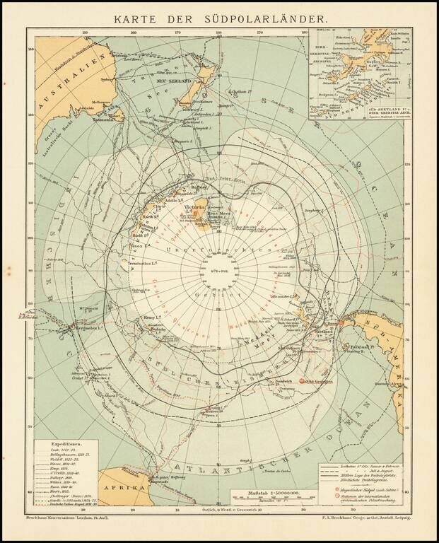
Finely executed map of the South Polar regions, published in Leipizig. The map is focused on the many explorations of the Antarctic regions up to several discoveries in 1902 and 1903. Very detailed map of Antarctica with insets and numerous tracks of...
This is a fantastic map of Antarctica, published at a time when the outline of the continent was just starting to take shape. Parts of the exterior of the continent are shown in detail, though the interior of the vast continent is little described....
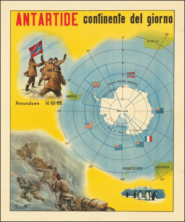
The Race for The South Pole Fine large, early twentieth-century Italian image illustrating the race for the South Pole and a map of Antarctica. The map depicts the race for the South Pole, where explorers from various nations sought to be the first...

Intereting publication and maps focused on the special methods of air navigation in the Polar regions. The maps cover the north and south Polar regions.
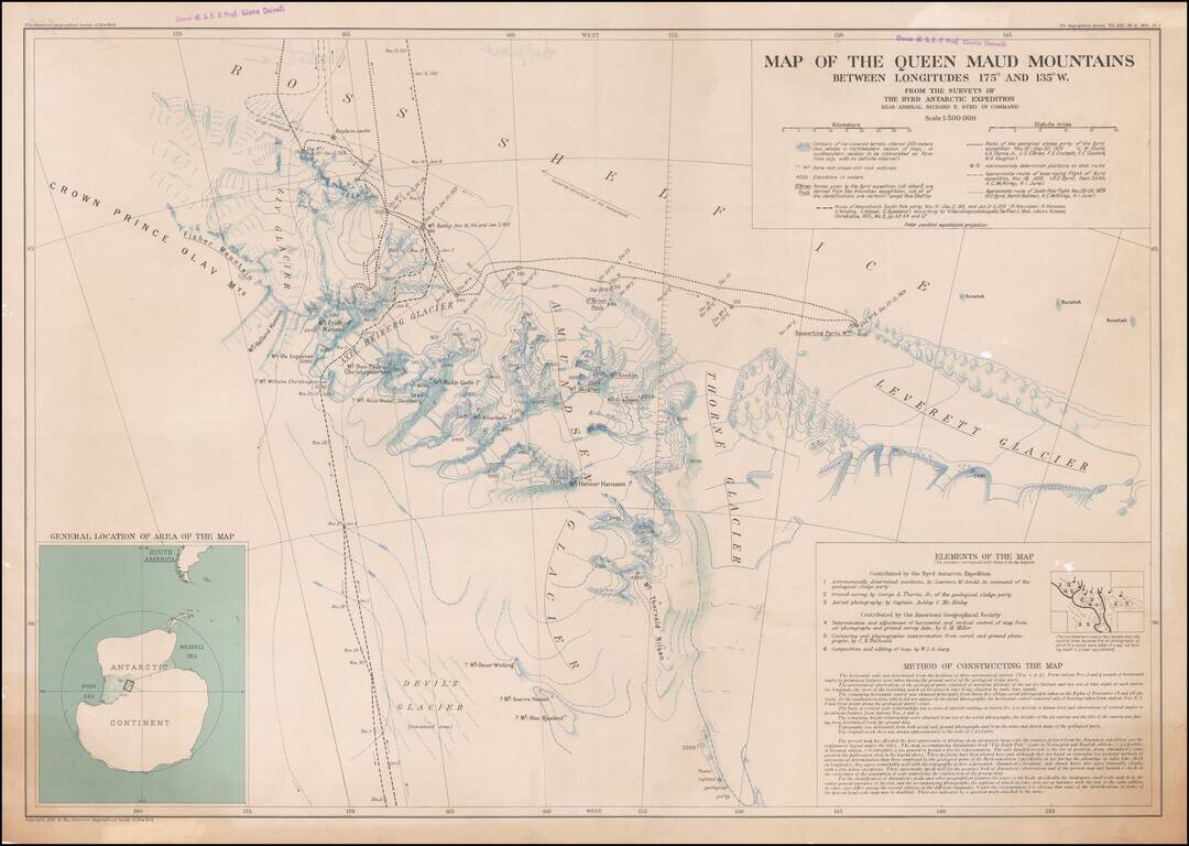
Owned By A Famous Italian Geography and Geologist The Queen Maud Mountains are a major group of mountains of the Transantarctic Mountains, lying between the Beardmore and Reedy Glaciers and including the area from the head of the Ross Ice Shelf to the...
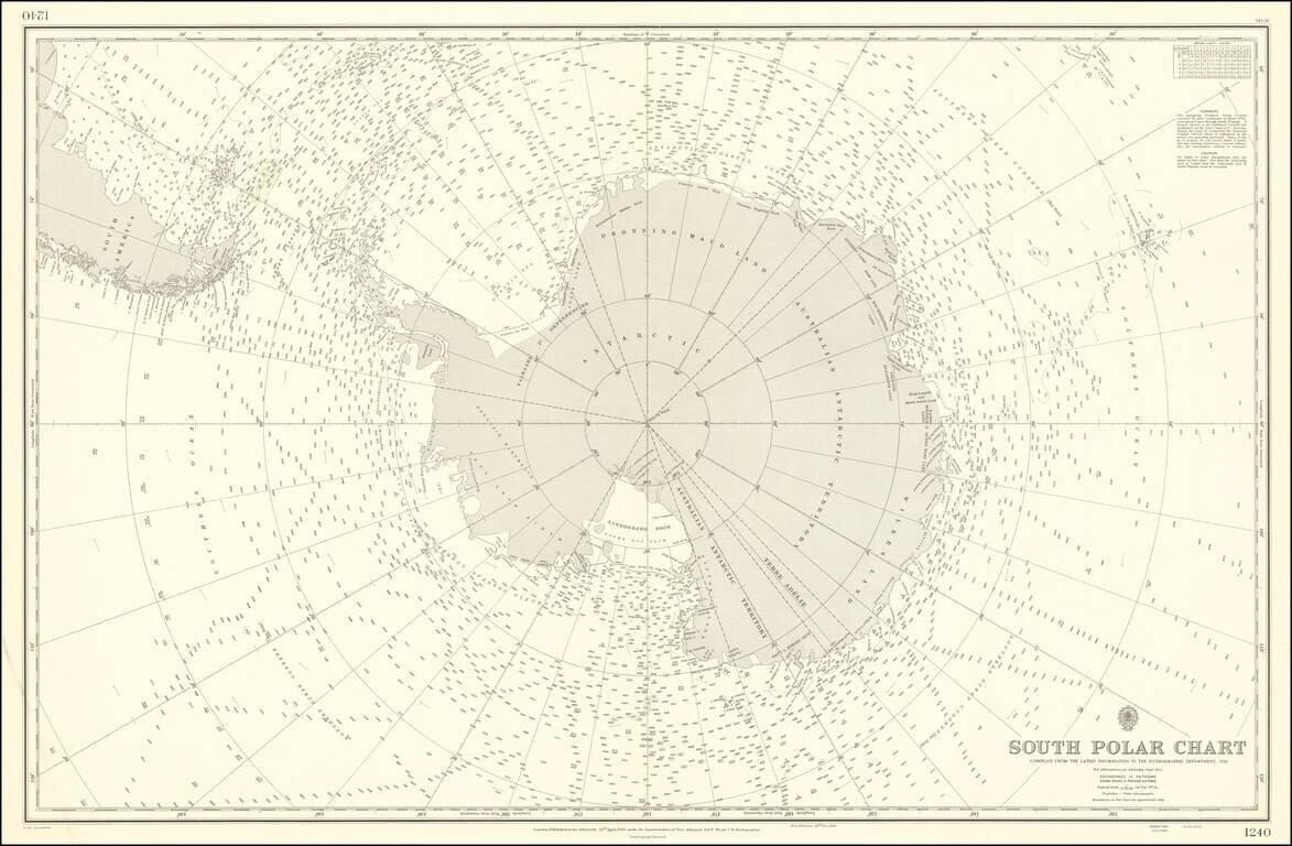
Rare and highly detailed map of the South Polar regions, published by the British Admiralty. The map incorporates information from the 1950 survey of the Antarctic Peninsula and the The Norwegian - British - Swedish Expedition (NBSAE) of 1949-52, the...

Rare U.S. Army recruiting poster featuring a globe at the center. According to the limitation note in the bottom margin, the poster was printed in an edition of 25,000, but it remains exceptionally scarce today; we find no records of it anywhere....
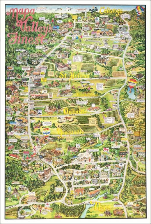
Decorative pictorial map of Napa Valley, from Napa to Calistoga, published by City Design. The map includes advertising for a number of local merchants, including wineries, restaurants, hotels and many wine related tourist attractions. Several...
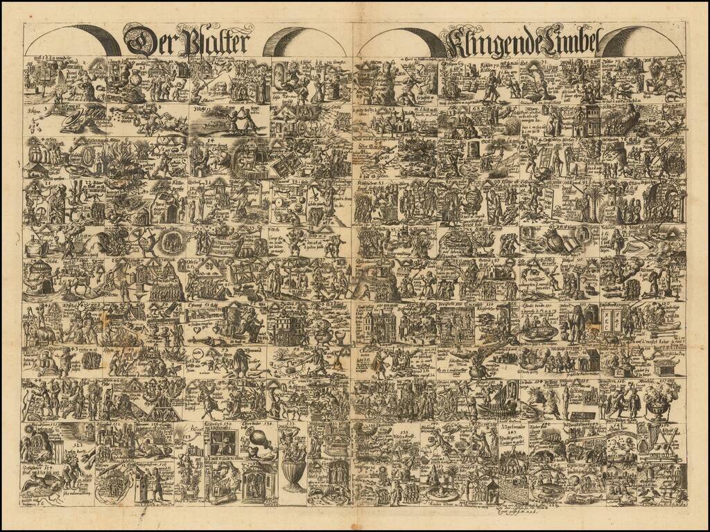
Highly unusual and decorative engraving illustrating stories from the Bible. The engraving comes from a collection by Johannes Buno (1617-1697), a Lutheran school teacher from Lüneburg, Germany. Buno's scarce work, a "Picture Bible", was filled with...
![Buch Hiob. bitter. [Allegorical print.]](/map/small/47918.jpg)
Highly unusual and decorative engraving illustrating stories from the Bible. The engraving comes from a collection by Johannes Buno (1617-1697), a Lutheran school teacher from Lüneburg, Germany. Buno's scarce work, a "Picture Bible", was filled with...
![Buch vonden Konigen. . . [Allegorical Biblical print.]](/map/small/47976.jpg)
Highly unusual and decorative engraving illustrating stories from the Bible in the form of a king who holds a scepter in his right hand. The engraving comes from a collection by Johannes Buno (1617-1697), a Lutheran school teacher from Lüneburg,...
![Matthaeus. . . [Allegorical Biblical engraving.]](/map/small/47816.jpg)
Highly unusual and decorative engraving illustrating stories from the Bible (Gospel of Matthew) in the form of a human face, flanked by a pair of wings. The engraving comes from a collection by Johannes Buno (1617-1697), a Lutheran school teacher from...
![II Buch der Chronica. [Allegorical Biblical engraving.]](/map/small/48090.jpg)
Highly unusual and decorative engraving illustrating stories from the Bible in the form of an upside down crown. The engraving comes from a collection by Johannes Buno (1617-1697), a Lutheran school teacher from Lüneburg, Germany. Buno's scarce work,...