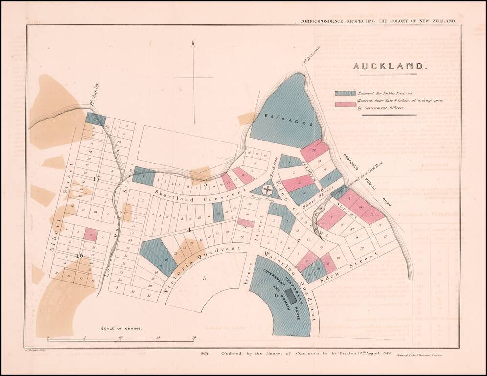
The Earliest Obtainable Map of Auckland, New Zealand Early plan of Auckland, New Zealand, from the Correspondence respecting the Colony of New Zealand, published by the House of Commons in London. The map shows allotments in the area between Albert...
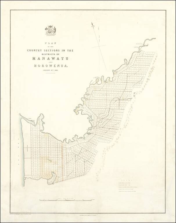
Promoting Emigration and Selling Land on the North Island -- Made for the New Zealand Company Fine, rare map of the Manawatu and Horowhenua Districts in the Manawatū-Whanganui region of the North Island, published for the New Zealand Company, one of...
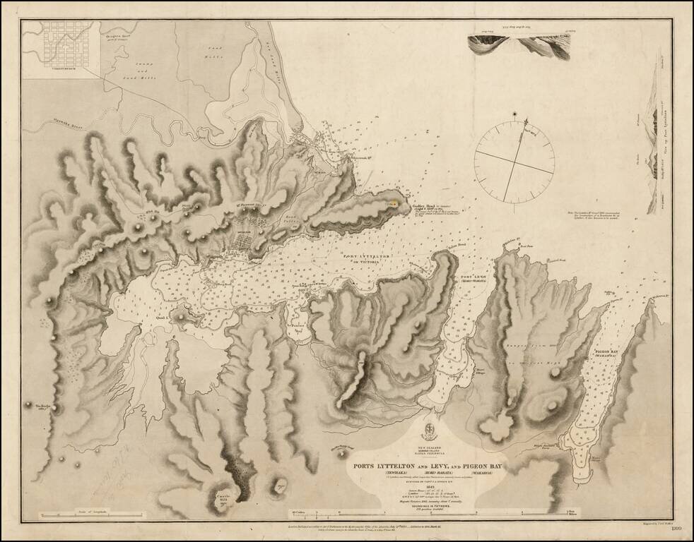
Finely executed chart showing Port Lyttelton and environs, extending north to Christchurch. The chart extends the area from north of the Avon and Heathcote Estuary down to beyond Pigeon Bay, showing the soundings in fathoms from the Estuary outlet to...
Excellent large map of New Zealand, which is now beginning to include some interior detail. One of the largest maps of New Zealand to appear in a commercial atlas in the 19th Century. Decorative Piano Key border. Fine example, on thick heavy paper.
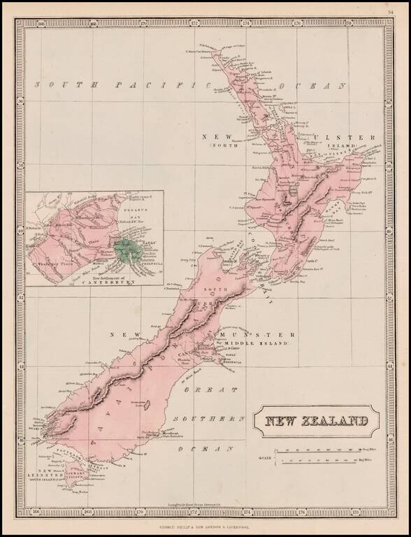
Highly detailed map of New Zealand, published by George Philip & Son in Liverpool. Includes a large inset of the "New Settlement Canterbury."
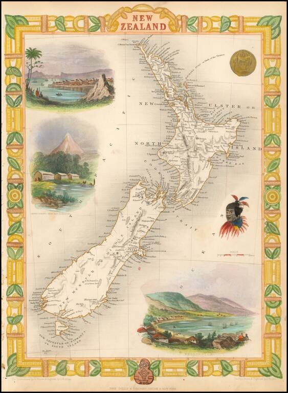
Nice full color example of Tallis' map of New Zealand. Includes decorative vignettes of Auckland, Wellington, Mount Egmont from New Plymouth, a Maori Warrior and seal. Engraved for R. Montgomery Martin's Illustrated Atlas. Tallis was one of the last...
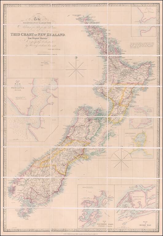
Previously Unrecorded, Late State of the Best General Map of New Zealand then Extant Important, previously-unrecorded state of the famous McDonnell-Wyld map of New Zealand, published by James Wyld Jr. in London in ca. 1885. This seems to be the...
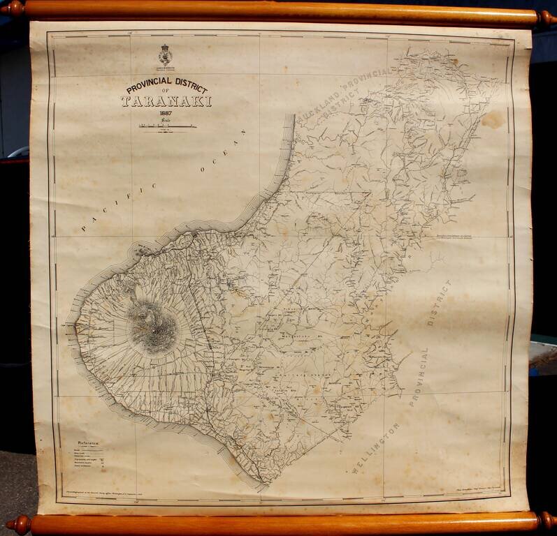
Rare Provincial Map of Taranaki District, New Zealand Highly detailed map of Taranaki Province, by the New Zealand Survey, led locally by Thomas Humphries, Chief Surveyor in New Plymouth. The most prominent feature on the map is Mount Taranaki, with...
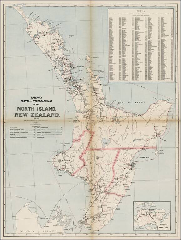
Map of the North Island of New Zealand showing railways, railway stations, post and telegraph offices and postal routes. Relief shown by hachures. Index locates places within the island. One of the largest maps of North Island to appear in a...
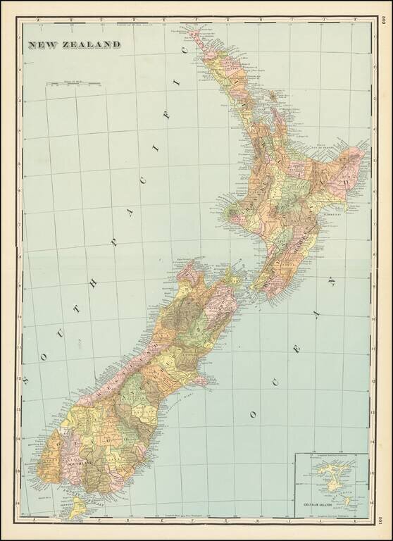
Large detailed map of New Zealand, published by George Cram in Chicago. Large inset of the Chatham Islands.
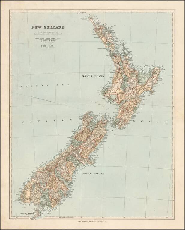
Fine and highly detailed map of New Zealand, from Stanford's London Atlas. The map is meticulously colored by counties and shows fine detail throughout.
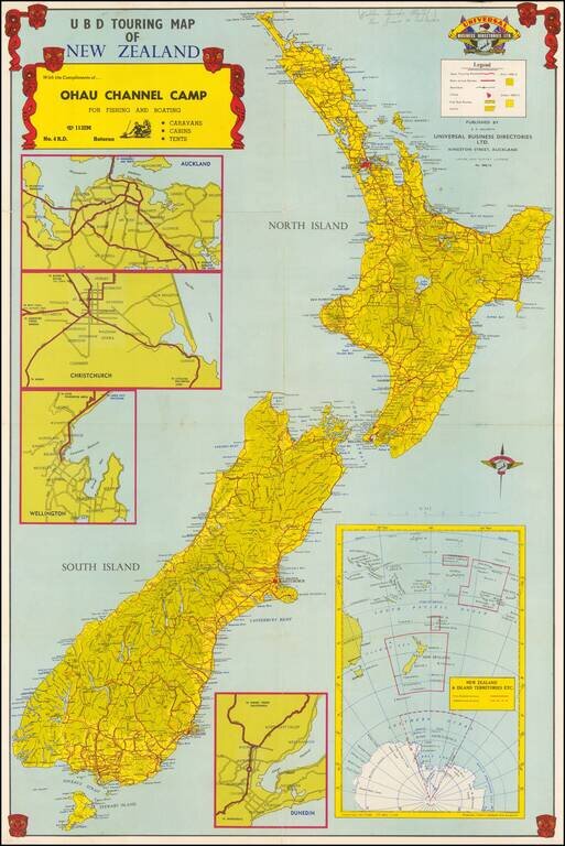
Decorative touring map of New Zealand, embellished with Mauri Warrior masks. Shows the main touring routes, railways, city bus routes, parks, etc. Large inset maps of Auckand, Dunedin, Christchurch and Wellington. On the verso, there are smaller maps...
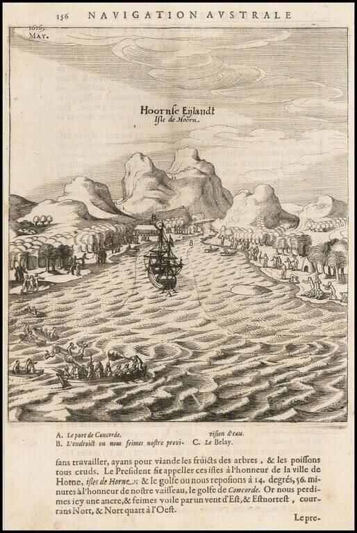
Scarce map of the bay and coast of the South Seas island of Futuna (Hoorn), from the voyage of Le Maire and Schouten. The bay shown was named after the ship Eendrachts (Unity Bay). Willem Cornelisz Schouten (1567-1625) was a navigator for the Dutch...
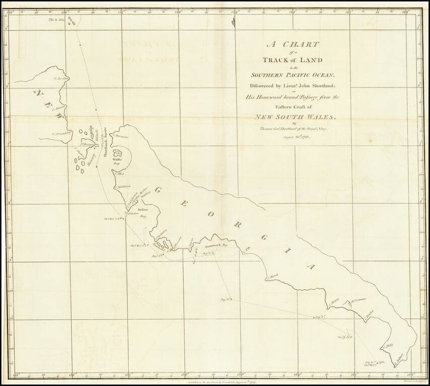
Detailed map of South Georgia, showing the tracks of Lieutenant John Shortland. John Shortland (1739–1803) entered the Royal Navy in 1755 as a midshipman and served under Admiral Boscawen off Newfoundland, under Admiral Byng off Minorca and under...
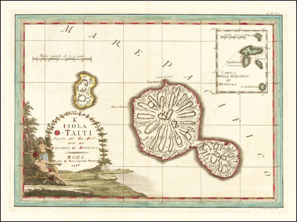
Decorative map of the island of Tahiti, published in Rome by Cassini, with a large inset map of the Marquesas Islands. Cassini's map celebrates the visit to Tahiti by Captain James Cook, during Cook's scientific mission to observe the transit of the...
![[Tonga Islands] Le Isole De Gli Amici Delineate Suller ulitime Osservazioni de Cap. Cook . . . 1798](/map/small/64141.jpg)
Decorative map of the island of the Friendly Islands (Tonga), published in Rome by Cassini, with a large inset map of the Marquesas Islands. Cassini's map illustrates Captain James Cook's visits to the islands in 1773, 1774, and 1777, with each visit...