Map size in jpg-format: 16.9484MiB
Click to open in high resolution (open in new tab).
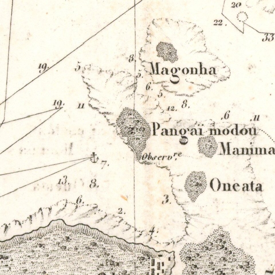
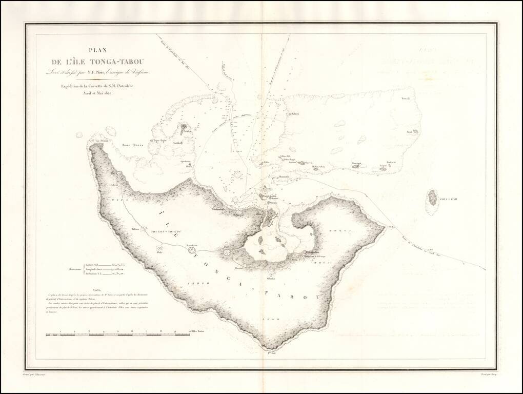
One of the earliest obtainable maps of Tonga.
Rear Admiral Jules Sébastien César Dumont d'Urville (1790-1842) was a French explorer and naval officer, who explored the south and western Pacific, Australia, New Zealand, and Antarctica. Dumont d'Urville led an expedition into the South Pacific aboard the Astrolabe, which sailed to the coast of southern Australia, extensively mapped the South Island of New Zealand, explored the archipelagos of Tonga and Fiji and the coasts of New Guinea. He located La Pérouse's shipwreck in Vanikoro and collected numerous remains of his boats, before returning to France in 1829.
After completing the voyage, he was promoted to captain and he was put in charge of writing the report of his travels. His five volume report of the expedition was published at the expense of the French government between 1832 and 1834. In his report, he criticized the military structures, his colleagues, the French Academy of Sciences and even the King - none of which, in his opinion, had given the voyage of the Astrolabe due acknowledgment.
If you are a student, write to us in telegram: @antiquemaps and indicate what material you need and for what work you need a map in high detail. We are ready to provide material on special terms. For students only!