Map size in jpg-format: 26.6084MiB
Click to open in high resolution (open in new tab).
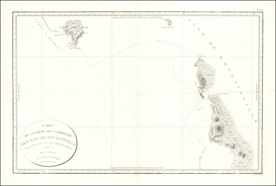
Fine early sea chart showin New Ireland and the Bougainville Islands.
This chart spans from the southern tip of Latangai Island (here called New Ireland) to the northwest coastline of Bougainville Island.
Bruni d'Entrecasteaux's route is traced and dated July 1792.
If you are a student, write to us in telegram: @antiquemaps and indicate what material you need and for what work you need a map in high detail. We are ready to provide material on special terms. For students only!