logo

1950. Tahiti

  • Tahiti

Map size in jpg-format: 7.15069MiB

Download "Tahiti", in high resolution.

Tahiti information:

Year of creation: 
Resolution size (pixels): 
 4984x6446 px
Disk Size: 
 7.15069MiB
Number of pages: 
 1
Place: 
 Paris

Print information. Print size (Width x height in inches):
Printing at 72 dpi 
  69.22 х 89.53
Printing at 150 dpi 
 33.23 х 42.97
Printing at 300 dpi 
 16.61 х 21.49

An example of detailing the file of this map of in a printable high-resolution:

Click to open in high resolution (open in new tab).
Attention! this is just the central piece (central area 960x960 px) of the map file!
This is an example, so that you can see and study the level of detail of a given map. The entire Map will be fully available after payment!

Tahiti

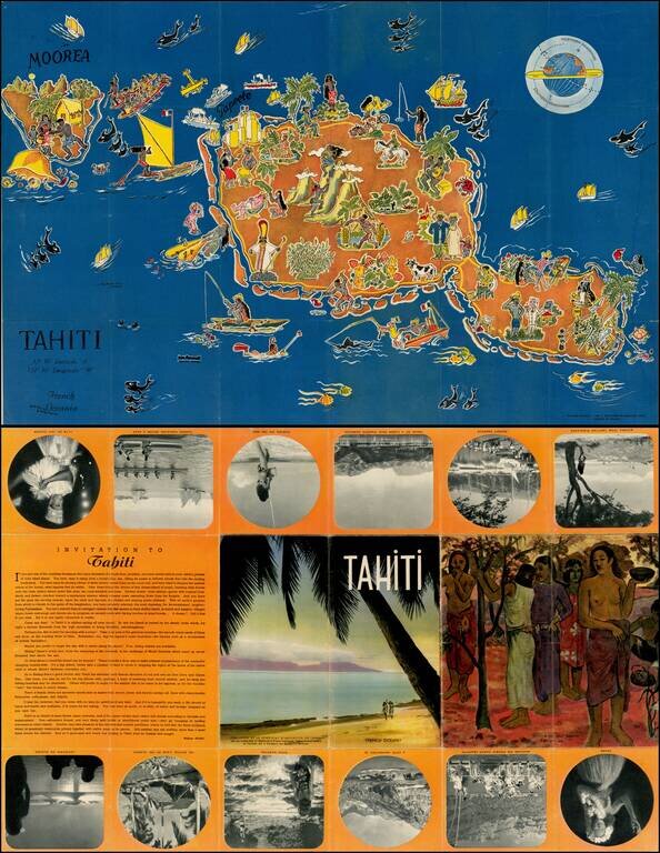
Decorative pictorial map of Tahiti, drawn by Jean Rousaute for Le Syndicat d'Initiative de Tahiti in Paris.

The map shows a colorful look at the peoples, wildlife, and tourists found around Tahiti.


Special conditions for students!

If you are a student, write to us in telegram: @antiquemaps and indicate what material you need and for what work you need a map in high detail. We are ready to provide material on special terms. For students only!

Item information:

Year of creation:
Size:
4984x6446 px
Disk:
7.15069MiB
Number of pages:
1
Place:
Paris
Author:
Le Syndicat d'Initiative de Tahiti.
$14.99

Related item