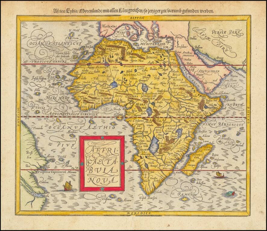
Striking Map of Africa, from Münster’s Renowned Cosmographia Fine example of Münster’s second map of Africa, from his important Cosmographia. This map replaced Münster’s boxier depiction of Africa in 1588. It was based on Abraham...
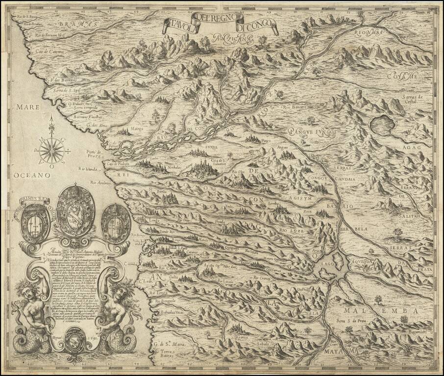
The Most Important Map of West Africa Published in the Sixteenth Century Fine example of Pigafetta's map of West Africa, published in Rome in 1591 and engraved by Natale Bonifacio. Pigafetta's map of Africa is based on the explorations of Duarte...
![[South African Section] [A discription of Aegipt from Cair downeward] . . . Printed in London by Iohn Wolfe Graven by William Rogers](/map/small/69463.jpg)
Southern sheet of John Wolfe's rare 2-sheet map of Africa, based upon Filiippo Pigafetta's important early map of Africa, which appeared in the rare English edition of Linschoten's Itinerario, Iohn Huighen van Linschoten. His discours of voyages . . ....
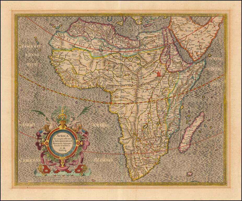
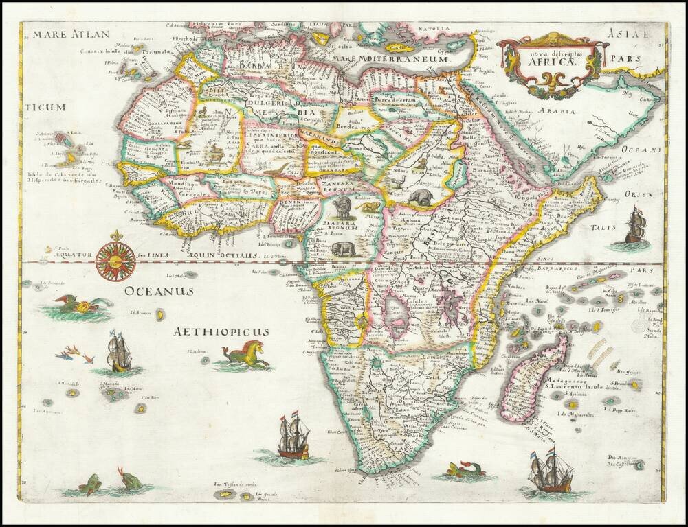
Nice old color example of the most influential maps of Africa published at the end of the 16th century. Mercator's finely engraved map of Africa depicts the continent as it was known in the late 16th century. This map is based on Gerard Mercator's...
Antique Map of Africa Heightened in Gold Leaf Striking example of Hondius' map of Africa, first issued in 1606. This was Hondius' second map of Africa, and reflects considerable improvements in the geography of the interior. Cape Horn is more rounded...
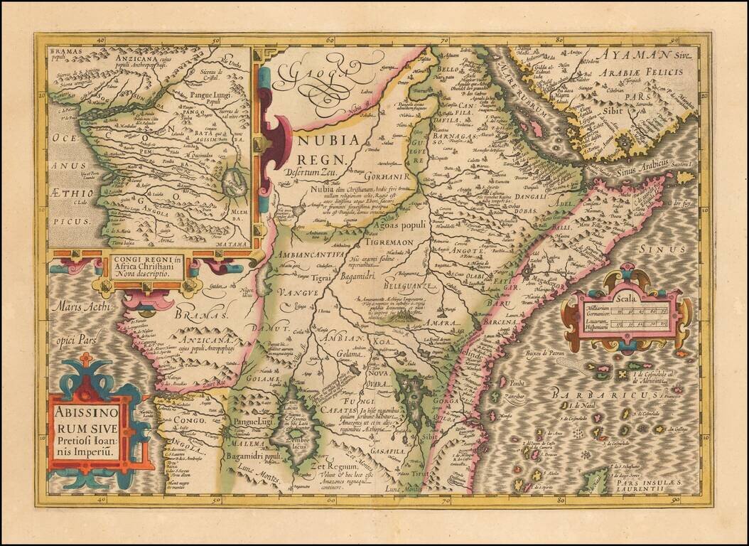
The Kingdom of Prester John Large format map of the Kingdom of Prester John, the mythical African King whom the Crusaders believed had converted to Christianity. While Prester John and his Kingdom were mythical, it did not stop the major European...
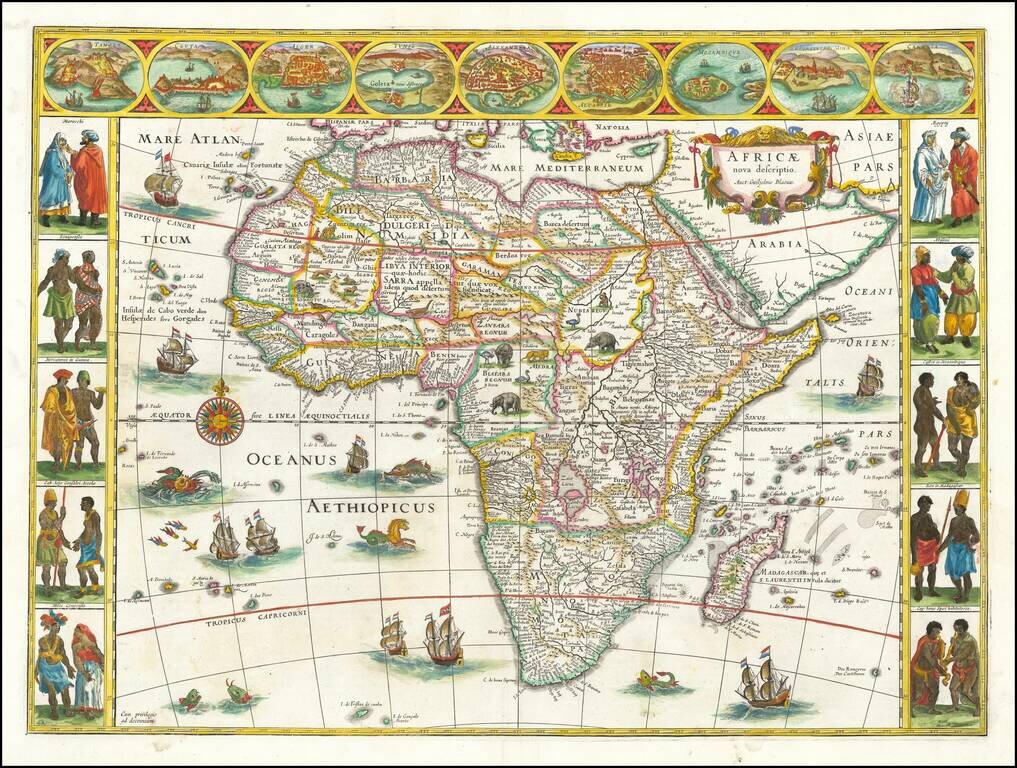
Finely, Beautifully-Colored Example of Blaeu's Map of Africa Striking example of the second state of Blaeu’s expansive map of the continent of Africa, the most iconic map of Africa of the seventeenth century. The map is tightly framed around the...
Decorative example of Merian's map of Africa. This map is richly embellished with animals, including elephants, monkeys, ostriches, gazelles, lions, cheetahs and camels. In the oceans are numerous sailing ships, sea monsters, flying fish, and a...
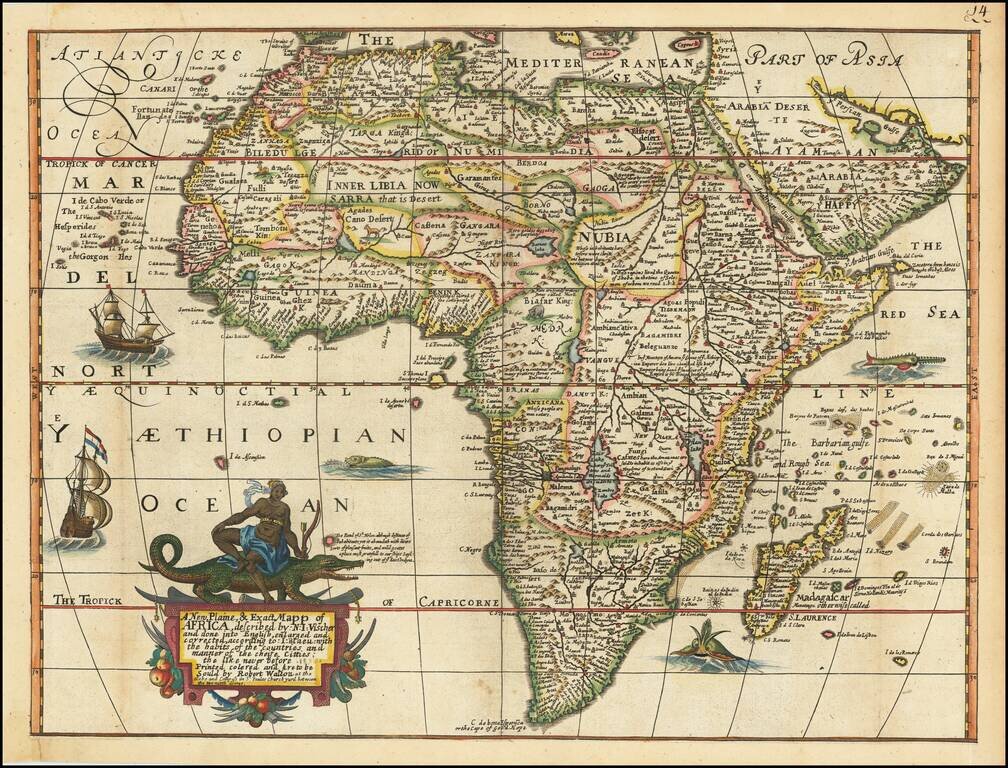
Vibrant Seventeenth-Century Map of Africa, Published in London A rare and striking map of Africa, published in London by Robert Walton. The map is not recorded by either Tooley or Norwich and contains many intriguing details revealing how Europeans...
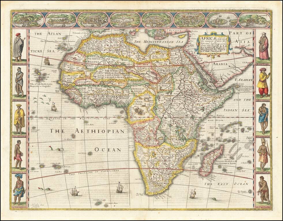
Striking example of John Speed's decorative map of Africa. The side borders contain two sets of five decorative costumes of various African peoples; the top border shows views of eight African cities. The source of the Nile is based upon Ptolemy (two...
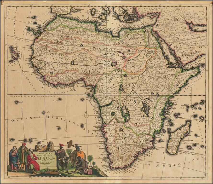
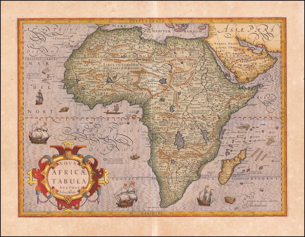
Nice example of this scarce decorative map of Africa. The map became the standard for subsequent maps of Africa, originally based upon the work of Frederick De Wit. There are a number of notable deep inlets on the southeast coast. The large lakes and...
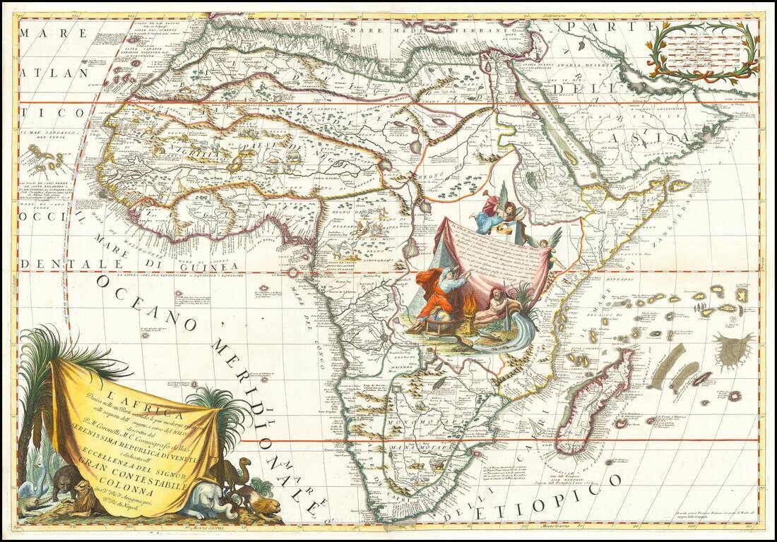
Decorative example of Coronelli's 2-sheet map of Africa, featuring up to date information from modern reports and recent discoveries regarding the sources of the Nile River. Coronelli's map is full of topographical features and place names, and more...
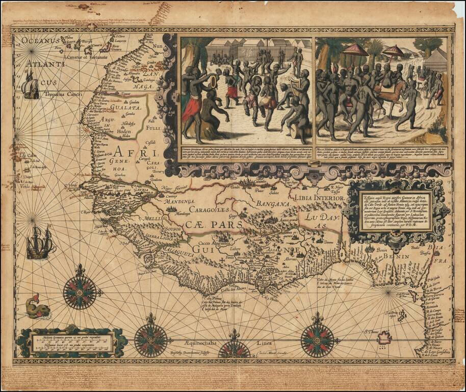
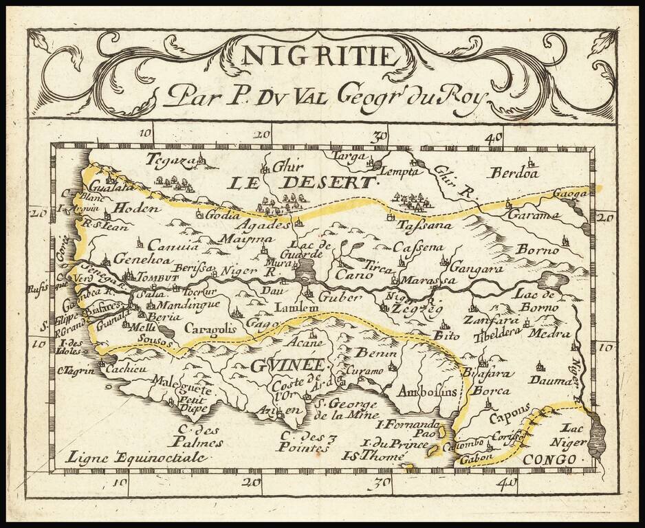
One of the Great Early Maps of West Africa With Significant Manuscript Annotations Important early map of West Africa showing the coastal region from the Canary Islands to the Bight of Benin and São Tomé and Principe. This a striking, dark...
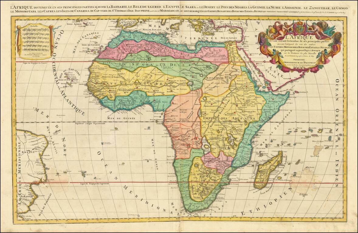
Fine Large-Format Map of Africa by Jaillot Striking map of the continent of Africa, by the French mapmaker Alexis-Hubert Jaillot. Although the imprint line has not been updated, this example was probably published by Mortier in Amsterdam around 1696....
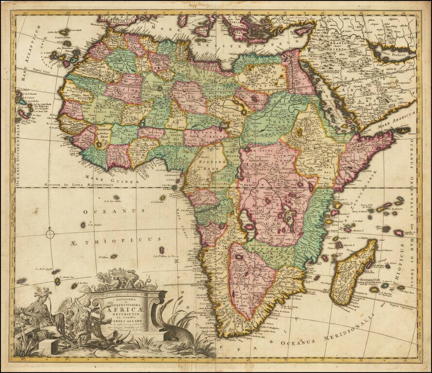
Nice example of this finely engraved map of Africa published by Carol Allard, based on De Wit's map of Africa c.1670. This map is similar to the De Wit's Africa in its later states and even uses some of De Wit's lettering within the surrounding...