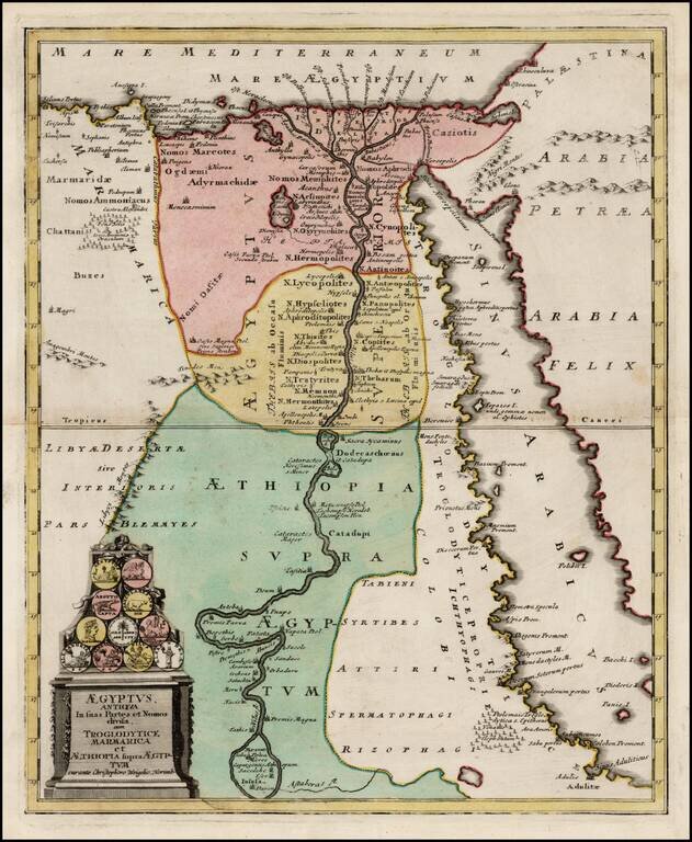
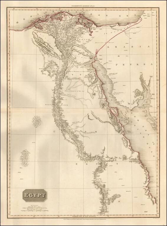
Detailed map of Egypt, embellished with a cartouche illustrating 11 early Egyptian Coins. Provides a fine image of Egypt and the Red Sea, extending south the Astaboras River.
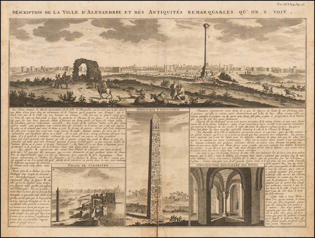
A magnificent panoramic view of the great Egyptian port city of Alexandria accompanied by detailed views of the ruins of Cleopatra's palace, the Obelisk of Alexandria, and "the interior construction of towers." The images are keyed to the surrounding...
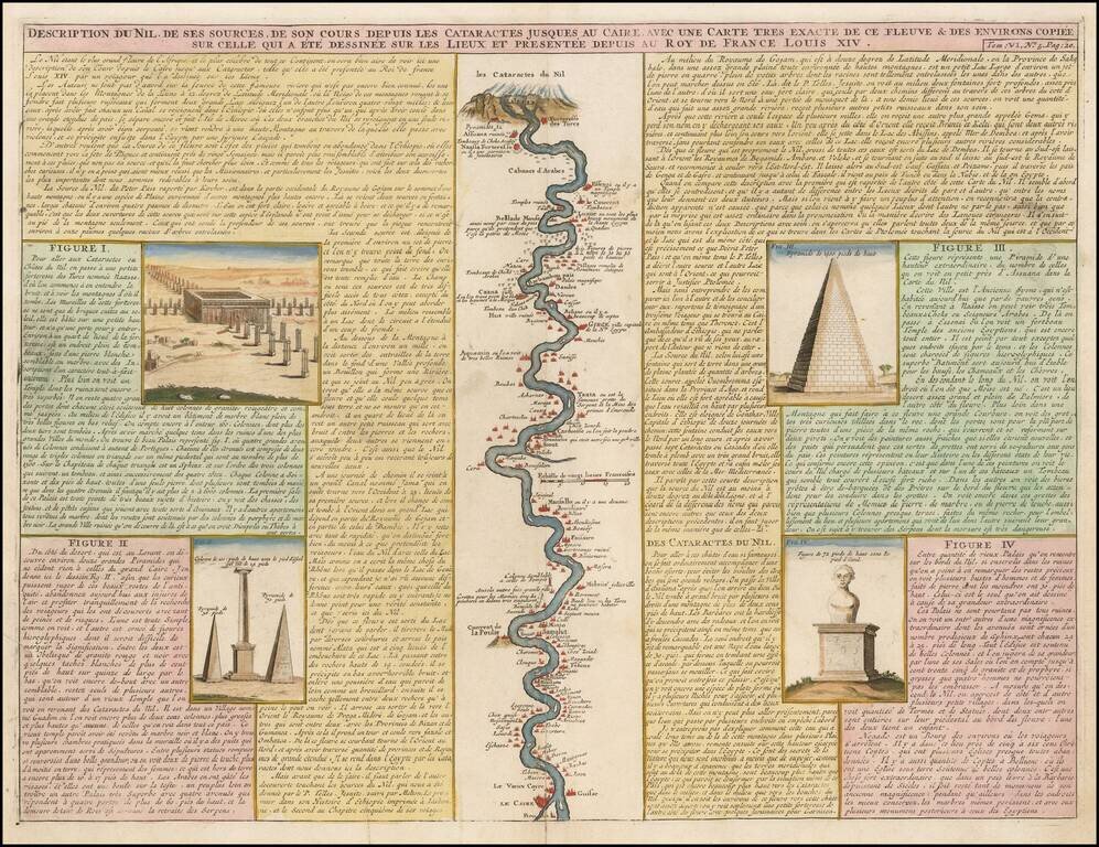
Detailed map of the course of the Nile, from the cataracts of the Nile at the south (top of the image) to Cairo and Giza. At the right, one of the Pyramids is shown (1400 Pieds tall), with additional images at the left from the Nile River Valley.
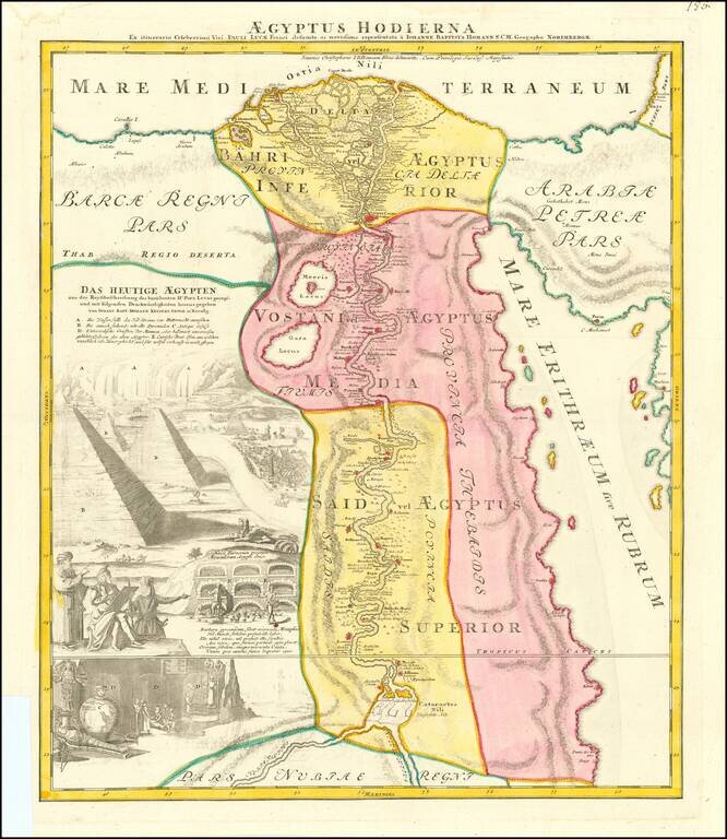
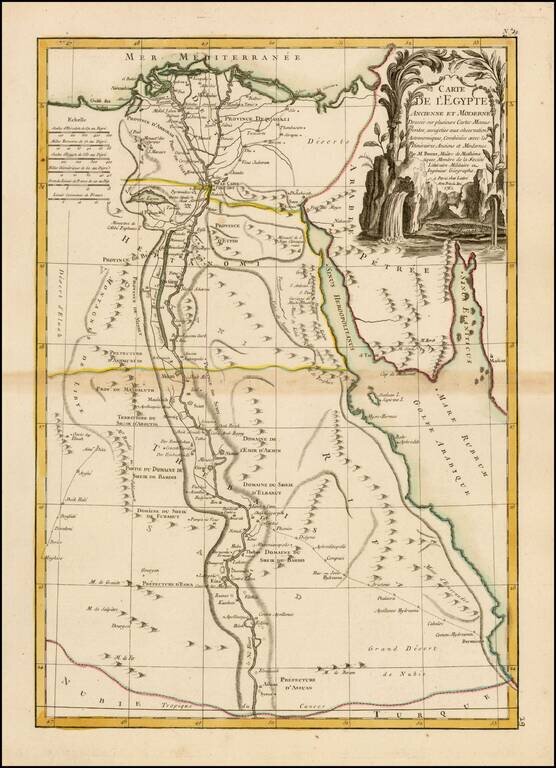
Nice full color example of Homann's decorative map of Egypt. Homann's map of Egypt is focused on the Nile River Valley from the Mediterranean to below the first cataract at the confluence of the White and Blue Nile. Nearly a third of the map is...
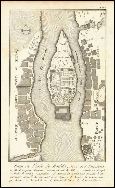
Antique engraved map of Roda Island in Cairo, Egypt. This map comes from the 1755 Copenhagen edition of Frederic Louis Norden's Voyage D'Egypte et de Nubie, in which it was plate 25. There are other editions of the map with different text settings...
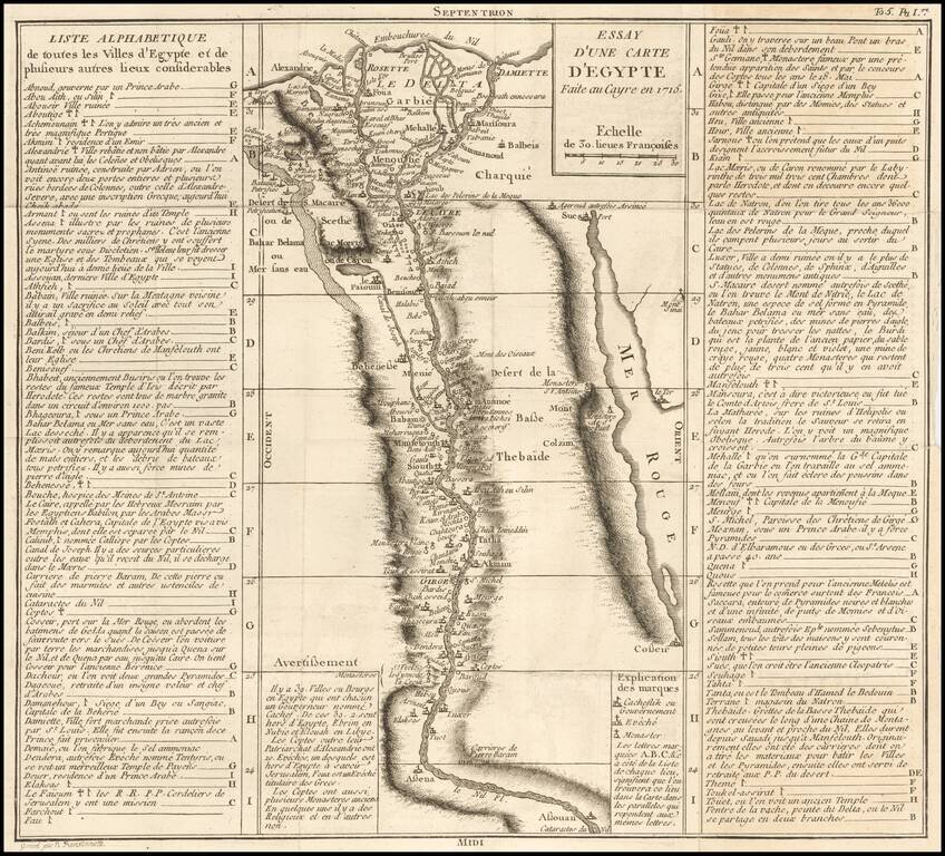
Scarce map of a portion of Egypt, focused on the course of the Nile River. The title suggests that the map is based upon a map made in Cairo in 1715. The map extends from the Cataracts of the Nile and Aswan to the Nile River Delta, meticulously...
Highly detailed and decorative map of Egypt, published by Lattre in Paris. Provies a highly detailed treatment of the course of the Nile, early roads, historical and modern place names. Extends south to Asuan and east to the Red Sea.
![Egypt called in the Country Missir by Monsr. D'Anville of the Royal Academy of Belles Lettres, & of that of Siciences [sic] of Petersburg Secretary to H.S.H. the Duke of Orleans. MDCCLXV.](/map/small/49130.jpg)
Fascinating engraved map of the Nile north from Aswan, with extensive labeling of the sites along the river. Laurie & Whittle credit D'Anville as the source for the map. Expeditions further down the Nile did not proceed successfully until the 19th...
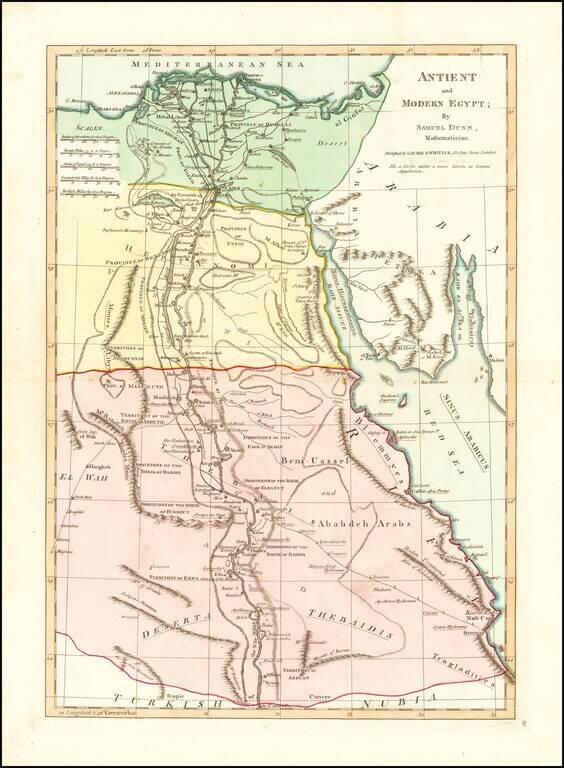
Interesting map extending from the mouth of the Nile and Nile River Valley (extending to the Assuan and the Cataract) to the Red Sea. Includes both ancient and modern names, including Troglodictica, Theaidis, El Way, Heptanomi, Thebais, etc. A number...
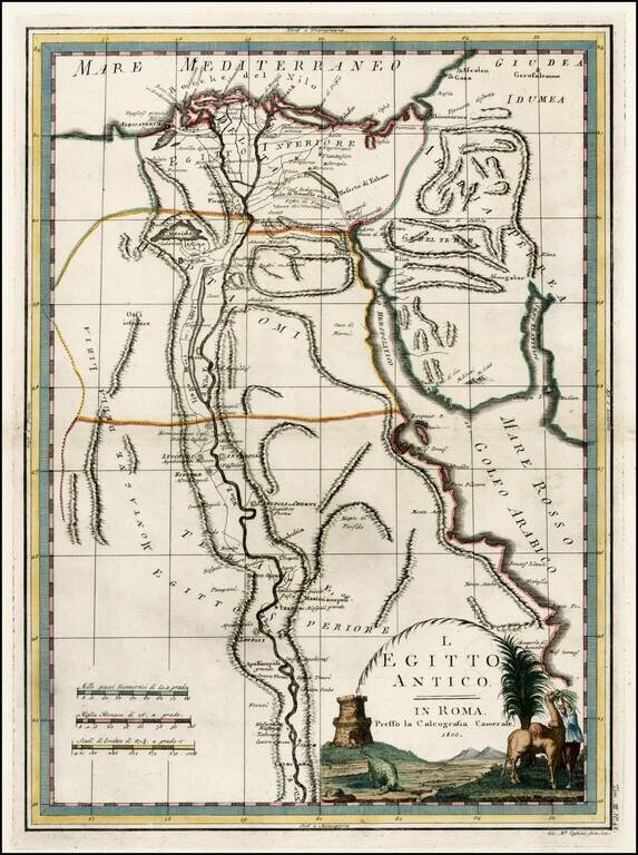
Fascinating early map of Ancient Egypt and the course of the Nile River, from Nuovo Atlante Geografico Universale. published by Cassini in Rome.
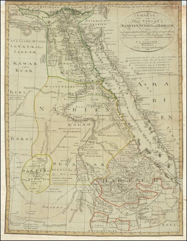
A detailed chart of Egypt, Sudan, and Ethiopia focused on the course of the Nile. Extensive detail is shown, with the many towns along the Nile, Red Sea, and other areas all labeled. Trade routes are shown through the desert and the mountain ranges of...
Detailed map of Egypt adn the Nile River to just South of Assuan, published by the Homann Heirs. In the west, the Grand Oasis and Small Oasis are noted, as is the beginning of the Caravan Route to Fez in Morocco. Further south, the Caravan Route to...
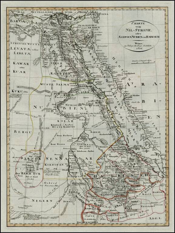
First edition of this scarce map of Egypt and Abyssinia, which was later copied in a pirated edition published in Prague.
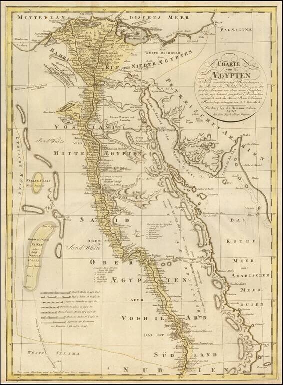
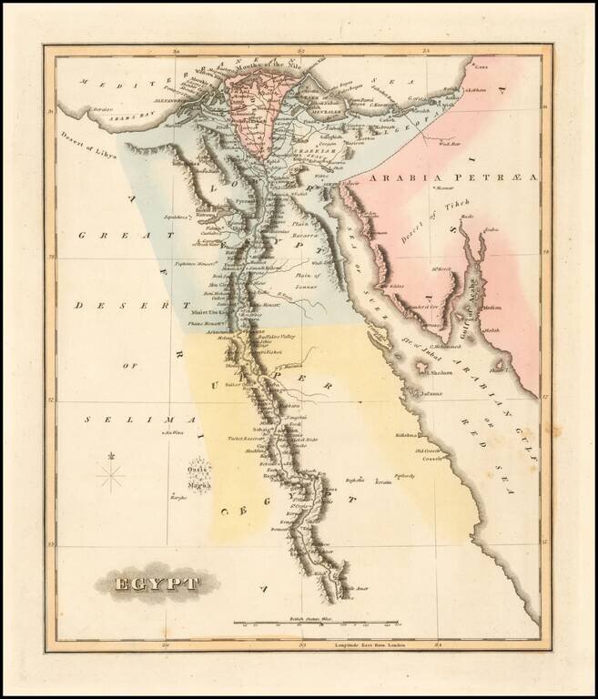
Highly detailed map of Egypt, following the Nile as far south as Asouan and Shelalat and including the Oasis of Magna, Oasis of Parva and other remarkable fine details. Includes the Gulf of Suez, Red Sea and Gulf of Acaba. One of the best regional...
Scarce map of Ancient Egypt by Fielding Lucas Jr., which appeared in his General Atlas. Lucas's map is the first detailed commercial map of Ancient Egypt published in America. The map depicts the interior topographic details of the island. The map is...
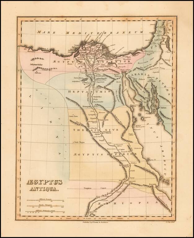
Scarce map of Ancient Egypt by Fielding Lucas Jr., which appeared in his General Atlas. Lucas's map is the first detailed commercial map of Ancient Egypt published in America. The map depicts the interior topographic details of the island. The map is...