Map size in jpg-format: 73.7354MiB
Click to open in high resolution (open in new tab).
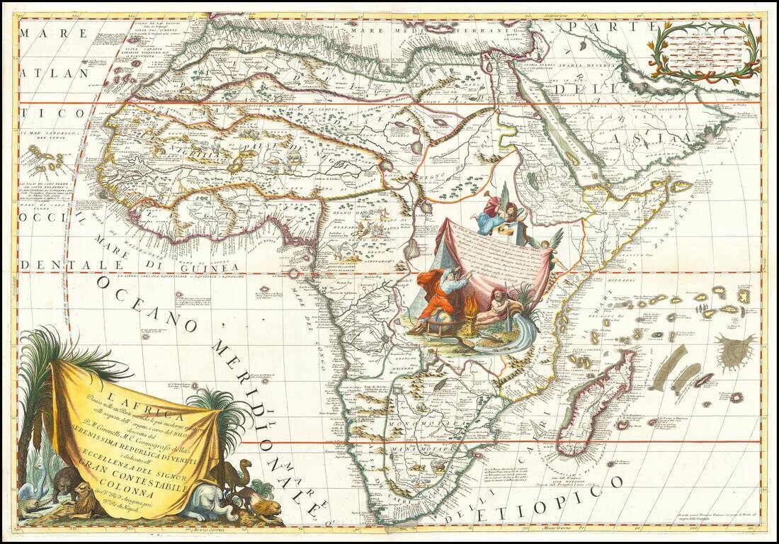
Decorative example of Coronelli's 2-sheet map of Africa, featuring up to date information from modern reports and recent discoveries regarding the sources of the Nile River.
Coronelli's map is full of topographical features and place names, and more accurate than many maps of the period. Coronelli claims to have been the first to correctly describe the source of the Nile, in Lake Tsana, Abyssinia.
Beside the fascinating detail, the maps are richly decorated with animals and scenes of horsemen in combat or hunting the animals. The large title cartouche on the west sheet is surrounded by several indigenous animals including ostrich, crocodile, lions, elephant and camel. On the other sheet is a large scene in Central Africa with an angel blowing a trumpet, while another holds the corner of the tent and a scribe standing on a globe records information concerning the origin of the Nile on the side of the tent. Also included in the scene is an allegorical figure representing Father Nile with the river flowing from his overturned urn.
If you are a student, write to us in telegram: @antiquemaps and indicate what material you need and for what work you need a map in high detail. We are ready to provide material on special terms. For students only!
![[Eastern Hemisphere Globe Gores] (Nova et integra universi Orbis descriptio)](/map/small/54480.jpg)