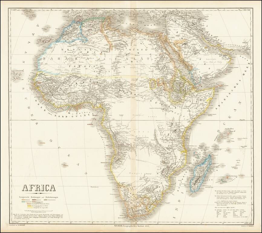
Fine large map of Africa, published by German mapmaker Heinrich Kiepert in Weimar. The map is colored to illustrate the various local and colonial powers (Britain, Spain, Netherlands, France and Portugal). The color coding also locate the...
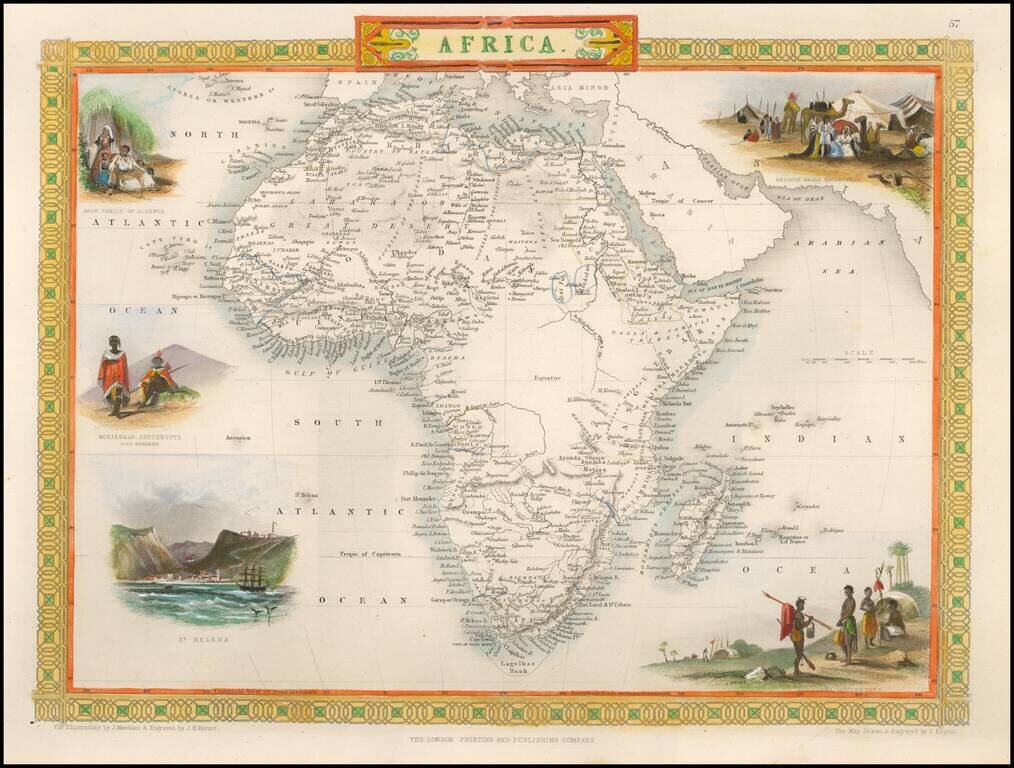
Fine full color example of this marvelous map of Africa. Decorative vignettes show a Bedouin Arabs Encampment, Korranna Hottentots, St. Helena, Bosjesman Hottentots Wild Bushmen, and an Arab Family of Algeria. Engraved for R. Montgomery Martin's...
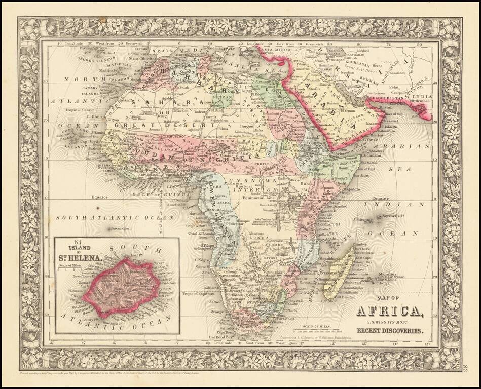
Decorative and detailed map of the African Continent, with an inset map of St. Helena. SA Mitchell Jr. acquired his father's former business from DeSilver in 1860 and relaunched a very successful atlas publishing business which survived another 20+...

Detailed map of Africa, published by Stieler. The map reflects the explorations by Europeans in the interior parts of the continent, but still reflects the relatively sparse geographical information known about most of the interior parts. The...
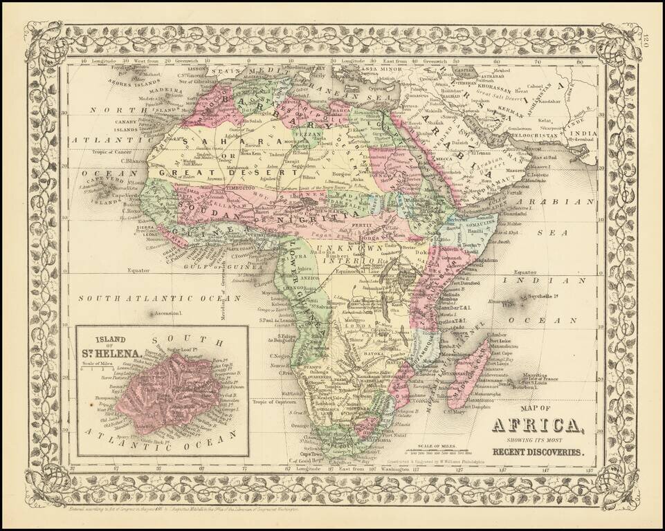
Decorative and detailed map of the African Continent, with an inset map of St. Helena. SA Mitchell Jr. acquired his father's former business from DeSilver in 1860 and relaunched a very successful atlas publishing business which survived another 20+...
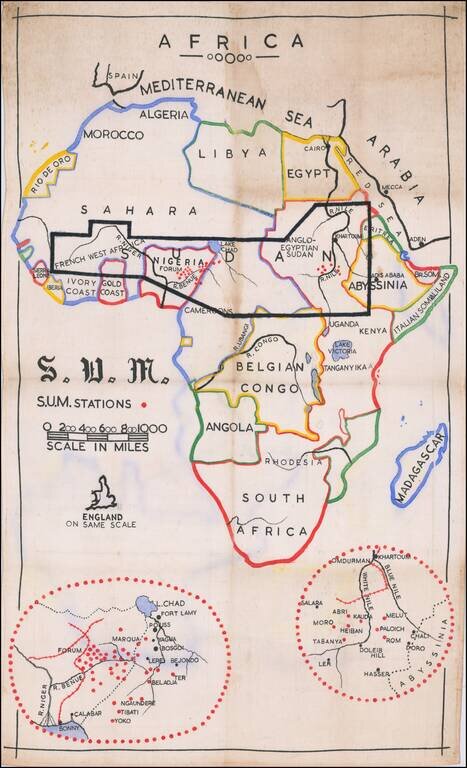
Manuscript Missionary Map of Africa. Interesting map of Africa, prepared by the Christian missionaries "Sudan United Mission" or S.U.M. The map highlights the group's area of focus - immediate Subsaharan Africa - and includes insets of their missions...
![[Africa - Anti-Colonialism]](/map/small/66878.jpg)
Striking image of Africa, with a quote from Amilcar Cabral. The map was likely printed shortly after Cabral's assassination in 1973. Always bear in mind that people are not fighting for ideas, for the things in anyone's head. They are fighting to...
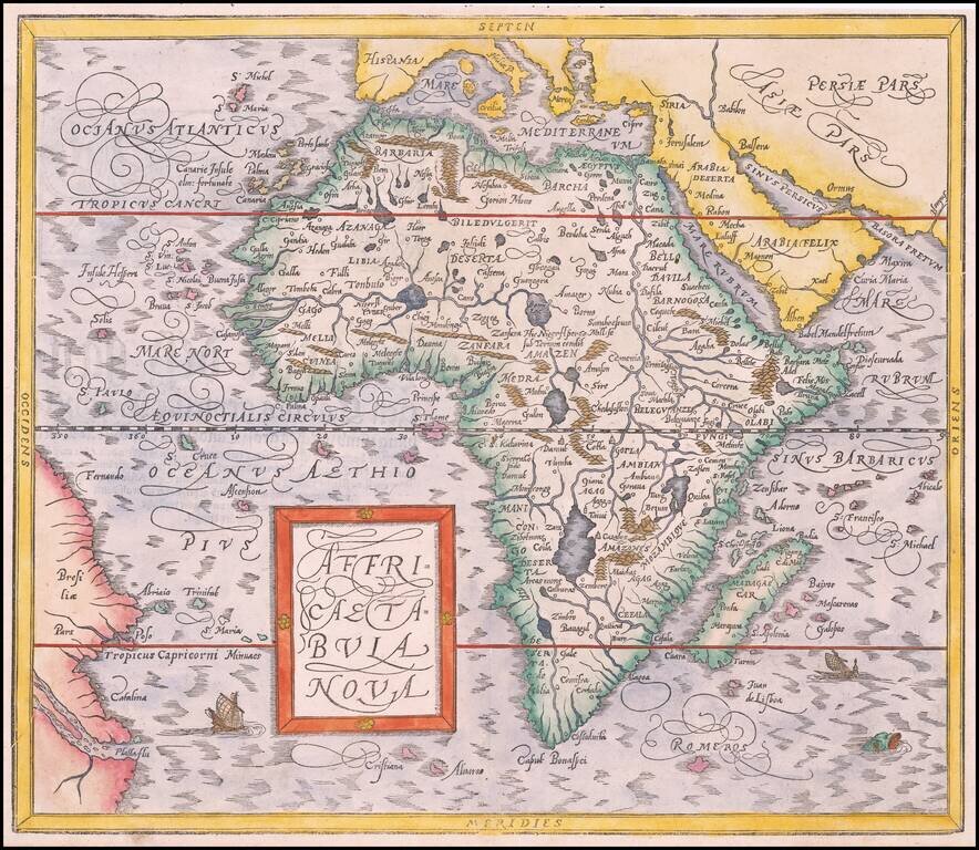
Striking Map of Africa, from Münster’s Renowned Cosmographia Fine example of Münster’s second map of Africa, from his important Cosmographia. This map replaced Münster’s boxier depiction of Africa in 1588. It was based on Abraham...
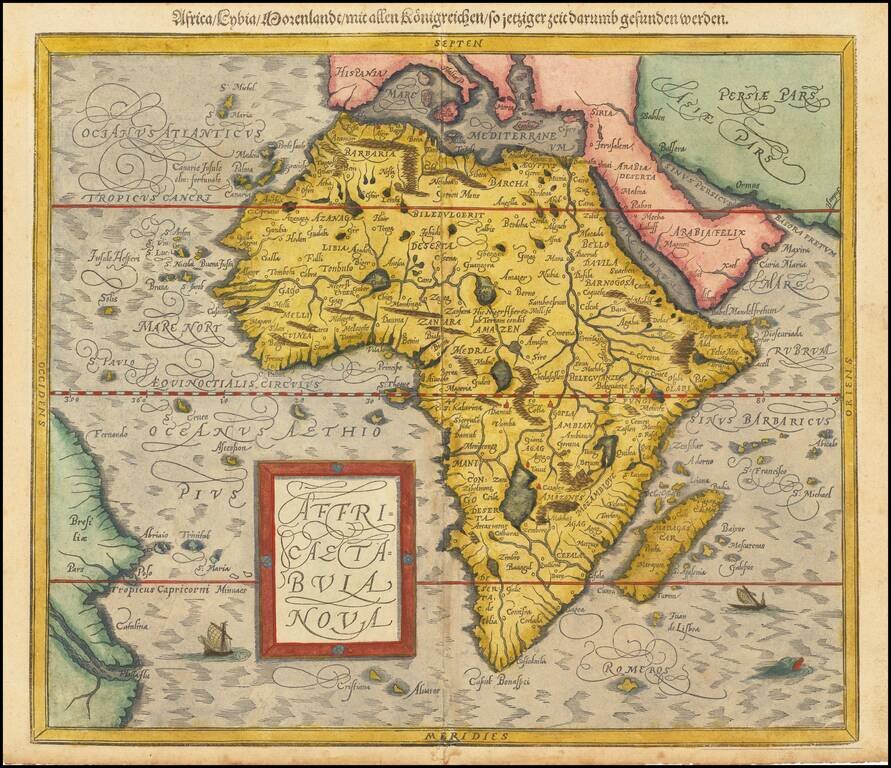
Striking Map of Africa, from Münster’s Renowned Cosmographia Fine example of Münster’s second map of Africa, from his important Cosmographia. This map replaced Münster’s boxier depiction of Africa in 1588. It was based on Abraham...
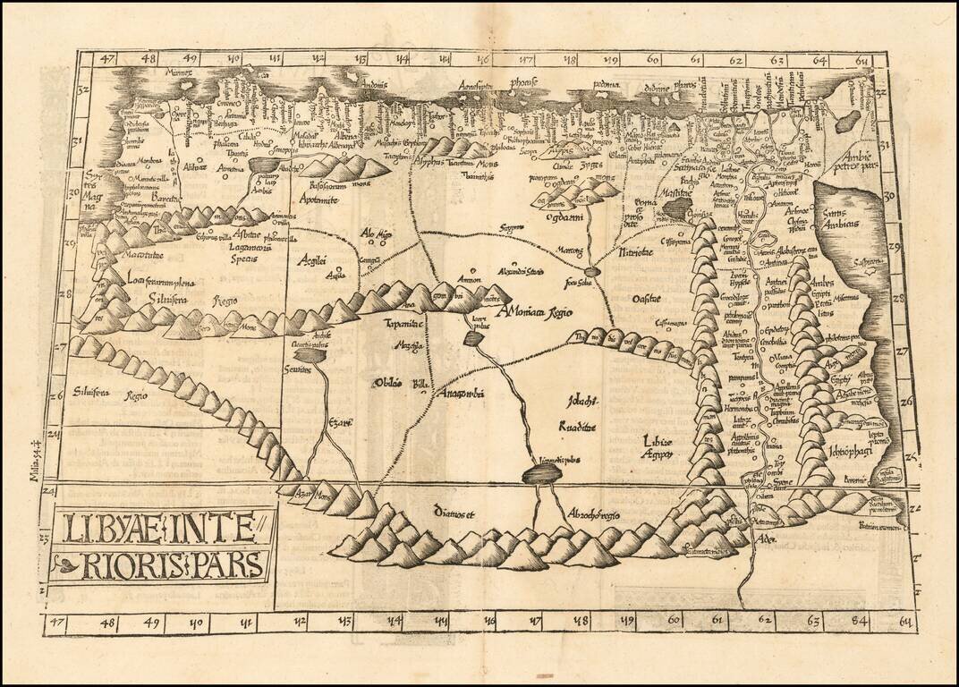
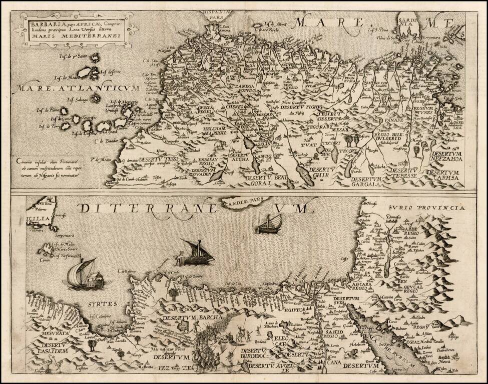
Rare Early Map of North Africa & The Nile River Valley Striking early modern map of North Africa and Egypt, from the Red Sea, the Nile and Egypt to the Gulf of Libya. Extends up rivers along the Nile to Aden. Latin text and elaborate decorations...
Striking dark impression of Ruscelli's map of a part of North Africa and the Mediterranean, showing the north coast of Africa including Egypt and the Nile River. Ruscelli's Atlas is an expanded edition of Gastaldi's Geographiae of 1548, which has been...
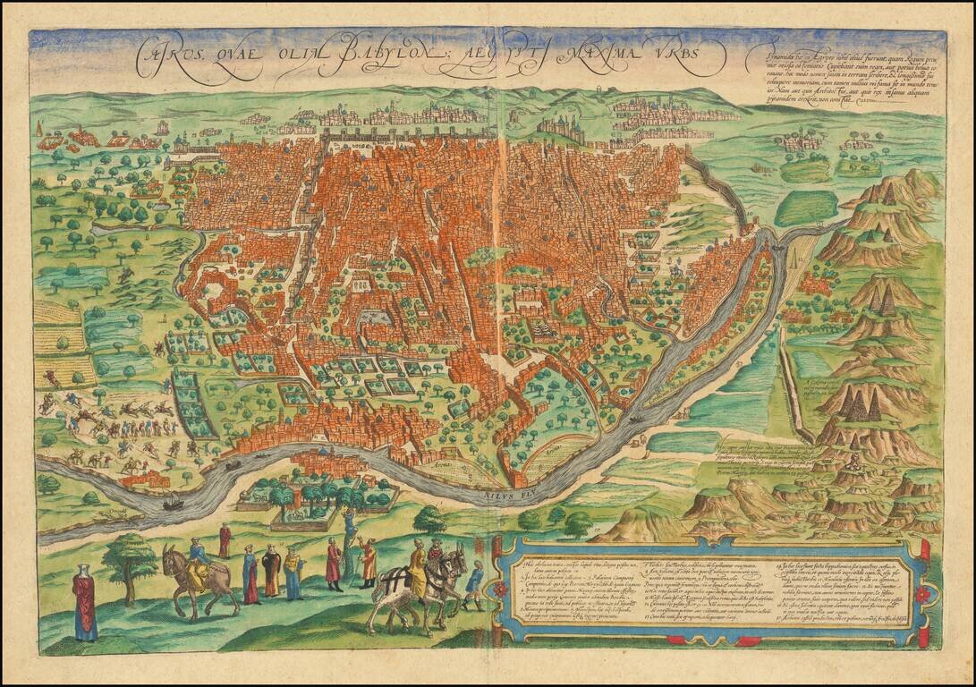
Fine old color example of this important early view of Cairo from a hillside opposite the Nile, from Braun & Hogenberg's Civitates Orbis Terrarum, the most important town book of the 16th Century. Elaborate detail, including fortified walls,...
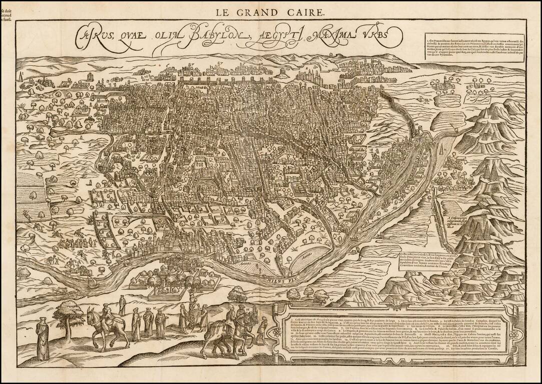
Rare 16th Century view of Cairo from a hillside opposite the Nile, published in Paris in 1575. De Belleforest's view is drawn from Braun & Hogenberg's Civitatus Orbis Terrarum, the most important town book of the 16th Century. Elaborate detail,...
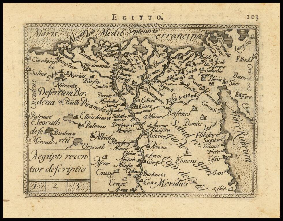
Detailed map of Egypt and a portion of the Red Sea, from and early edition of Ortelius' Epitome. The first miniature version of Ortelius' Theatrum was published by Philippe Galle in 1577 as Spieghel der Werelt. Galle began a new edition with new...
Nice example of De Jode's map of North Africa, Egypt, the Red Sea and the Holy Land, including all of the Mediterranean coastline of Africa. The map is divided into two sections and includes an elephant, lions, battle scene, sailing ships and palm trees.
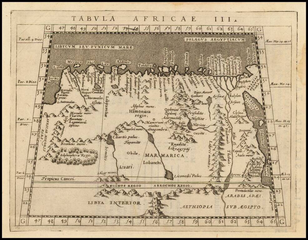
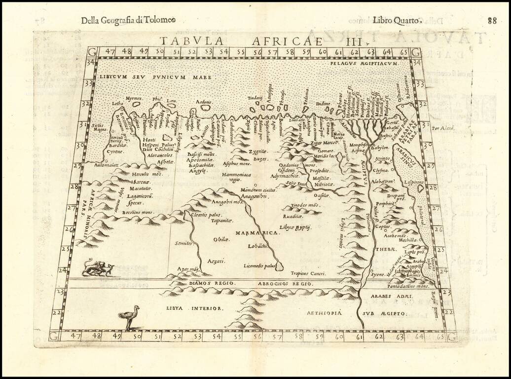
A nice example of Magini's map of the Northeastern portion of Africa, based on Ptolemy. Extends east to Egypt and the Red Sea and south to Libya Interior.