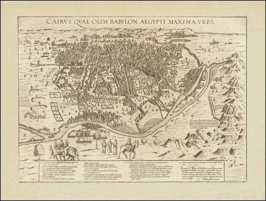
Rare 16th Century view of Cairo from a hillside opposite the Nile, by the Sienese map maker Matteo Florimi. Florimi's view is drawn from Braun & Hogenberg;s Civitatus Orbis Terrarum, the most important town book of the 16th Century. Elaborate...
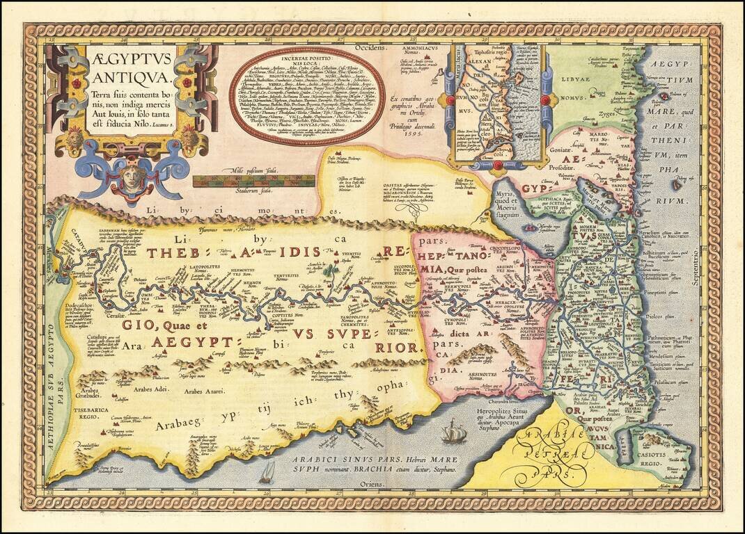
Fascinating Map of Ancient Egypt from Ortelius’ Parergon, The World’s First Historical Atlas Gorgeous example of Ortelius' second map of Egypt, which was issued only in late editions of his Parergon. Ortelius’ interest in ancient civilizations...
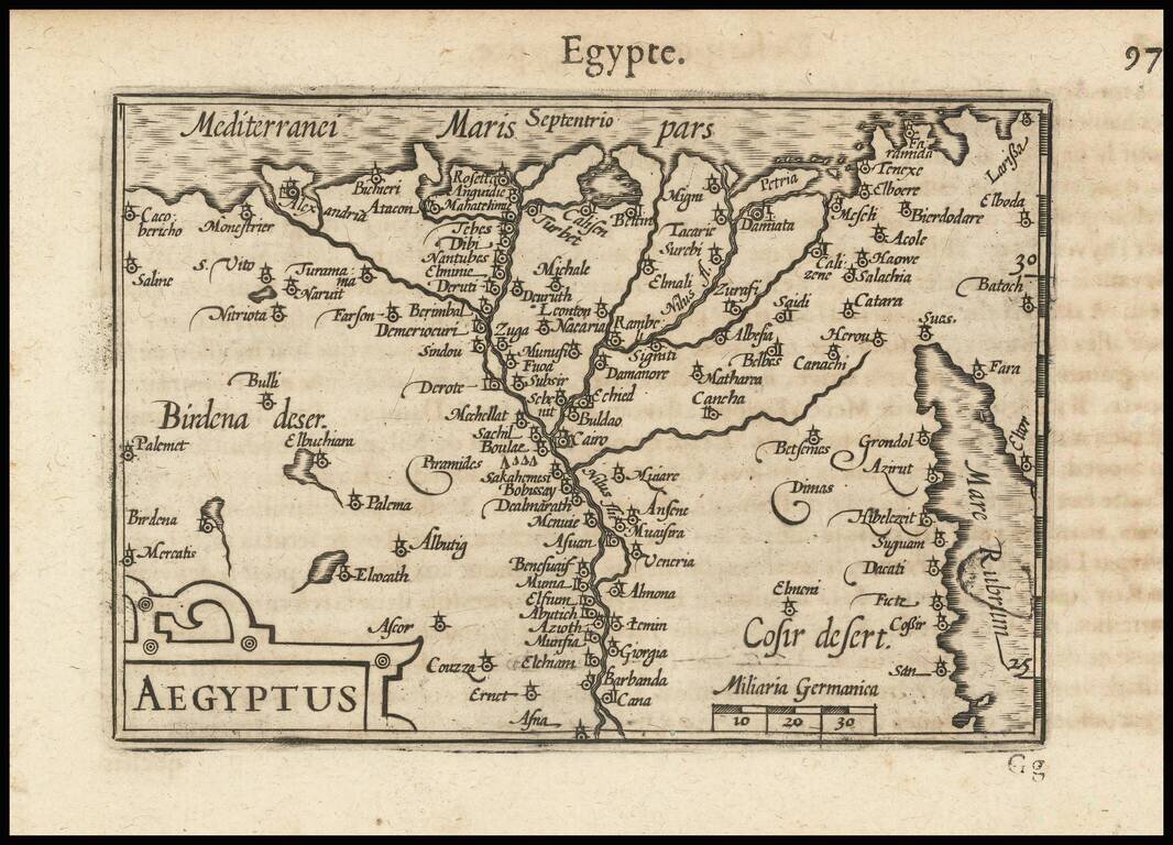
Nice example of this early state of Barent Langenes's map of Egypt and the Nile, which first appeared in the 1598 edition of Langenes's Caert-Thresoor, published in Middelburg. Langenes's map was first issued in his Caert-Thresoor and later...
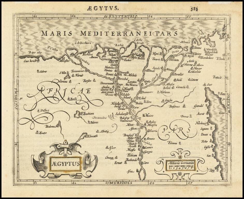
Attractive map of Egypt tracking the Nile from Asuan to the Mediterranean and extending East to the Red Sea, based upon a larger map by Hondius. Includes two cartouches.
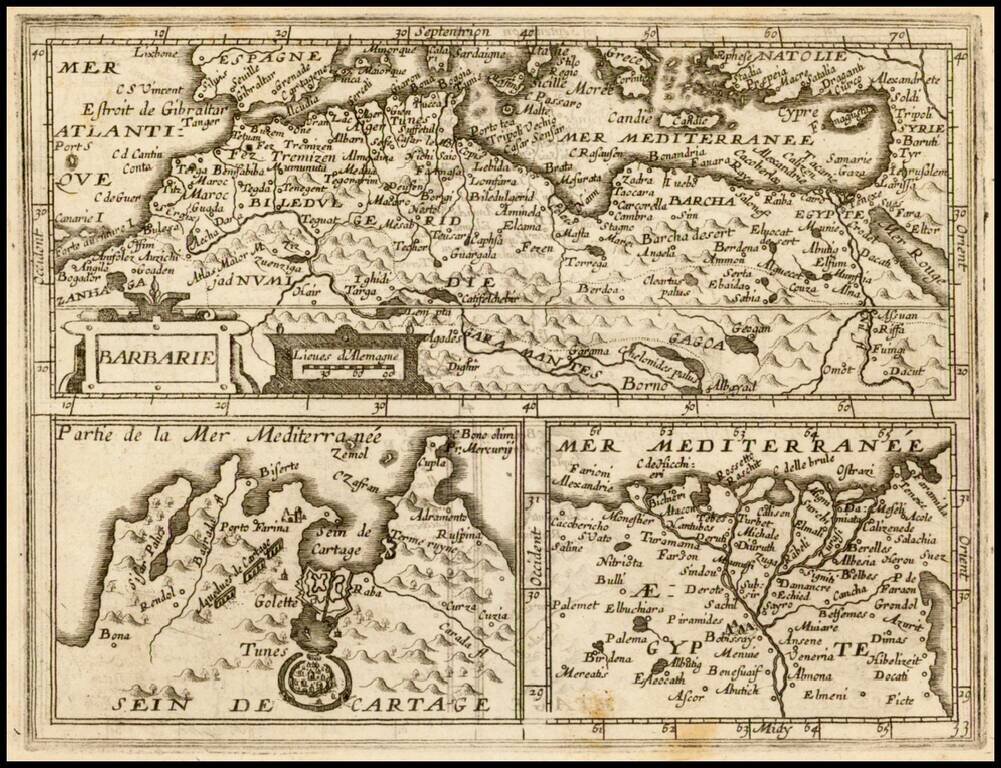
Rare map showing the African Coastline of the Mediterranean, with two inset maps Egypt and Carthage, which appeared in Boisseau's Tresor des carte Geographiques, published in Paris. The map is based upon Jansson's map, published in his Atlas Minor in...
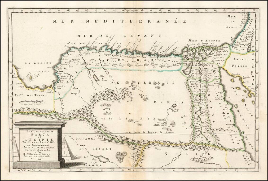
Nice example of Sanson's 1655 double-page engraved map of Egypt stretching west to the Gulf of Sirte. Nicolas Sanson (1600-1667) sometimes called Nicolas Sanson d'Abbeville or Sanson d'Abbeville, was the most important French cartographer of the 17th...
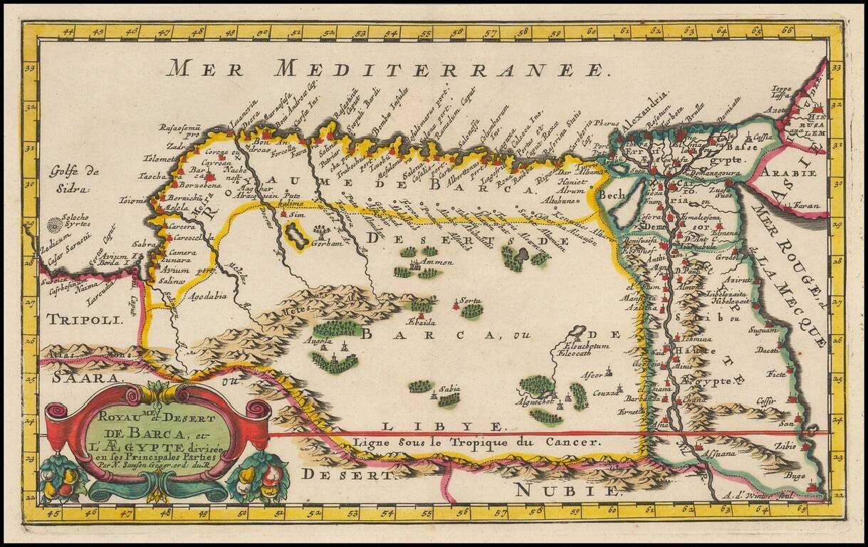
Fine example of Egypt and eastern Libya first published by Nicholas Sanson in 1657. Sanson was the Royal Geographer to the King of France and perhaps the most important commercial mapmaker of his generation.
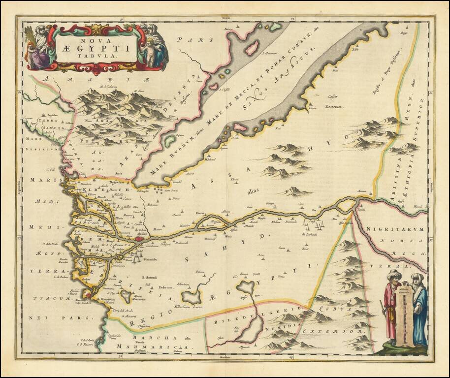
A nice example of Blaeu's modern map of Egypt, in fine old color. The map shows Egypt oriented with east at the top, centered on the Nile River. Pyramids are illustrated in two locations along the Nile. The copper plate for this map eventually went...
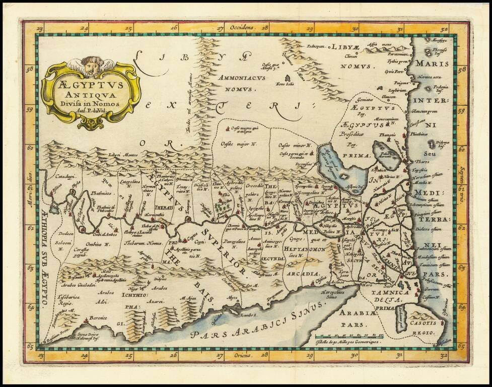
Decorative map of ancient Egypt by Pierre du Val published in an historical atlas by Phillip Cluverius. The map is oriented with the north to the right.
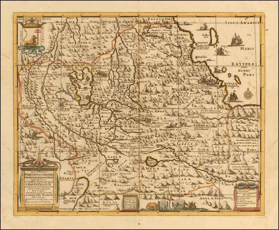
Scarce late 17th Century map of the Upper Nile and Kingdom of Prester John, based upon Jobi Ludolfi map of 1683. The map provides a detailed treatment of Ethiopia and the Eritrean coast, originating from an Ethiopian manuscript. Embellished with...
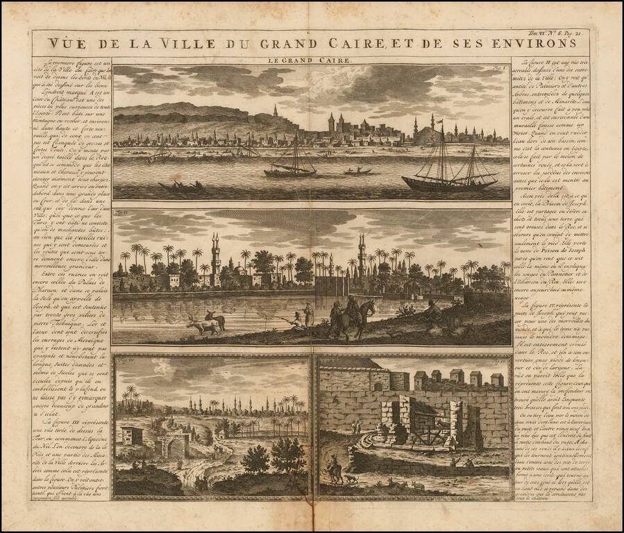
Antique engraved view of Cairo, with several supporting vignettes, from the famous Atlas Historique of Henri Chatelain, published in Amsterdam in between 1705 and 1720. The views near the River Nile are filled with palms and boats.
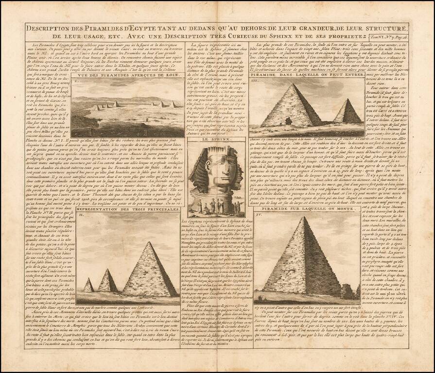
Interesting view showing 5 views of the pyramids and an image of the Sphinx. This view appeared in Henri Chatelain's monumental 7 volume Atlas Historique.
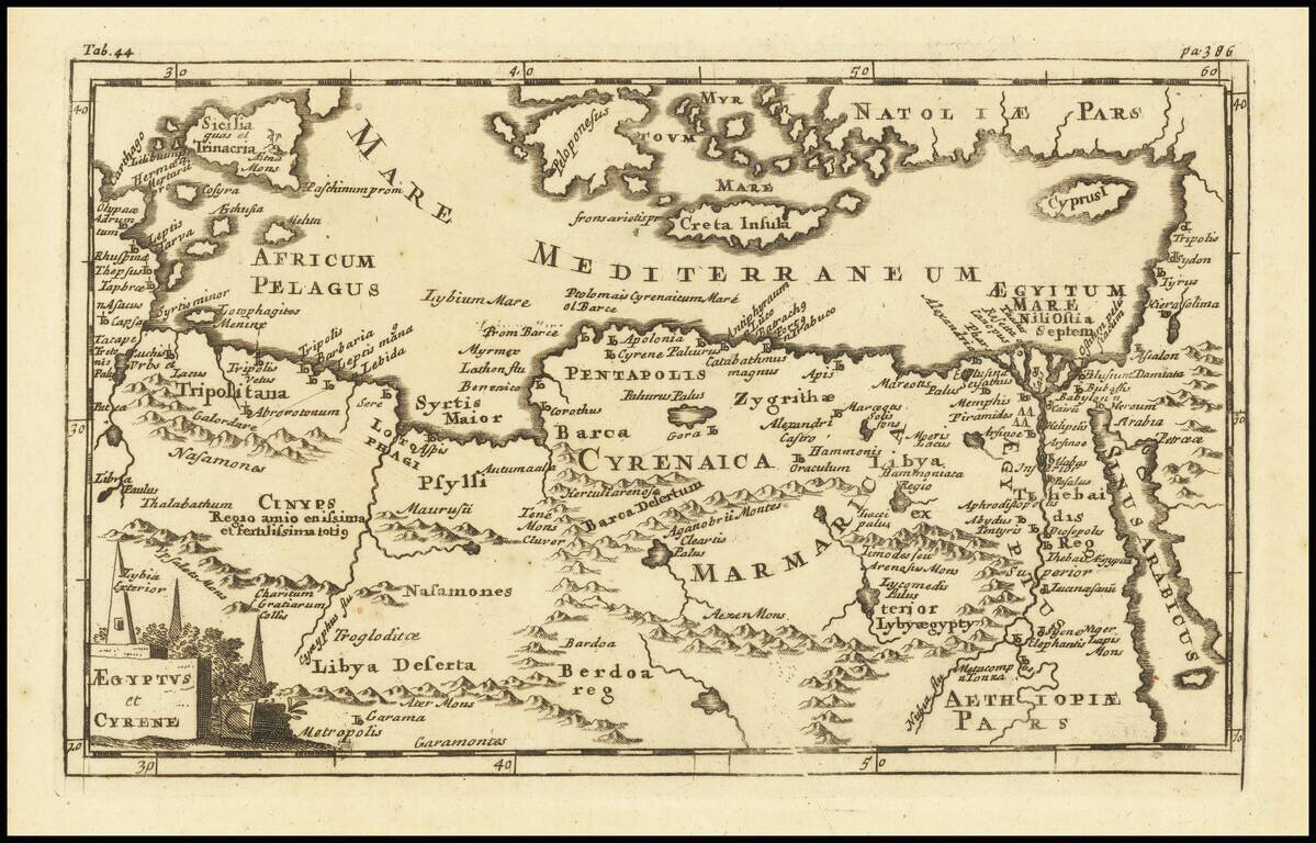
Detailed ancient map of the region between the Gulf of Lybia and the Red Sea, with marvelous detail along the Mediterranean Coastline and the Nile. Includes many ancient placenames throughout. From the Atlas geographus, edited by J. Nicholson, London...
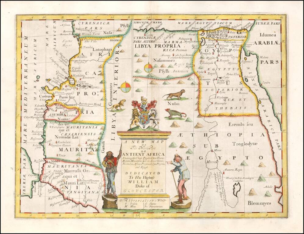
Decorative map of the north part of Ancient Africa. This decorative map was part of a set of 22 maps dedicated to William, Duke of Glouchester, who was then an 11 year old student at Oxford.
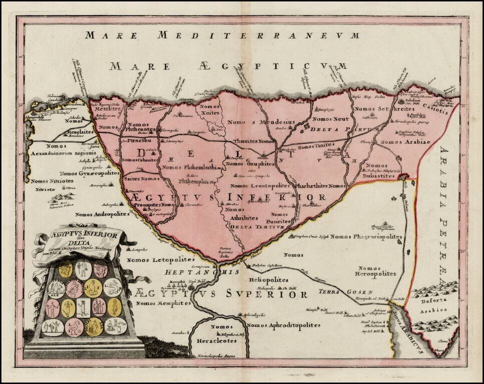
Detailed map of the Lower Part of Egypt, embellished with a cartouche illustrating 16 early Egyptian Coins. Provides a large format look at the Nile Delta, extending south the area near Memphis, Goshen, Nilopolis and Heracleopolis.