Map size in jpg-format: 304.288MiB
Click to open in high resolution (open in new tab).
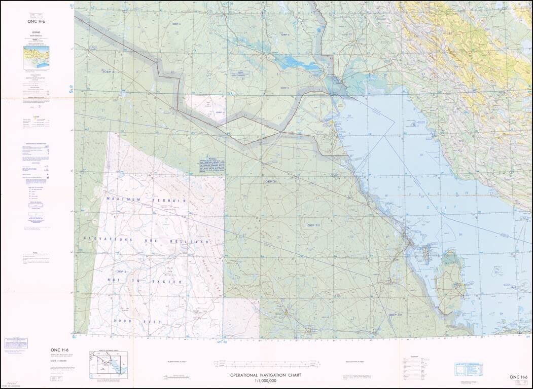
Interesting aeronautical map of the northern half of the Persian Gulf, with great detail of oil wells and pipelines. The map was issued by the Defense Mapping Agency Aerospace Center.
The map also features disputed borders and other information available to the United States military at the beginning of the 1970s. The map shows much of the offshore activity of Qatar, Kuwait, Saudi Arabia, and the UAE.
If you are a student, write to us in telegram: @antiquemaps and indicate what material you need and for what work you need a map in high detail. We are ready to provide material on special terms. For students only!
![[Sinai Peninsula] (Ottoman Turkish Language Sinai and Palestine Campaign Map)](/map/small/54465.jpg)
![[Arabian Peninsula, Red Sea, Nile River and Gulf of Aden] L'Afrique . . . 1740](/map/small/59382.jpg)
