Map size in jpg-format: 24.5096MiB
Click to open in high resolution (open in new tab).
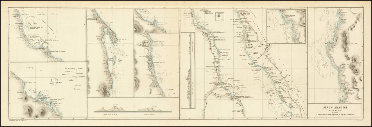
This is an antique map of the middle portion of the Red Sea, referred to on the map as the Sea of Arabia, stretching from approximately the latitude of Medina to the northern coast of Eritrea. This region, one of the most important shipping lanes in the world, is now split between three countries, Sudan, Egypt, and Saudi Arabia. The work was originally included in Karl Muller's Geographi Graeci minores, alongside many other maps of the region.
The map is highly detailed, showing many settlements, mountains, wadis, and more. Most interestingly, Muller provides Ptolomeic coordinates for some of these, and the map credits Agartachidemis, Arthemidorum, Pliny, and Ptolomy as its sources. Eight insets are provided, showing areas of particular interest in additional detail. One of these shows a budding Jeddah. Mount Elba and Castle Hill are shown in panorama. In all, this is a nice decorative chart of the region.
Karl Muller's Geographi Graeci minores appears to be a partial attempt to collect the vast geographical knowledge of the Greeks. He provides some new translations, describes the knowledge of the ancients, and compares his findings to modern geography. The work was published at a time when the studies of the ancient world were just starting to be done in a modern fashion.
Works such as Muller's are an often-underutilized source of knowledge regarding antiquity. Fenet states that "The majority of the nautical voyages collated by Muller need modern and detailed commentary. Recent publications have started to use these types of sources more frequently." In all, this is work and map were an important early modern study on the subject.
If you are a student, write to us in telegram: @antiquemaps and indicate what material you need and for what work you need a map in high detail. We are ready to provide material on special terms. For students only!
![[Sinai Peninsula] (Ottoman Turkish Language Sinai and Palestine Campaign Map)](/map/small/54465.jpg)
![[Arabian Peninsula, Red Sea, Nile River and Gulf of Aden] L'Afrique . . . 1740](/map/small/59382.jpg)
