logo

1775. Persian Gulph, from the Original by D'Anville

  • Persian Gulph, from the Original by D'Anville

Persian Gulph, from the Original by D'Anville information:

Year of creation: 
Resolution size (pixels): 
 10547x7315 px
Disk Size: 
 18.3616MiB
Number of pages: 
 1
Place: 
 London
Author: 

Print information. Print size (Width x height in inches):
Printing at 72 dpi 
  146.49 х 101.6
Printing at 150 dpi 
 70.31 х 48.77
Printing at 300 dpi 
 35.16 х 24.38

An example of detailing the file of this map of in a printable high-resolution:

Click to open in high resolution (open in new tab).
Attention! this is just the central piece (central area 960x960 px) of the map file!
This is an example, so that you can see and study the level of detail of a given map. The entire Map will be fully available after payment!

Persian Gulph, from the Original by D'Anville

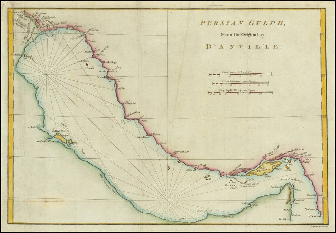
Scarce English Map of the Gulf

Scarce coastal chart of the Gulf, from Basra to Cape Jask and Kursekian.

The map shows several toponyms in the UAE, including Julfar, la Pagode blache, and Zaka.

The map shows a lot of detail around Bahrain and Qatar, including Samaka, Deb and Rogn.


Special conditions for students!

If you are a student, write to us in telegram: @antiquemaps and indicate what material you need and for what work you need a map in high detail. We are ready to provide material on special terms. For students only!

Item information:

Year of creation:
Size:
10547x7315 px
Disk:
18.3616MiB
Number of pages:
1
Place:
London
Author:
John E. Harrison.
$14.99

Related item