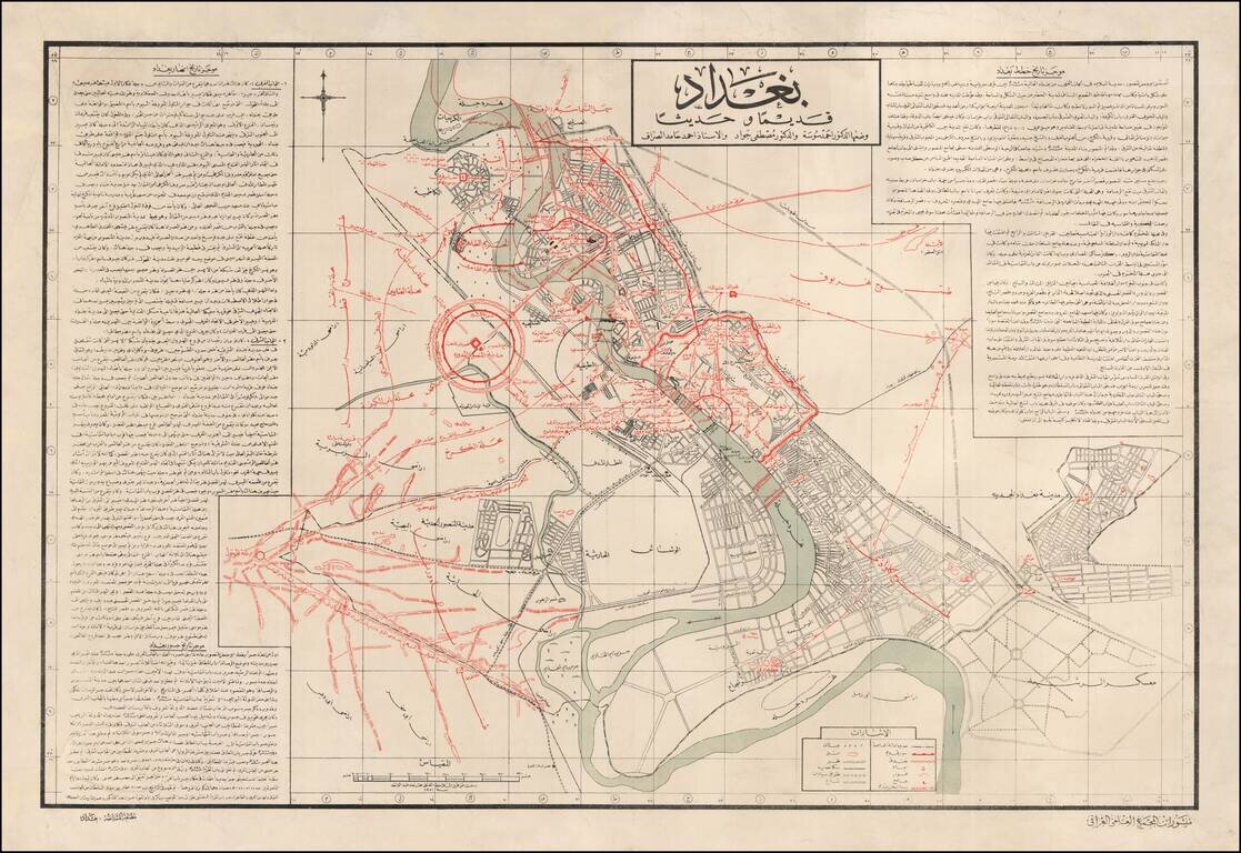
Historical Map of Baghdad by the Iraqi Academy of Science and Famed Iraqi Scholar Mustafa Jawad Fine map describing the early and modern history of Baghdad, with richly detailed text produced by Iraq’s top scholars and a focus on the changing course...
![[Armenia] [Published in Fresno!]](/map/small/68443.jpg)
Fresno, California Imprint! -- Striking and Informative Brochure Map of Armenia Celebrating Armenian History and Culture Fine map of Armenia SSR by a noted Armenian printer and scholar. The central map shows Armenia’s borders as it existed under...
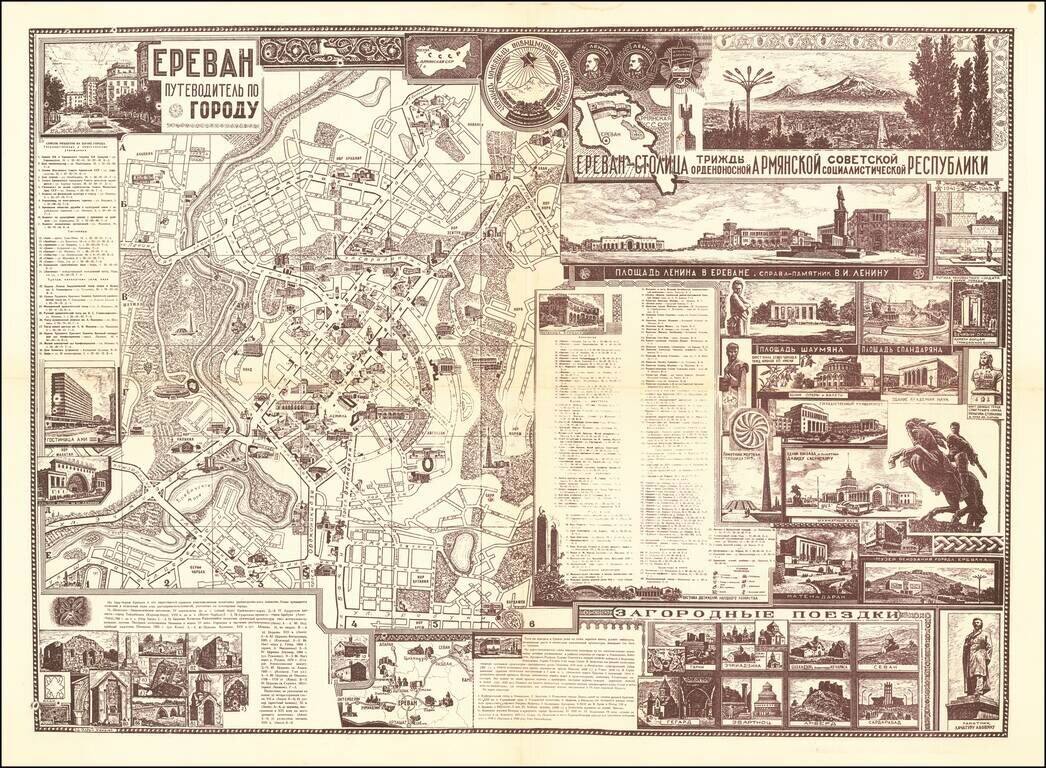
A rare and highly attractive double-sided sheet featuring a map and city guide to Yerevan, the Armenian capital, issued in Russian Cyrillic with original graphics in a mélange of mid-century Soviet-style and traditional Armenian motifs, executed by...
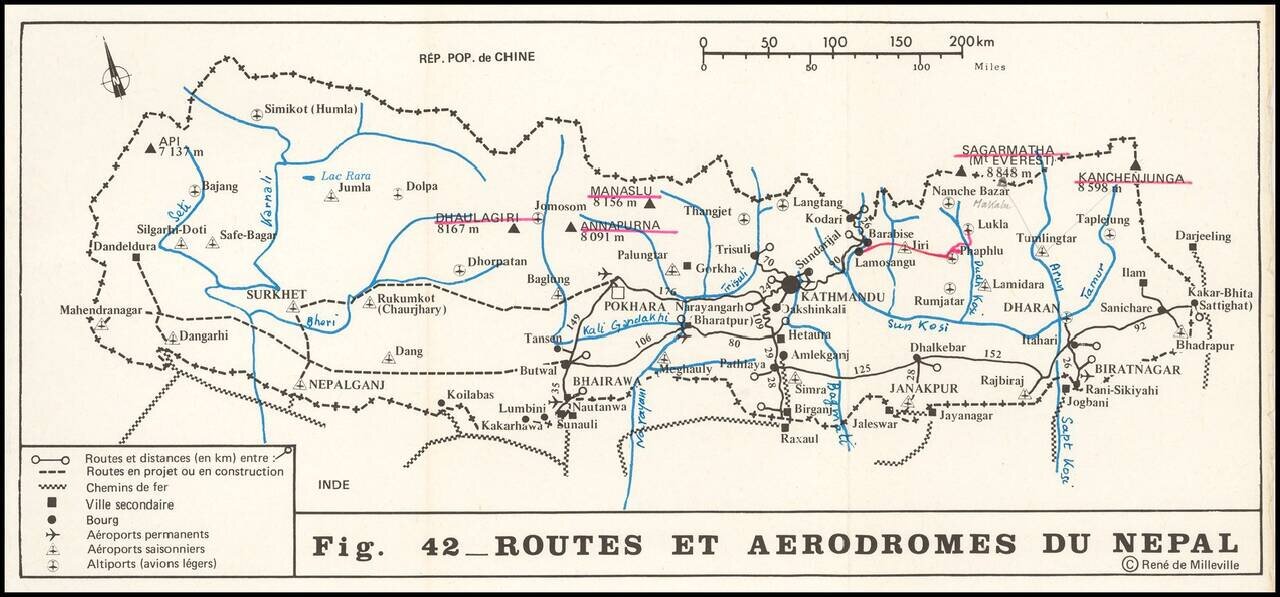
Scarce chart showing the routes and airports in Nepal, with numerous additional routes drawn in and named by a prior owner. Kathmandu appears at the low center, with a number of permanent and seasonal airports and landing strips noted, along with...
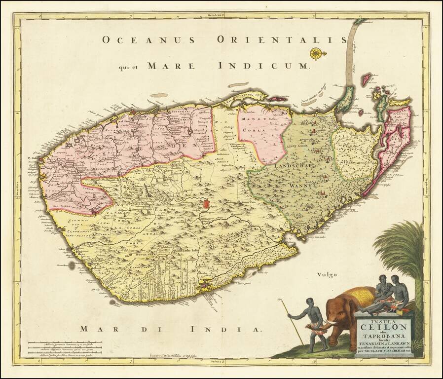
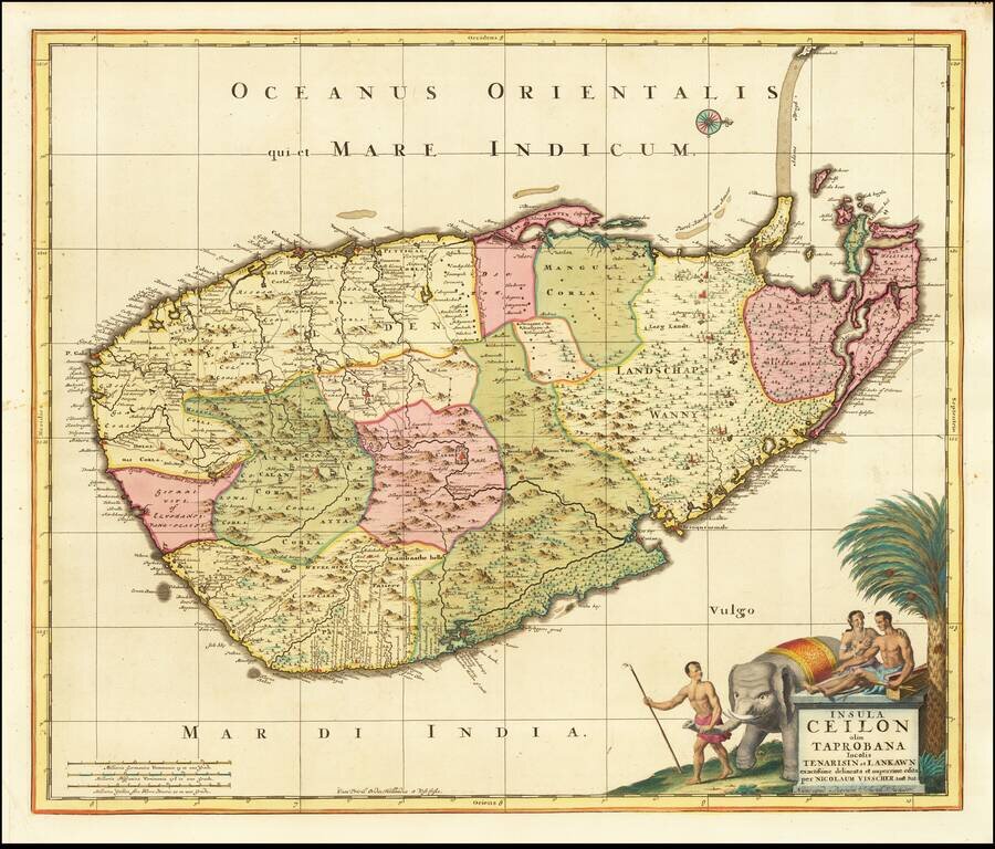
Fine large format map of Sri Lanka, first published in Amsterdam by Nicolas Visscher. One of the largest atlas maps of Sri Lanka, with a striking cartouche, embellished with an elephant and local Sri Lankans.
Fine large format map of Sri Lanka, first published in Amsterdam first published by Nicolas Visscher and later re-issued by Schenk. One of the largest atlas maps of Sri Lanka, with a striking cartouche, embellished with an elephant and local Sri...
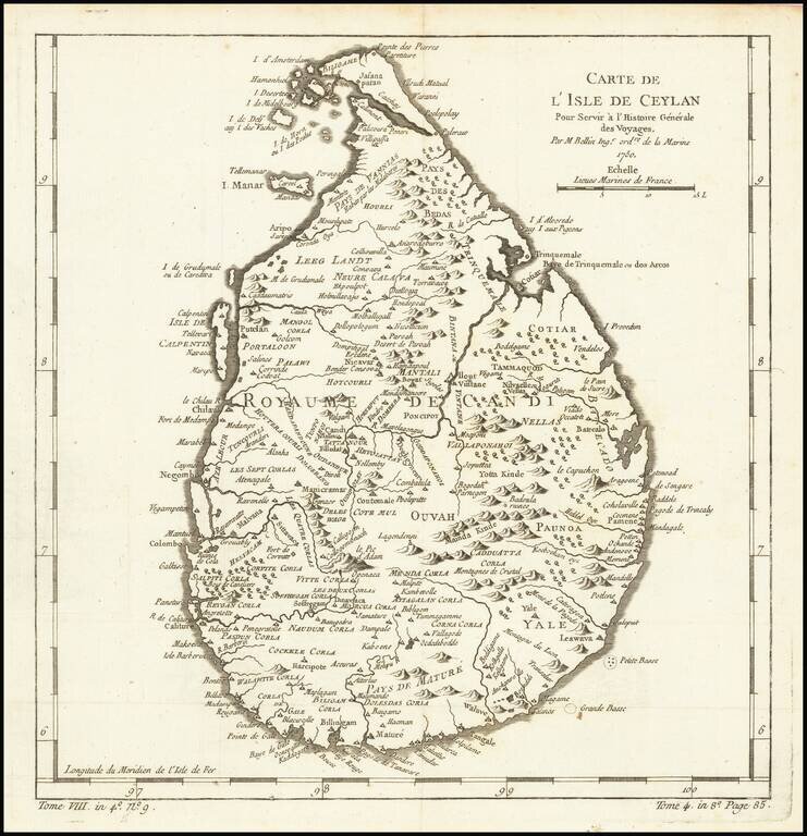
Finely engraved map of Sri Lanka, from Jacques Nicolas Bellin's Le Petit Atlas Maritime Recueti de Cartes et Plans des Quatre Parlies du Monde en Cinq Volumes, first published in Paris in 1764. Jacques Nicolas Bellin Jacques Nicolas Bellin...
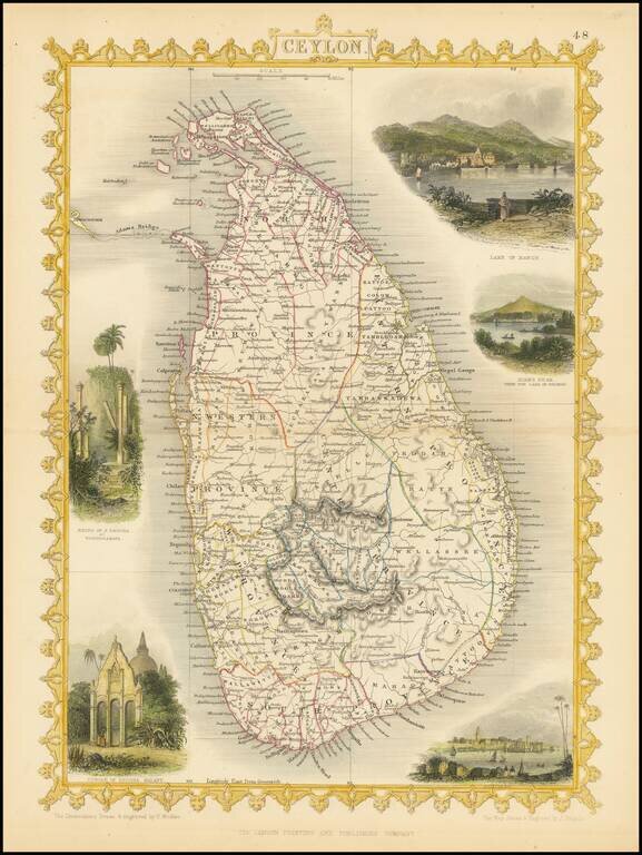
Striking full color example of the John Tallis map of Ceylon. Decorative vignettes of Lake of Kandy, Adams Peak from the Lake of Colorado, Temple of Buddha Kalany and the Ruins of the Dagora at Toopharamaya. Engraved for R. Montgomery Martin's...
![[Arabian Peninsula] [Sexta Asie Tabula, Arabia Felix.]](/map/small/64878.jpg)
True First State of the Earliest Woodblock Printed Map of the Arabian Peninsula Stunning map of the Arabian Peninsula, the first woodblock printed depiction of the region, in spectacular contemporary hand-coloring. The map is from the rare 1482 Ulm...
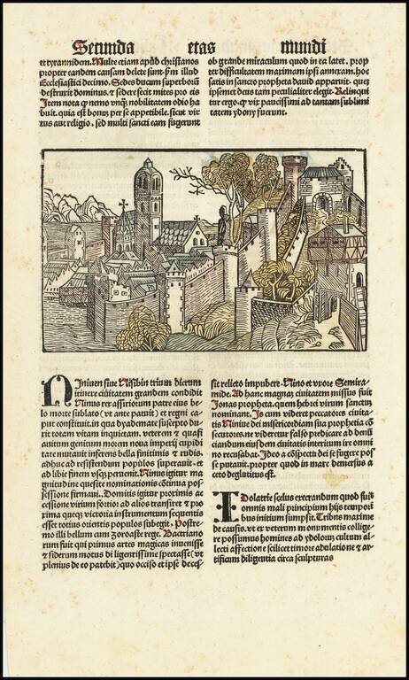
The Second Earliest Printed View of Nineveh Gorgeous example of Hartmann Schedel's incunable view of the Ancient Assyrian City of Nineveh from the small format edition of Schedel's Liber Chronicum, perhaps the single most influential secular...
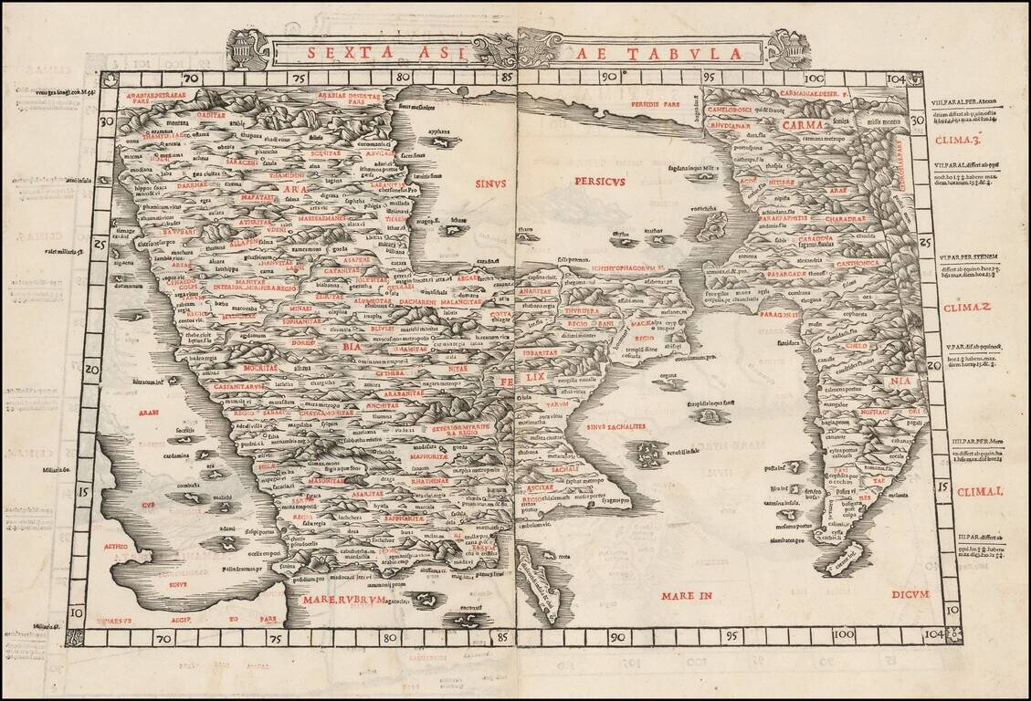
The First Map of the Arabian Peninsula Printed in Two Colors Fine, wide-margined example of Sylvanus' map of the Arabian Peninsula. This is one of the earliest obtainable maps of the region and was the first to be printed in two colors. The map...
![[Arabia] Tabula Sexta Asiae (Title on Verso)](/map/small/46799.jpg)
Nice example of the 1535 edition of Lorenz Fries' map of the Arabian Peninsula, Persian Gulf and adjoining regions. Important early map of the Middle East, from the 1535 edition of Lorenz Fries' Geographia, based upon the works of Claudius Ptolemy....
![[Iran, Eastern Iraq] Tabula Asiae V](/map/small/60562.jpg)
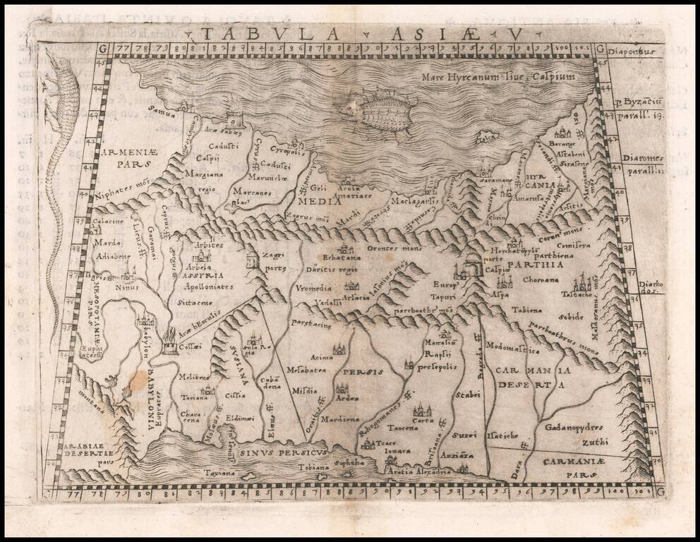
Important early map of the region between the Persian Gulf and the Caspian Sea, published in the 1542 edition of Munster's Geographia. The map extends from the Tigris River and the Euphrates River in modern-day Iraq (including Babylonia) to...
Fine example of Gastaldi's map of Cyprus, the Holy Land, Syria and neighboring regions, based upon the work of Claudius Ptolemy. Giacomo Gastaldi's Atlas of 1548 has been called the most comprehensive atlas produced between Martin Waldseemüller's...
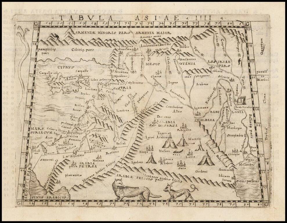
Important early Ptolemaic map of the region between the Persian Gulf and the Caspian Sea showing Babylon and Mesopotamia as well as several ancient religious sites. Giacomo Gastaldi's Atlas of 1548 has been called the most comprehensive atlas produced...
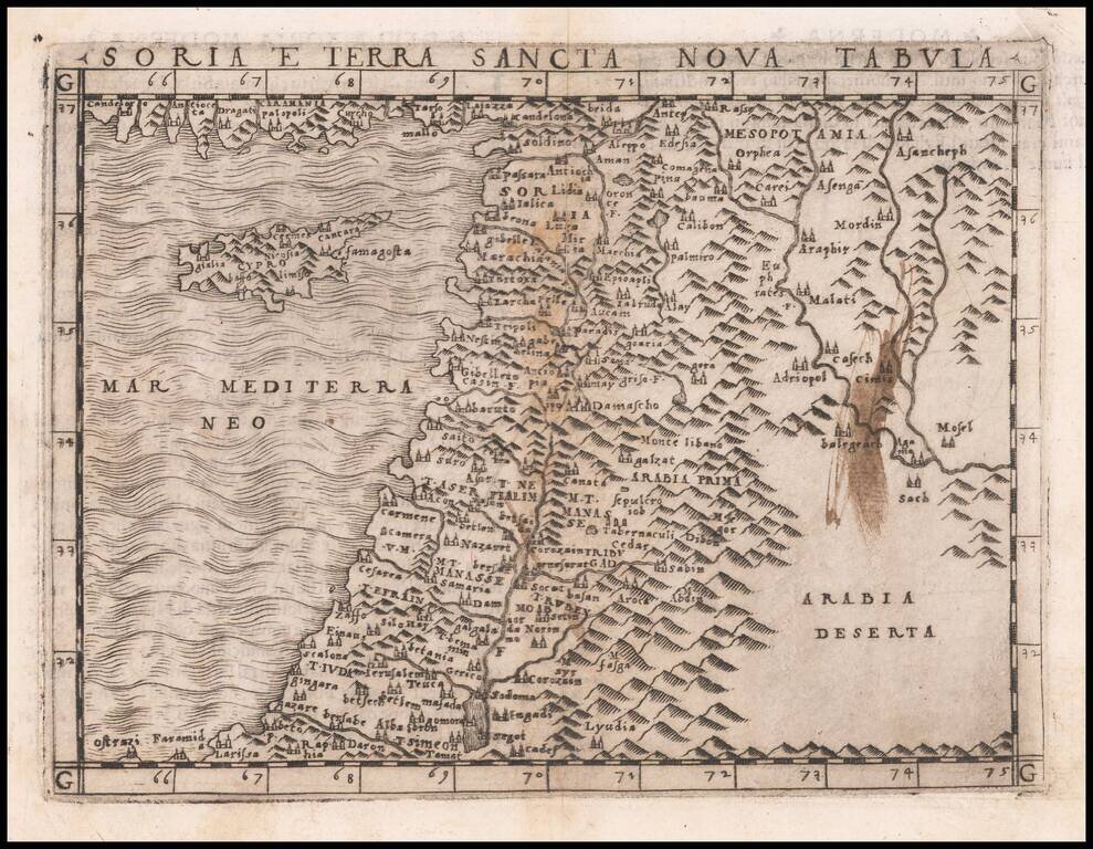
One of the earliest obtainable modern maps of the Holy Land and Cyprus, published by Giacomo Gastaldi in Venice. Gastaldi's maps are considered important early maps for regional collectors. The map show the Arabian Peninsula, Persian Gulf, Red Sea,...