logo

1768. Geogr: Charta ofwer Asiatiska Turkiet tillika med Arabien och Aegypten af A. Akerman

  • Geogr: Charta ofwer Asiatiska Turkiet tillika med Arabien och Aegypten af A. Akerman

Geogr: Charta ofwer Asiatiska Turkiet tillika med Arabien och Aegypten af A. Akerman information:

Year of creation: 
Resolution size (pixels): 
 3882x4698 px
Disk Size: 
 4.78429MiB
Number of pages: 
 1
Place: 
 Stockholm

Print information. Print size (Width x height in inches):
Printing at 72 dpi 
  53.92 х 65.25
Printing at 150 dpi 
 25.88 х 31.32
Printing at 300 dpi 
 12.94 х 15.66

An example of detailing the file of this map of in a printable high-resolution:

Click to open in high resolution (open in new tab).
Attention! this is just the central piece (central area 960x960 px) of the map file!
This is an example, so that you can see and study the level of detail of a given map. The entire Map will be fully available after payment!

Geogr: Charta ofwer Asiatiska Turkiet tillika med Arabien och Aegypten af A. Akerman

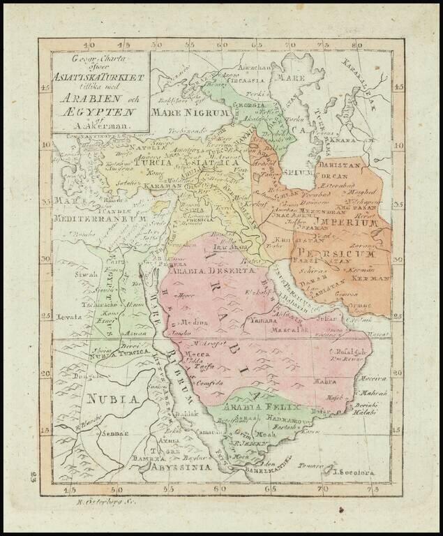
Rare map of the Ottoman Empire, published in Stockholm.

The map appeared in the Atlas juvenilis . . . , first published in Stockholm in 1768.


Special conditions for students!

If you are a student, write to us in telegram: @antiquemaps and indicate what material you need and for what work you need a map in high detail. We are ready to provide material on special terms. For students only!

Item information:

Year of creation:
Size:
3882x4698 px
Disk:
4.78429MiB
Number of pages:
1
Place:
Stockholm
Author:
Daniel Djurberg. Anders Akerman.
$14.99

Related item