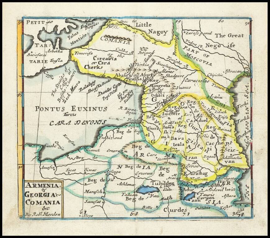
Rare English map of the region between the Black and Caspian Seas, published by Robert Morden. This map first appeared in Modern's rare Atlas Terestris, first published in 1687.
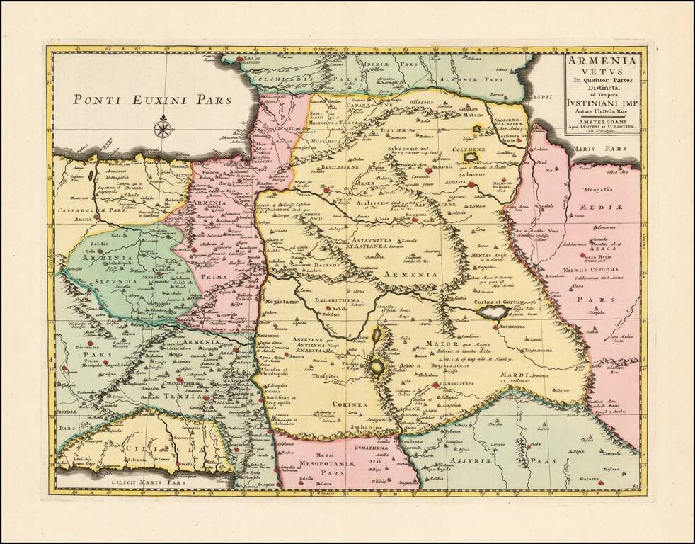
Scarce and highly detailed map of Ancient Armenia by Covens & Mortier, based upon an earlier map by Philippe De La Rue. One of the earliest printed maps to focus on Armenia.
![Imperii Persici In Omnes Suas Provincias . . . [includes Cyprus]](/map/small/64524.jpg)
Detailed map of the Persian Empire, published by Homann. The maps extends from the Black Sea, Khasikstan and Turkistan in the North to the Red Sea, Persian Gulf, Euphrates and the Mediterranean in the South, showing almost all of Cyprus. Decorative...
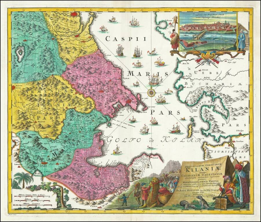
Decorative Map of Northern Iran, Part of Azerbaijan, Armenia and Turkmenistan -- Caspian Sea Region Gorgeous map of parts of Georgia, Armenia Kilani, Dageston, Schirvan and the southern part of the Caspian sea with Caucasus and Turkmenistan....
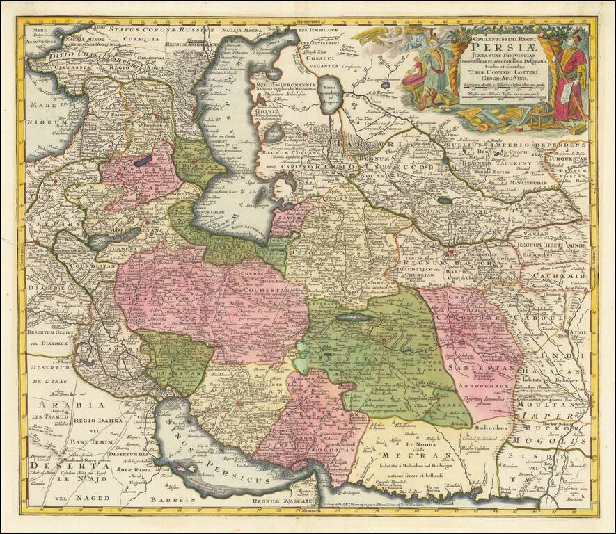
A scarce map of Persia, published by Tobias Conrad Lotter. The map extends from the Black Sea to Kashmir, and the area is divided into kingdoms and other entities. The map is highly detailed, with major roads, rivers, and many other features all shown...
Remondini's edition of the Santini map of the Persian Empire Detailed map of the Persian Empire extending north to the Caspian Sea and Uzbekistan, and from Armenia and the Persian Gulf in the west to the Indus River and the Karachi area in the east....
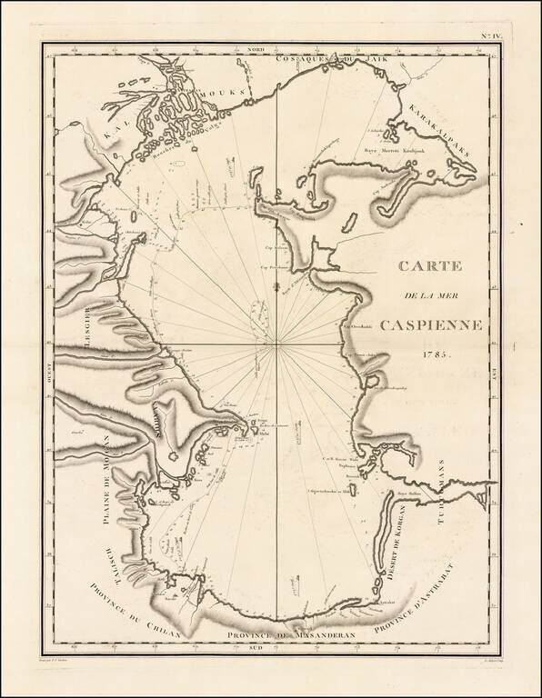
Fine large format map of the Caspian Sea by the Russian naturalist, Jean Antoine Guldenstaedt. Johann Anton Güldenstädt (1745-1781) was a Baltic German naturalist and explorer in Russian service. Güldenstadt studied pharmacy, botany and natural...
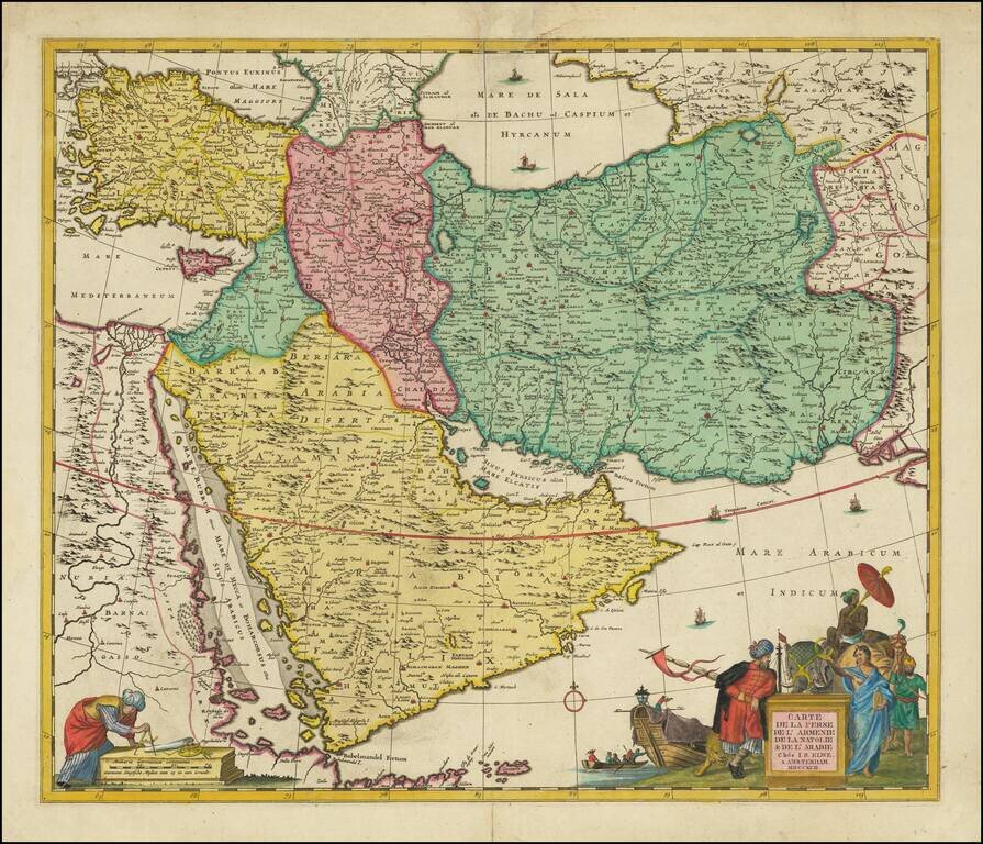
Scarce decorative map of the region bounded by the Saudi Peninsula, Red Sea, Nile River, Cyprus, Asia Minor, the Gulf of Aden, Indian Ocean, Armenia, the Caspian Sea, Afghanistan and the Indian Ocean, centered on the Persian Gulf. Includes two...
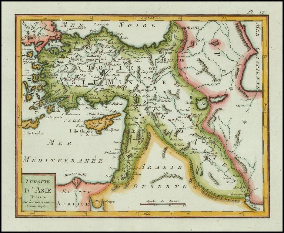
Finely engraved map of Asia Minor and Cyprus, published by Citoyen (Citizen) Berthelon in Paris, for the "Nouvelle Edition" of the Atlas Modern Portatif. . . . The Atlas Moderne Portatif was one of the most popular geographical atlases published at...
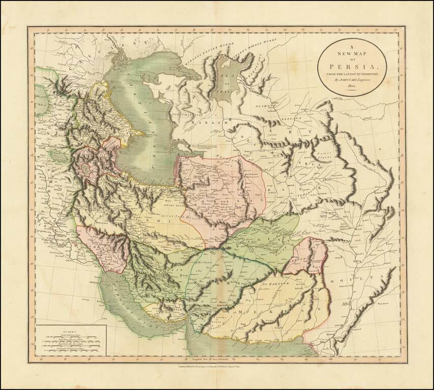
A highly detailed map of Persia, from an early edition of Cary's atlas. This is one of the most decorative and detailed large format maps of the region to appear in an English Atlas and is highly sought after by collectors for its detail and...
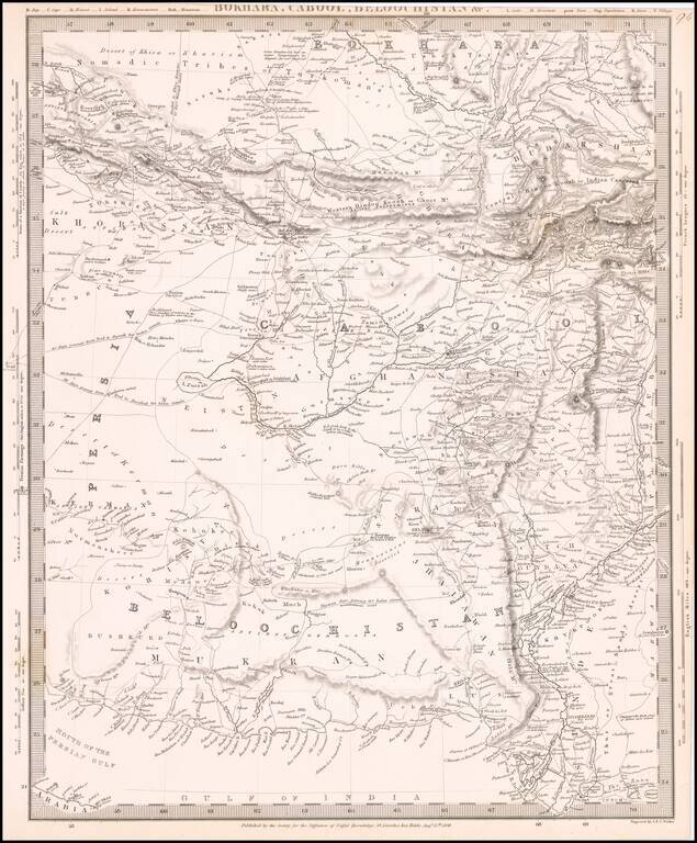
Highly detailed regional map, covering primarily Afghanistan and neighboring regions. Shows the overland routes through the region, along with towns, mountains, rivers and a host of other interesting details.
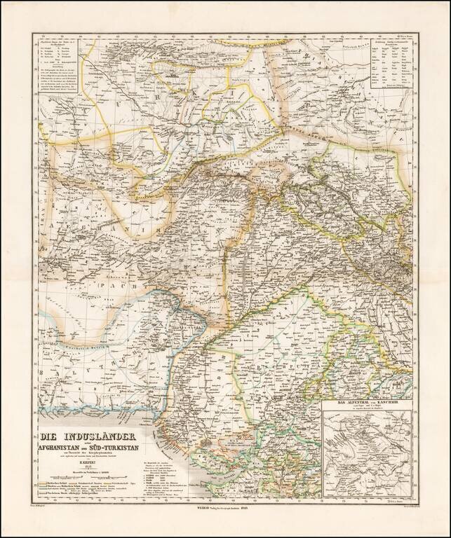
Striking map of Central Asia, published in Weimar by Heinrich Kiepert. The map extends from Afghanistan and Balutschistan in the west to Kaxgar, Jarkand, Delhi and Northwestern India. The map encompasses much of the modern day Pakistan, Afghanistan,...
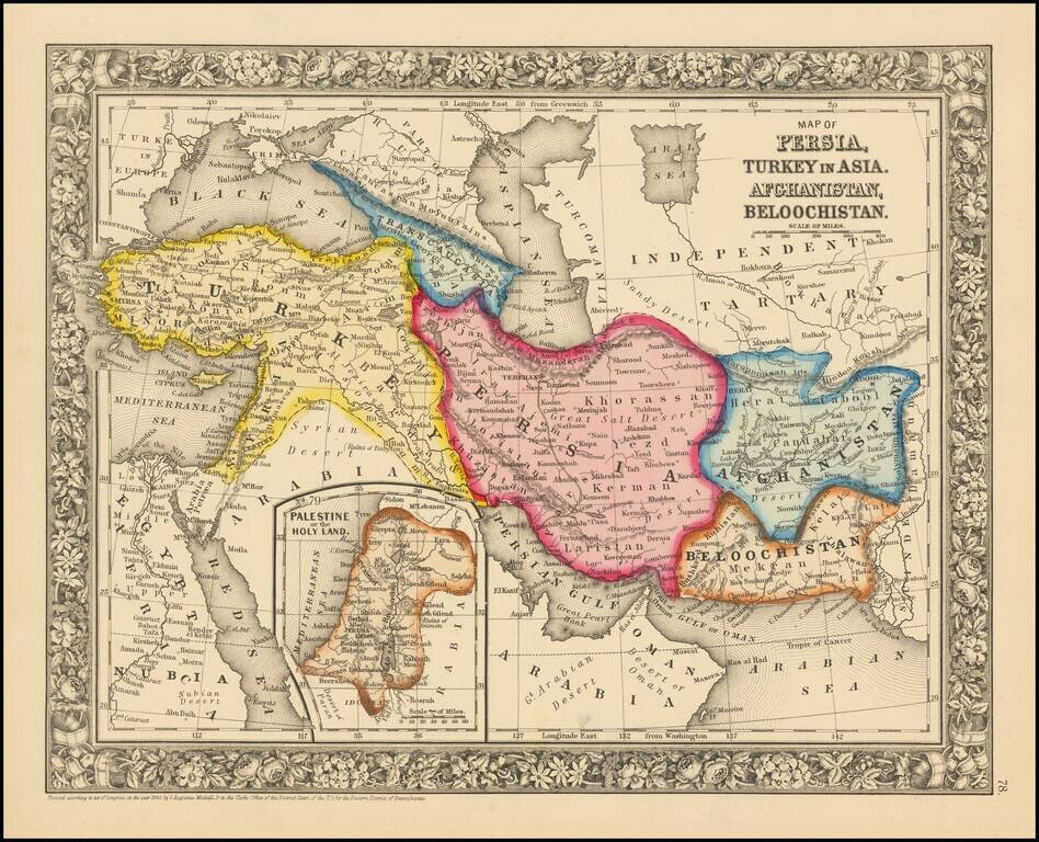
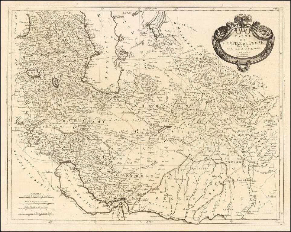
Attractive map centered on Persia and extending from Turkey and the Black Sea to Afghanistan and Beloochistan. Colored by countries Shows towns, tribes, roads, rivers, mountains, lakes, etc.
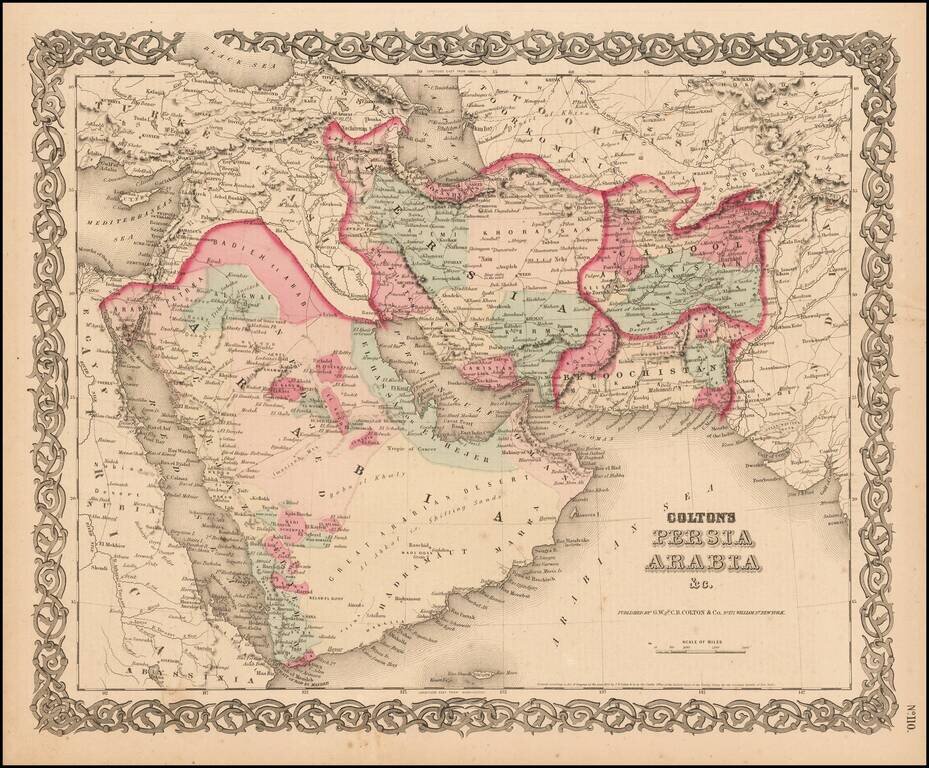
Detailed map of the Middle East, colored by Tribes, etc. Shows towns, roads, deserts, rivers, lakes, mountains, islands, etc. A terrific regional map, from JH Colton, one of the most prolific American mapmakers of the mid-19th Century.
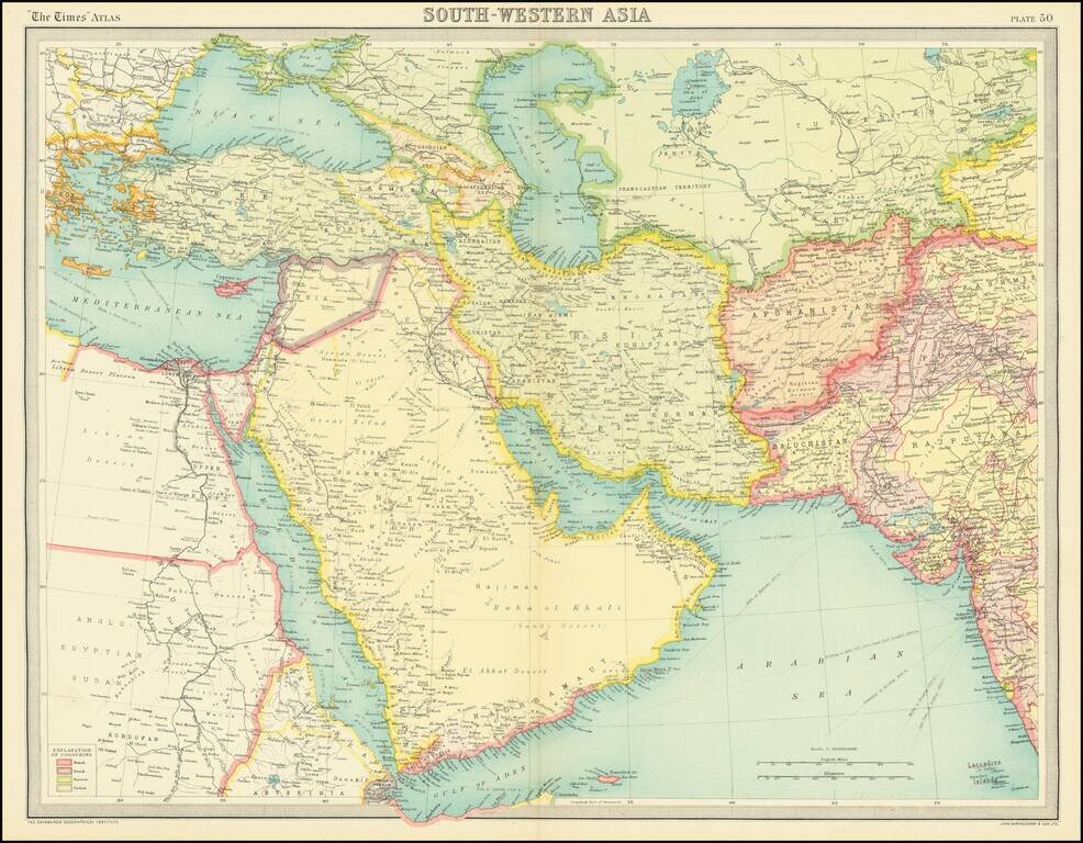
Detailed regional map of the Middle East and environs, from the Times London Atlas. "El Qatar" is shown, as is Doha. Further to the east, Abu Dhabi, Sharja, Ras el Kheimah, and Debai (Dubai) are shown in Trucial Oman.
![Le Guerre du Petrole [Caspian Sea and Northern Iran]](/map/small/63437.jpg)
Interesting map of the Caspian Sea, western Iran, Armenia, Azerbaijan, Georgia, and Eastern Iraq, illustrating the so-called "Guerre du Petrole" (Petroleum War). The map focuses on the growing importance of the Middle East and the Caucasus to global...