Map size in jpg-format: 524015B
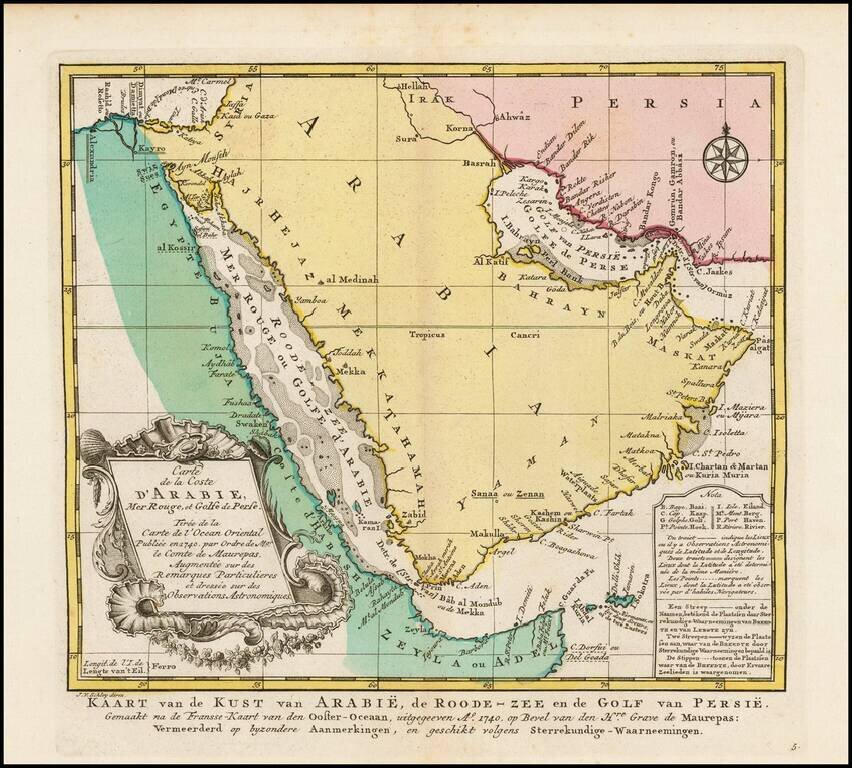
Striking full color example of the Dutch edition of Bellin's fine map of the Arabian Peninsula.
Includes an elaborate cartouche and detailed charting of the coastline of the Arabian Peninsula, Red Sea, Straits of Ormuz, etc. The Red Sea is alternatively named "Mer Rouge ou Golf d'Arabie."
Daba, Katara, Joddah, Al Katif, Mekka, al Medinah and Bahrayn are named.
Dutch title at the bottom. Decorative cartouche, compass rose.
Jakob van der Schley was a skilled draftsman and engraver who operated out of Amsterdam and had strong ties with the Hague. He was trained by Bernard Picart and his style resembles that of the elder man. Van der Schely was known for intricately engraved portraits and frontispieces. He signed most of the plates used in the Hague edition of the Abbe Prevost's Histoire generale des voyages.
If you are a student, write to us in telegram: @antiquemaps and indicate what material you need and for what work you need a map in high detail. We are ready to provide material on special terms. For students only!

![[Europe, Mediterranean, Asia Minor and the Persian Empire]](/map/small/43558.jpg)
