logo

1948. Kulturwaldlandschaft im Gebiet des Steigerwaldes von G. Kreuzer . . .

  • Kulturwaldlandschaft im Gebiet des Steigerwaldes von G. Kreuzer . . .

Kulturwaldlandschaft im Gebiet des Steigerwaldes von G. Kreuzer . . . information:

Year of creation: 
Resolution size (pixels): 
 19047x22329 px
Disk Size: 
 118.738MiB
Number of pages: 
 1
Place: 
 

Print information. Print size (Width x height in inches):
Printing at 72 dpi 
  264.54 х 310.13
Printing at 150 dpi 
 126.98 х 148.86
Printing at 300 dpi 
 63.49 х 74.43

An example of detailing the file of this map of in a printable high-resolution:

Click to open in high resolution (open in new tab).
Attention! this is just the central piece (central area 960x960 px) of the map file!
This is an example, so that you can see and study the level of detail of a given map. The entire Map will be fully available after payment!

Kulturwaldlandschaft im Gebiet des Steigerwaldes von G. Kreuzer . . .

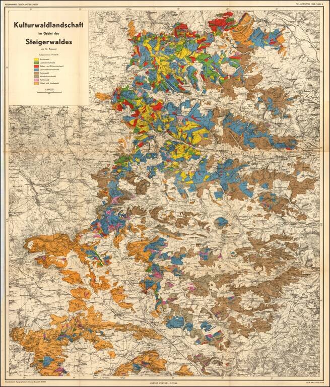
Cultural forest landscape in the Steigerwald of Germany, between Wurzberg and Nuremberg

The map is color coded to show the predominant trees in each region.


Special conditions for students!

If you are a student, write to us in telegram: @antiquemaps and indicate what material you need and for what work you need a map in high detail. We are ready to provide material on special terms. For students only!

Item information:

Year of creation:
Size:
19047x22329 px
Disk:
118.738MiB
Number of pages:
1
Place:

$21.99

Related item