
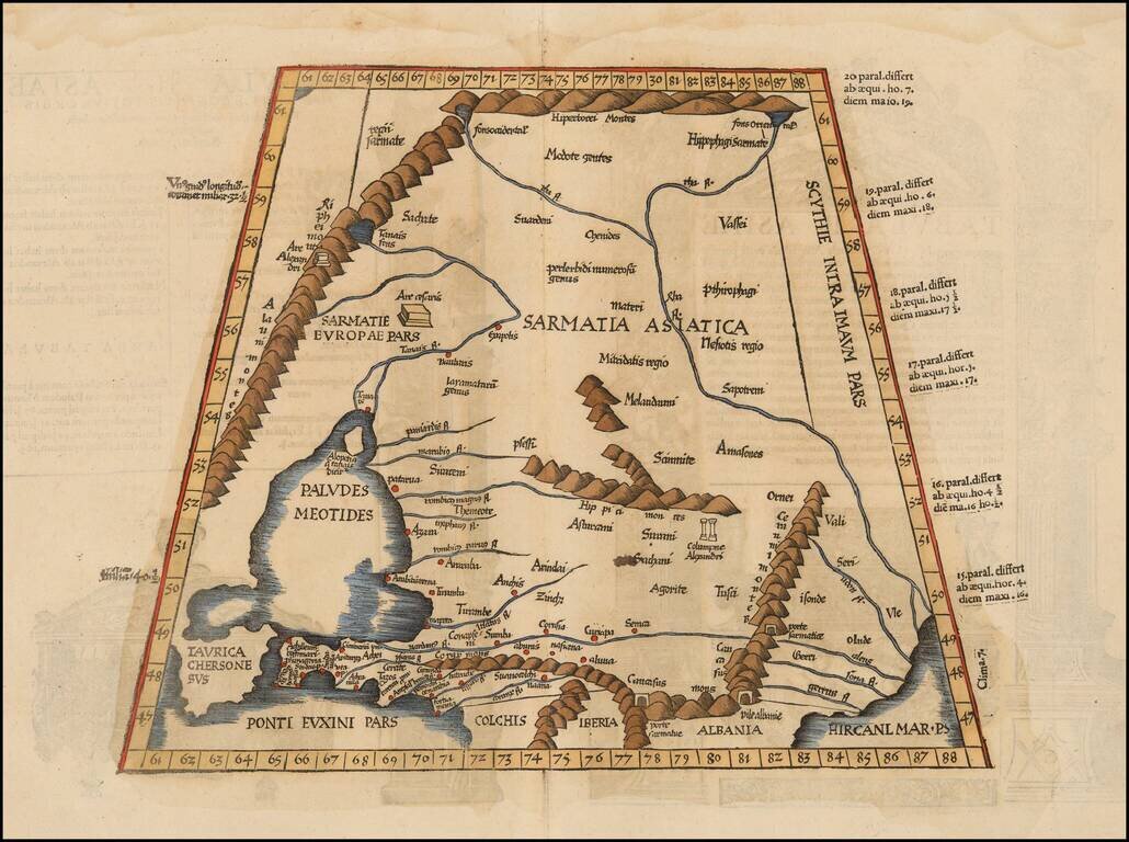
Detailed map of the region north of Black Sea and west of the Caspian, from the 1535 edition of Fries Geographia. The publisher of this edition, Michael Villanovus (or Servetus), was tried by Calvin for heresy and burned at the stake with several of...
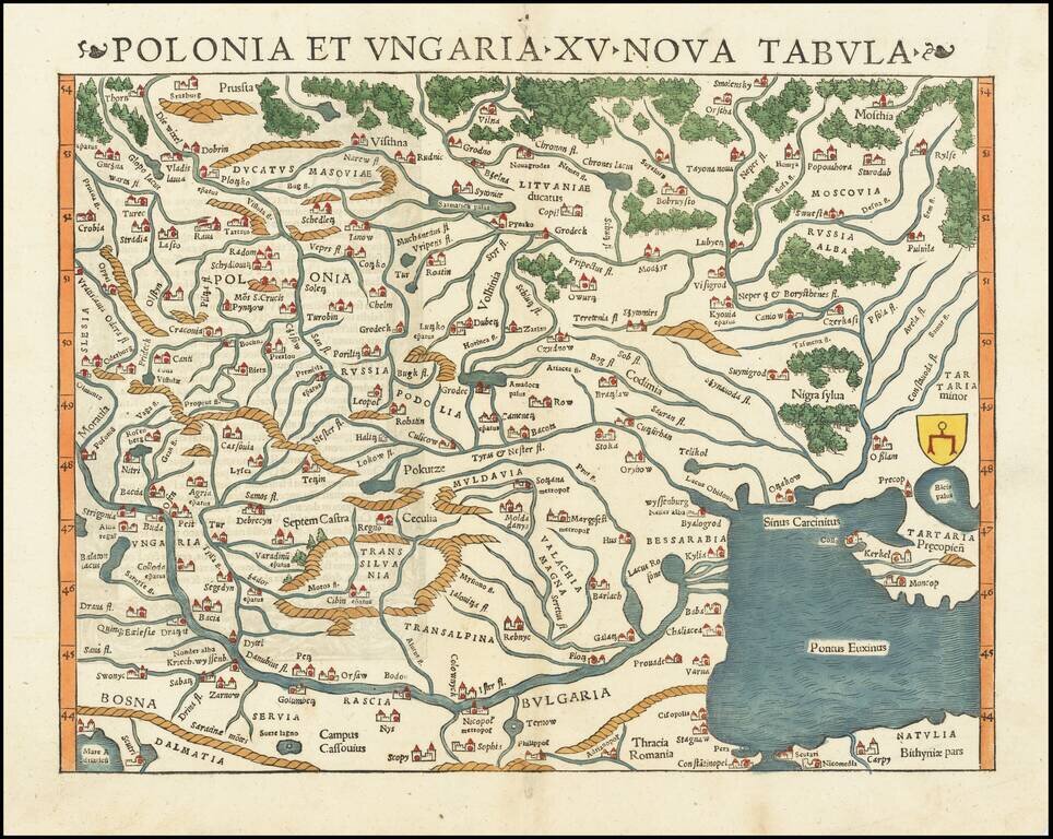
The Earliest Obtainable Map of Poland, Ukraine, Belarus, Hungary, etc. Rare early state of Munster's map of Poland, Lithuania, the Ukraine, Moscovy and the Balkans, extending from Prussia, Vilna and Smolensky in the north to Bosnia, Bulgaria,...
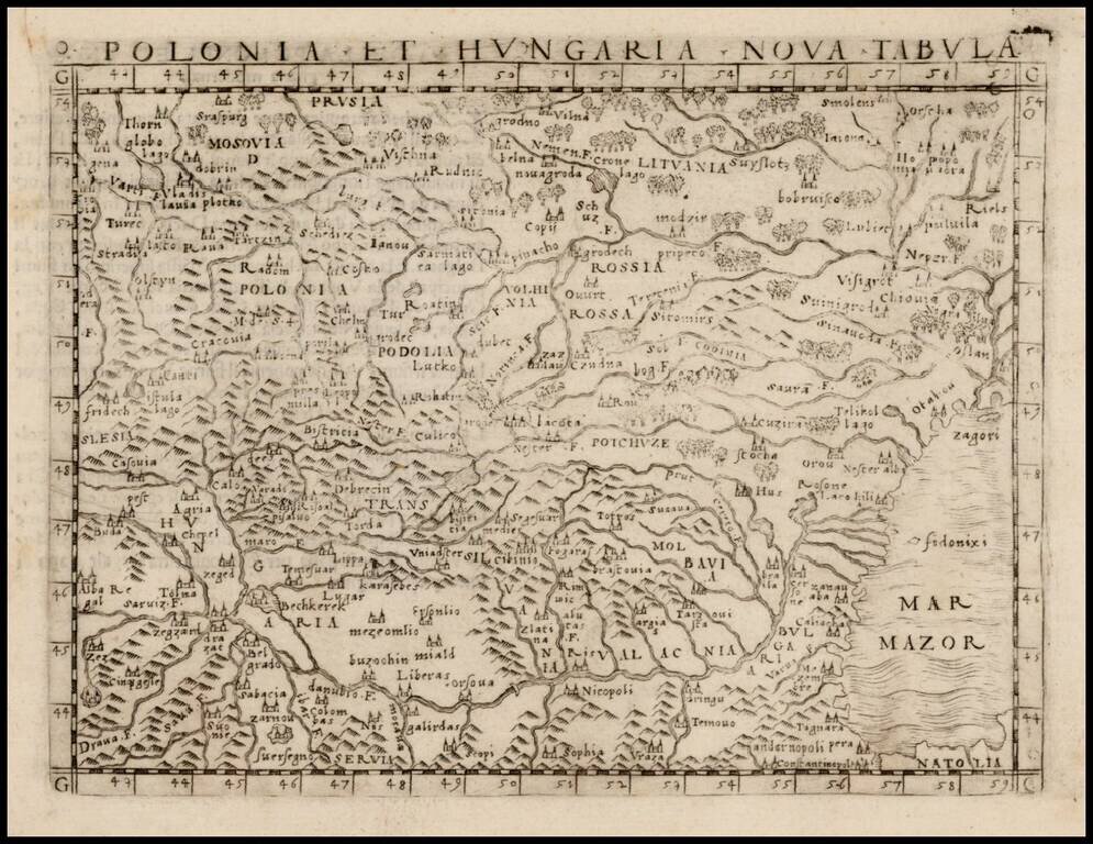
Nice example of one of the earliest obtainable modern maps of Poland, Lithuania and Hungary, published in Venice by Gastaldi. Gastaldi's maps are considered important early maps for regional collectors. Giacomo Gastaldi was one of the most important...
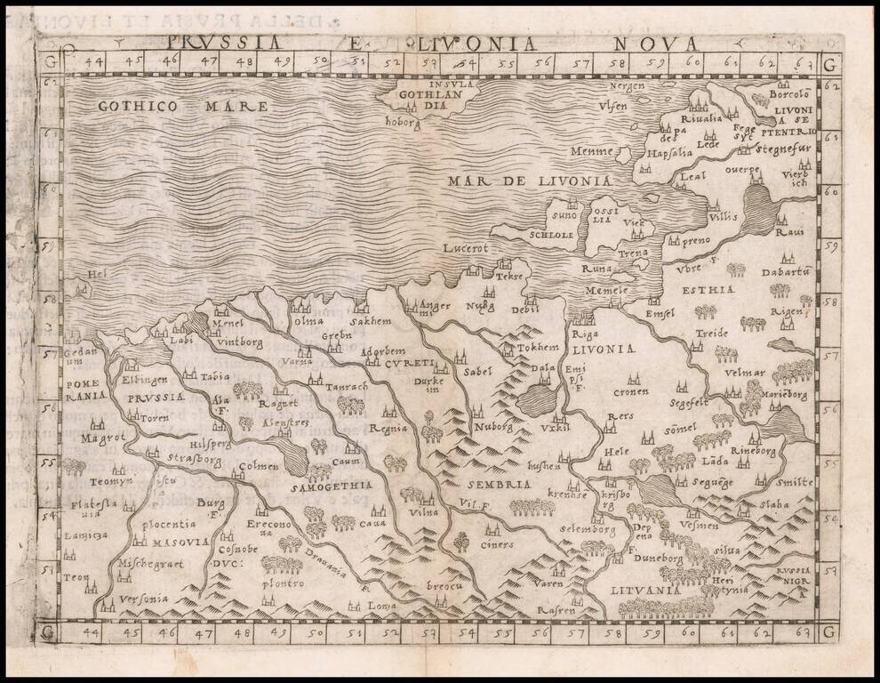
One of the Earliest Obtainable Modern Maps of the Baltic Region Nice example of Gastaldi's map of the region bounded by the Vistula River and Prussia in the west, Livonia in the east, and Lithuania in the southeast. The map is centered on Riga and...
![[Poland, Croatia, Slovenia, Hungary, Serbia, Romania, Ukraine, Bulgaria] (La discrittione della Transylvania et parte del l'Ungaria, et il simil della Romania)](/map/small/59225.jpg)
Middle section of Paolo Forlani's rare 3-sheet map, covering South Poland, Croatia, Slovenia, Hungary, Serbia, Romania, Ukraine, Bulgaria, with Transylvania in the center. Krakow appears in the north, with the Danube River crossing from the northwest...
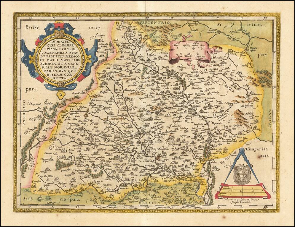
Fine old color example of the Ortelius map of Moravia, showing fortified cities, towns, rivers, etc. Large strapwork cartouche, title banner and smaller cartouche. From Ortelius' Theatrum Orbis Terrarum, the first modern atlas of the World.
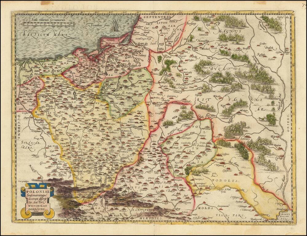
Decorative example of Ortelius' first map of Poland, from Ortelius' Theatrum Orbis Terrarum, the first modern atlas of the World. This map is based upon the map of Godrecki which was first published in 1558. One of the earliest modern maps of Poland.
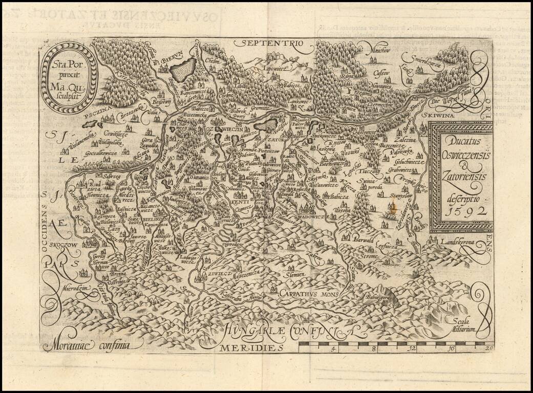
Detailed map of Southern Poland and the from the Wesel River in the north to the Carpathian Mountains in the south, centered on Auschwitz. Matthaus Quad was a German cartographer based in Cologne. The map appeared in several Geographical works...
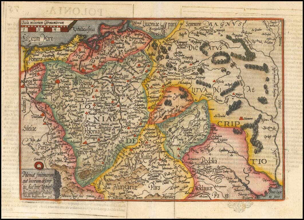
Striking example of Quad's map of Poland, reduced from Ortelius' map. The map is based upon the map of Godrecki, first published in 1558.
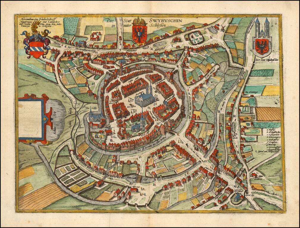
Fine example of Braun & Hogenberg's map of Swiebodzin. The earliest historical records mentioning Swiebodzin dates to the beginning of the fourteenth century. The town grew around the confluence of old trade routes linking Silesia with Pomerania...
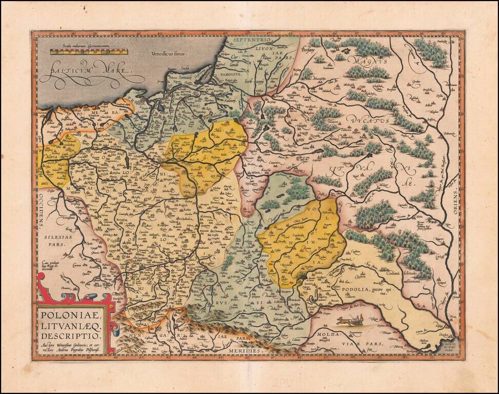
Nice example of Ortelius' second map of Poland and Lithuania which first appeared in the 1595 Latin edition of Ortelius' Theatrum. The map extends from the Dniepr River in the east to the Oder in the west and includes all of Poland, as well as...
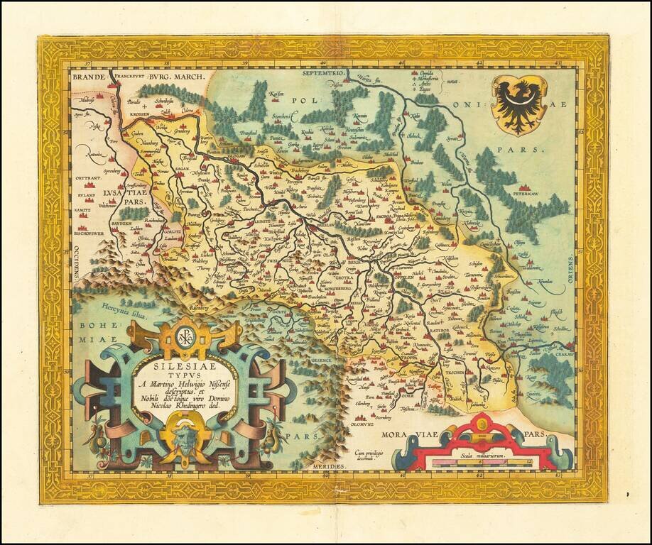
Fine old color example of the second of Ortelius' map of Silesia, which has been enlarged and embellished with a much more elaborate cartouche and military scale. Centered on Brelaw. The map is based upon the work of Martin Helwig. From Ortelius'...
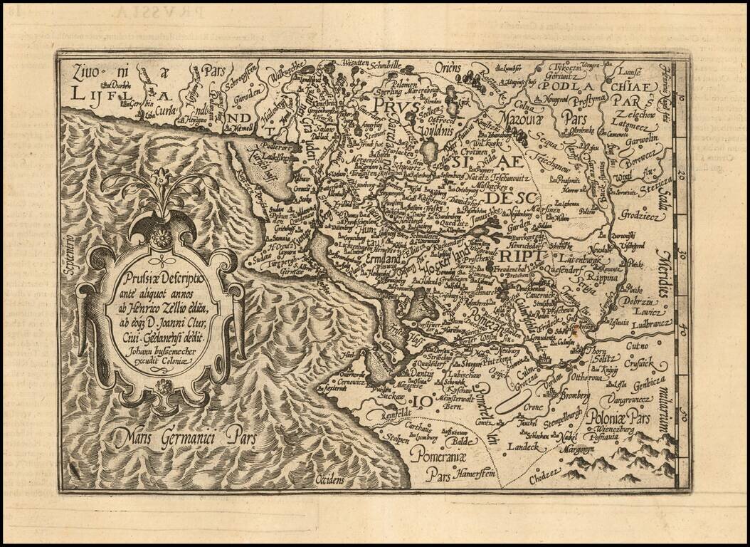
An Early Map of Prussia Detailed map of the region centered on the southern Baltic Coast, reaching inland to the Bug River. Includes a detailed early coverage of the areas around Dantzig, Konnigsberg and the Lithuanian coastline. East is oriented...
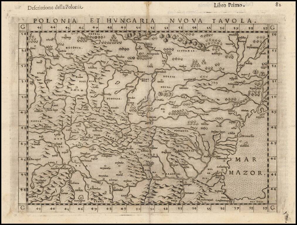
Striking dark impression of Ruscelli's map of Poland, Hungary, Slovakia, the Czech Republic and parts of the region bounded by the Black Sea in the east and the Danube in the south. Ruscelli's Atlas is an expanded edition of Gastaldi's Atlas of 1548,...
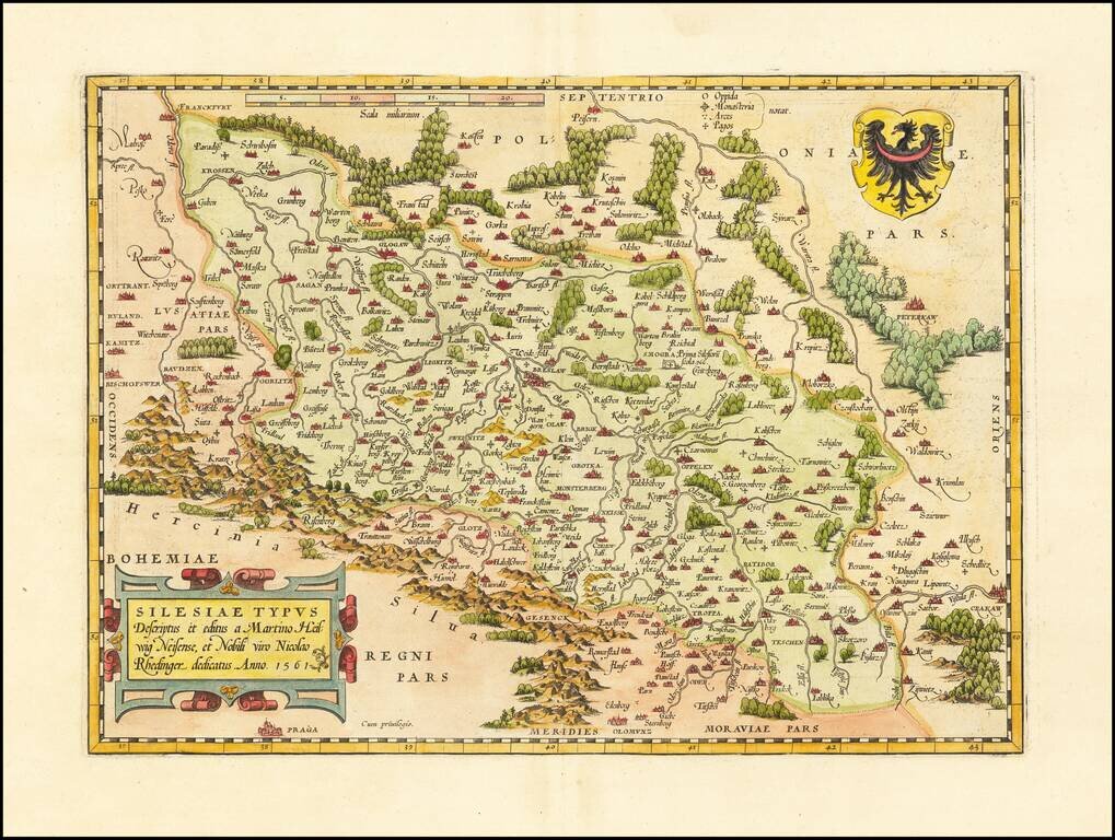
The Abraham Ortelius edition of Martin Helwig's seminal map of Silesia. Important regional map of Silesia, from Abraham Ortelius' Theatrum Orbis Terrarum, the first modern atlas of the World. Shows the region from Olomunz and Crackaw in the south to...
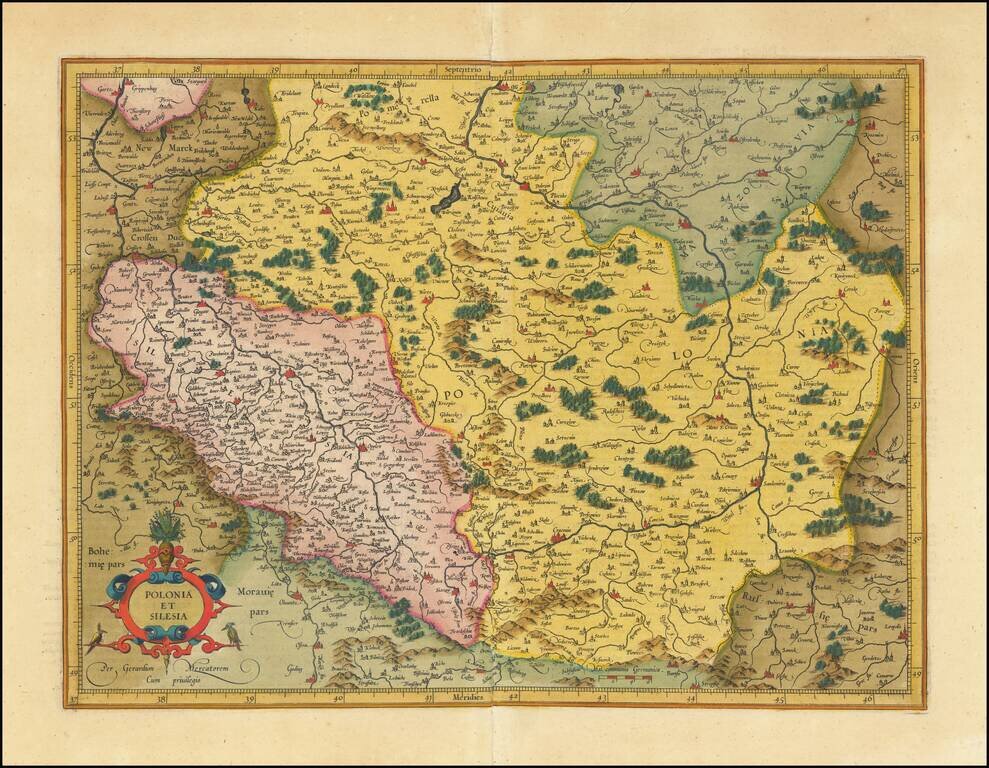
Fine old color example Mercator's detailed map of a portion of Poland, including a number of its major cities (Warsaw, Krackow, Oppeln, Breslau, Gnezna, Graudenz, Lublin, etc.).