Map size in jpg-format: 19.99MiB
Click to open in high resolution (open in new tab).

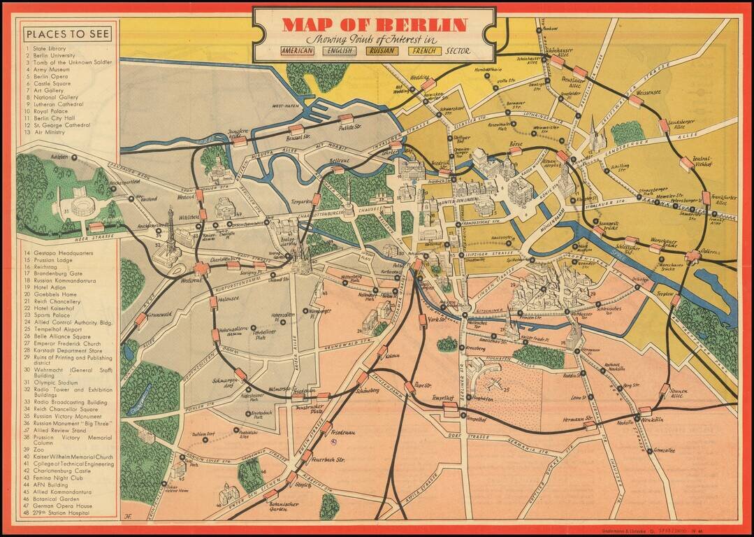
An attractive vintage pictorial map of Berlin during the earliest days of Allied occupation, preserving a rare view of the city prior to the building of the Berlin Wall. The front of the work depicts the heart of Berlin and its surroundings, stretching from the Olympic stadium to Treptower Park. The map is colored according to the newly created sectors: Russian in gold, French in yellow, English in grey, and American in Red. The monuments and points of interest of the city, ranging from the Brandenburg Gate to the Gestapo headquarters, are shown pictorially and labeled in an index.
Number 29 on the map, to the north of the American Zone, shows the "Ruins of the Printing and Publishing District" with every building ruined and rubble strewn about. We do not know for certain why the map chooses to feature this district as particularly noteworthy for its destruction, as the city as a whole had been almost completely destroyed by the Allied bombing campaign and the Battle of Berlin itself.
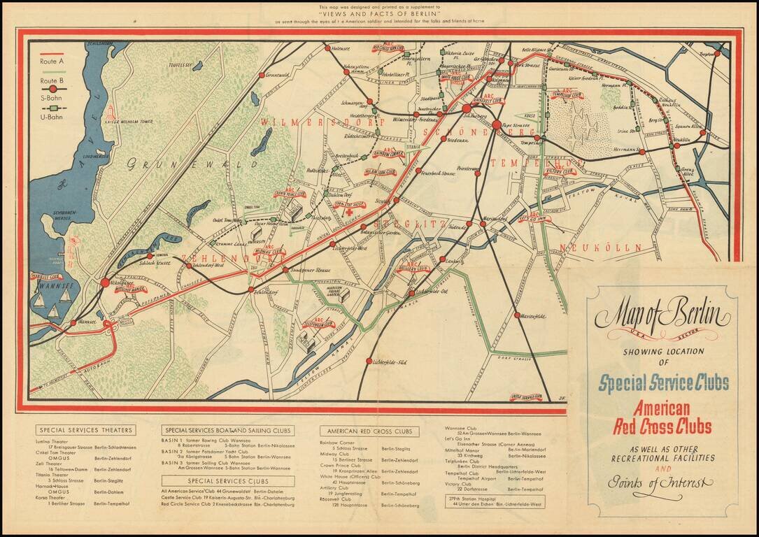
The verso shows the location of various clubs, including those of the Special Services and American Red Cross, with some buildings and parks shown pictorially. This map focuses on the southern part of the city, where American troops were stationed.
The sectors are remarkably well-connected in this map. Suggested visitor routes meander through the city, crossing back and forth between East and West Berlin. The S- and U-Bahn run along the same routes they had since 1930, with stations equally distributed between the sectors. The rapidly increasing tensions, which would lead to the Berlin Blockade and the construction of the Berlin Wall less than half a decade after the completion of this map, are not yet the concern of American soldiers or of this map at the time.
The Special Services force was the entertainment branch of the US Military, responsible for keeping troops entertained during the war. Several famous actors, singers, and artists started their careers in this force, including Dick Van Dyke and Clint Eastwood. At clubs of the Special Services, and of the Red Cross, American troops would have been able to go for entertainment, dances, and (of particular importance in the "Clubmobiles") donuts.
This map was made as a supplement to the US Army 78th Special Services Office book Views and Facts of Berlin: As seen through the eyes of the American soldier and intended for the folks and friends at home.
If you are a student, write to us in telegram: @antiquemaps and indicate what material you need and for what work you need a map in high detail. We are ready to provide material on special terms. For students only!


