logo

1837. Frankfort (Frankfurt) (Am Main)

  • Frankfort (Frankfurt) (Am Main)

Frankfort (Frankfurt) (Am Main) information:

Year of creation: 
Resolution size (pixels): 
 9613x7611 px
Disk Size: 
 20.5269MiB
Number of pages: 
 1
Place: 
 London
Author: 
 SDUK

Print information. Print size (Width x height in inches):
Printing at 72 dpi 
  133.51 х 105.71
Printing at 150 dpi 
 64.09 х 50.74
Printing at 300 dpi 
 32.04 х 25.37

An example of detailing the file of this map of in a printable high-resolution:

Click to open in high resolution (open in new tab).
Attention! this is just the central piece (central area 960x960 px) of the map file!
This is an example, so that you can see and study the level of detail of a given map. The entire Map will be fully available after payment!

Frankfort (Frankfurt) (Am Main)

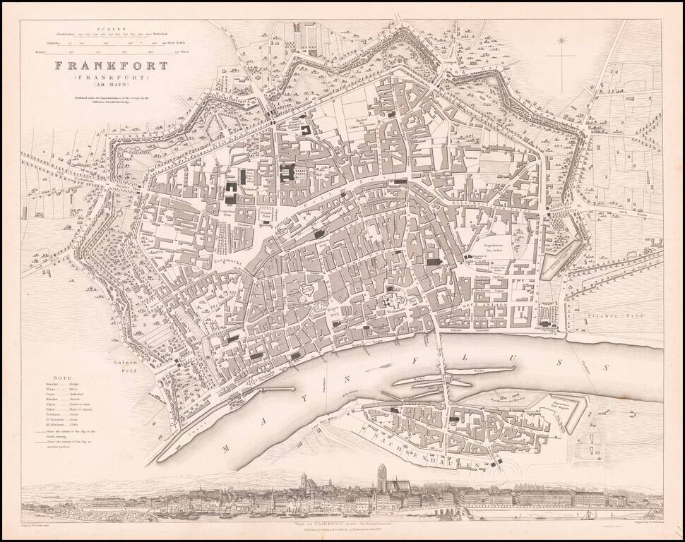
Striking plan of Frankfurt, with a large panoramic birdseye view of the town from Sachenhausen.

One of the best 19th Century English town plans to appear in a commercial atlas.


Special conditions for students!

If you are a student, write to us in telegram: @antiquemaps and indicate what material you need and for what work you need a map in high detail. We are ready to provide material on special terms. For students only!

Item information:

Year of creation:
Size:
9613x7611 px
Disk:
20.5269MiB
Number of pages:
1
Place:
London
Author:
SDUK.
$14.99

Related item