Map size in jpg-format: 6.57755MiB
Click to open in high resolution (open in new tab).
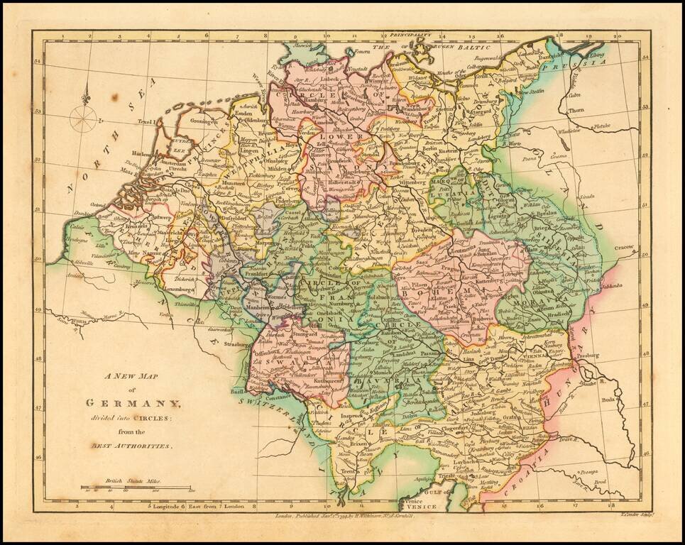
An interesting regional map showing the Dutchys of Bremen, Holstein, Mecklenberg, Schwerin, Gustro, Magdeburg, Verden, Saxe Launberg, the County of Dannenberg, a group of southern Principalities including Calenburg, Grubenhagen, Haaberstadt, Wolfenbuttel, Hildesheim, Luneburg-Zell, and a host of Bishopricks, Archbishopricks etc.
Shows towns, rivers, mountains, lakes, etc.
Robert Wilkinson was active in London as a cartographic publisher from 1785 to 1825. He produced a number of nice works, including a General Atlas and a re-issuance of Bowen & Kitchen's English Atlas, along with excellent large format separate maps.
If you are a student, write to us in telegram: @antiquemaps and indicate what material you need and for what work you need a map in high detail. We are ready to provide material on special terms. For students only!


