Map size in jpg-format: 18.4611MiB
Click to open in high resolution (open in new tab).
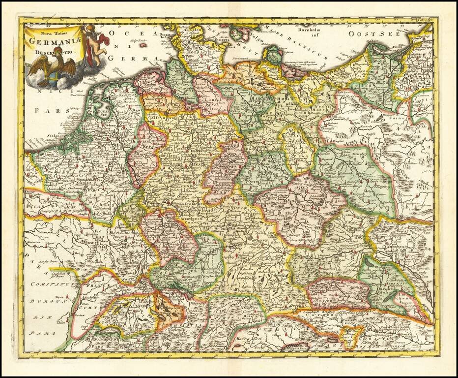
Interesting map of the Holy Roman Empire, including Germany, Poland, Lithuania, the Low Countries, Austria, Hungary, etc.
From Cluverius' Introductio in Universam Geographiam (first issued in 1629) and re-issued many times over the next 100 years, with maps being incorporated by various publishers beginning in the late 17th Century.
If you are a student, write to us in telegram: @antiquemaps and indicate what material you need and for what work you need a map in high detail. We are ready to provide material on special terms. For students only!


