logo

1793. Regni Angliae et Principatus Cambriae Tabula Nova . . . MDCCLXXXXIII

  • Regni Angliae et Principatus Cambriae Tabula Nova . . .  MDCCLXXXXIII

Regni Angliae et Principatus Cambriae Tabula Nova . . . MDCCLXXXXIII information:

Year of creation: 
Resolution size (pixels): 
 6537x7762 px
Disk Size: 
 13033000B
Number of pages: 
 1
Place: 
 Nuremberg
Author: 

Print information. Print size (Width x height in inches):
Printing at 72 dpi 
  90.79 х 107.81
Printing at 150 dpi 
 43.58 х 51.75
Printing at 300 dpi 
 21.79 х 25.87

An example of detailing the file of this map of in a printable high-resolution:

Click to open in high resolution (open in new tab).
Attention! this is just the central piece (central area 960x960 px) of the map file!
This is an example, so that you can see and study the level of detail of a given map. The entire Map will be fully available after payment!

Regni Angliae et Principatus Cambriae Tabula Nova . . .  MDCCLXXXXIII

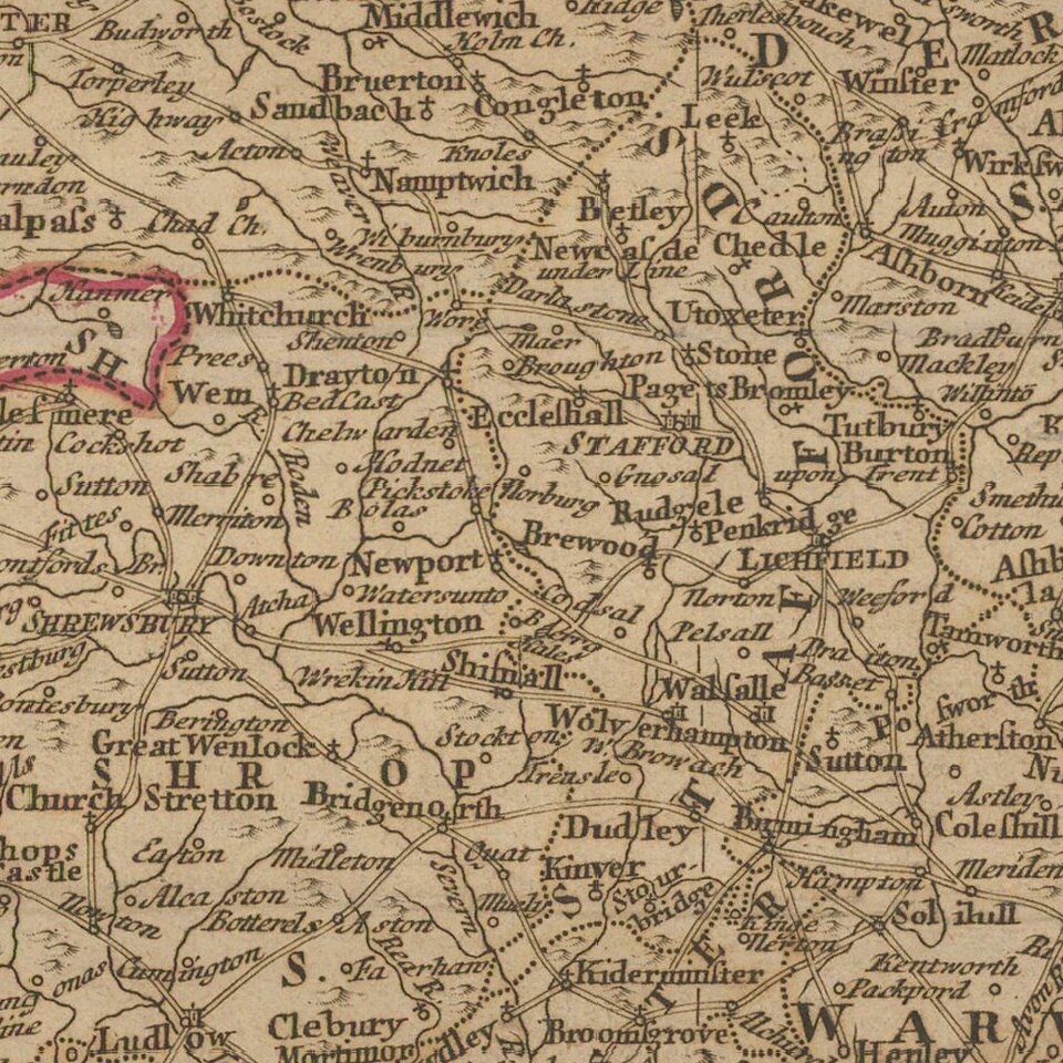
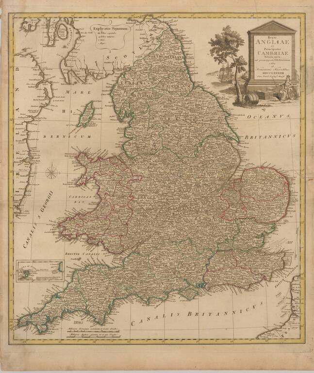
Decorative map of England and Wales, published in Nuremberg.

The map is partially colored by counties and is based upon the map of Thomas Kitchin.

Homann Heirs was a German publishing firm that enjoyed a major place in the European map market throughout the eighteenth century. Founded in 1702 by Johann Baptist Homann, the business passed to his son, Christoph, upon Johann’s death in 1724. Christoph died in 1730, aged only 27, and the firm was inherited by subsequent Homann heirs. This altered the name of the company, which was known as Homann Erben, or Homann heirs. The firm continued in business until 1848.


Special conditions for students!

If you are a student, write to us in telegram: @antiquemaps and indicate what material you need and for what work you need a map in high detail. We are ready to provide material on special terms. For students only!

Item information:

Year of creation:
Size:
6537x7762 px
Disk:
13033000B
Number of pages:
1
Place:
Nuremberg
Author:
Homann Heirs.
$14.99

Related item