logo

1778. Le Royaume D'Angleterre, divise selon les sept Royaumes ou Heptrachie des Saxons, avec La Principaute De Galles, et subdivisie en Shires ou Comtes . . . 1778

  • Le Royaume D'Angleterre, divise selon les sept Royaumes ou Heptrachie des Saxons, avec La Principaute De Galles, et subdivisie en Shires ou Comtes . . . 1778

Le Royaume D'Angleterre, divise selon les sept Royaumes ou Heptrachie des Saxons, avec La Principaute De Galles, et subdivisie en Shires ou Comtes . . . 1778 information:

Year of creation: 
Resolution size (pixels): 
 1852x1712 px
Disk Size: 
 1014.24KiB
Number of pages: 
 1
Place: 
 Venice

Print information. Print size (Width x height in inches):
Printing at 72 dpi 
  25.72 х 23.78
Printing at 150 dpi 
 12.35 х 11.41
Printing at 300 dpi 
 6.17 х 5.71

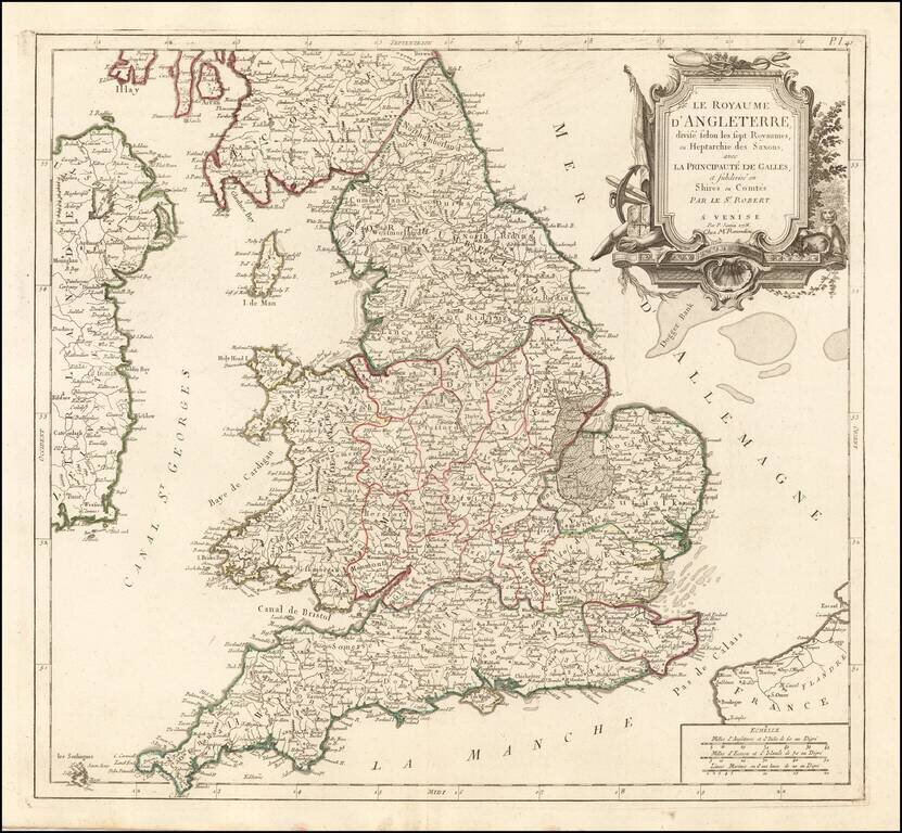
Detailed Santini/Remondini map of the English Heptarchy.

An excellent large format map of England and Wales, divided by Heptarchies and showing towns, rivers, lakes, roads and many other details.

Based upon De Vaugondy's map first issued in the early 1750s.


Special conditions for students!

If you are a student, write to us in telegram: @antiquemaps and indicate what material you need and for what work you need a map in high detail. We are ready to provide material on special terms. For students only!

Item information:

Year of creation:
Size:
1852x1712 px
Disk:
1014.24KiB
Number of pages:
1
Place:
Venice
Author:
Giovanni Antonio Remondini.
$9.99

Related item