Map size in jpg-format: 35.8827MiB
Click to open in high resolution (open in new tab).
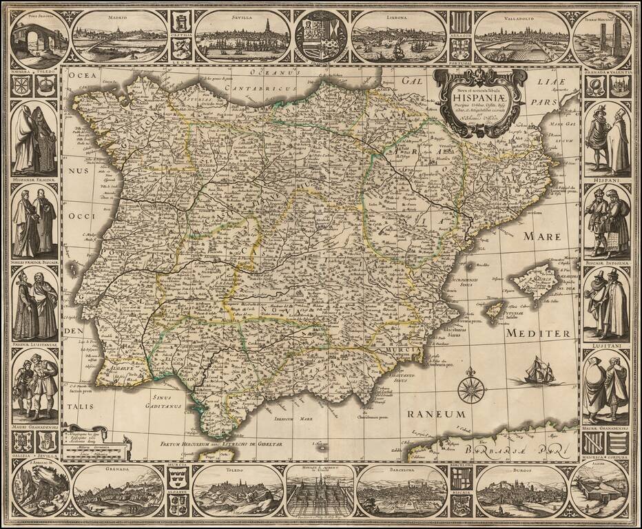
Rare separately issued map of the Iberian Peninsula, published in Amsterdam by Nicholas Visscher in 1660.
The map is embellished with city views across the top:
At the sides, the map is embellished with the indigenous costumes of different regions within Spain. The borders are also illustrated in the corners and elsewhere by scenes of famous places in Spain and the coats of arms of its major regions.
A fine dark impression of a rare carte-a-figures map of Spain.
If you are a student, write to us in telegram: @antiquemaps and indicate what material you need and for what work you need a map in high detail. We are ready to provide material on special terms. For students only!
![(Pro-Spanish Republic Political Broadside) [Lift The Embargo Against The Spanish Republic] President Roosevelt says . . .](/map/small/50218.jpg)

