Map size in jpg-format: 45.7624MiB
Click to open in high resolution (open in new tab).
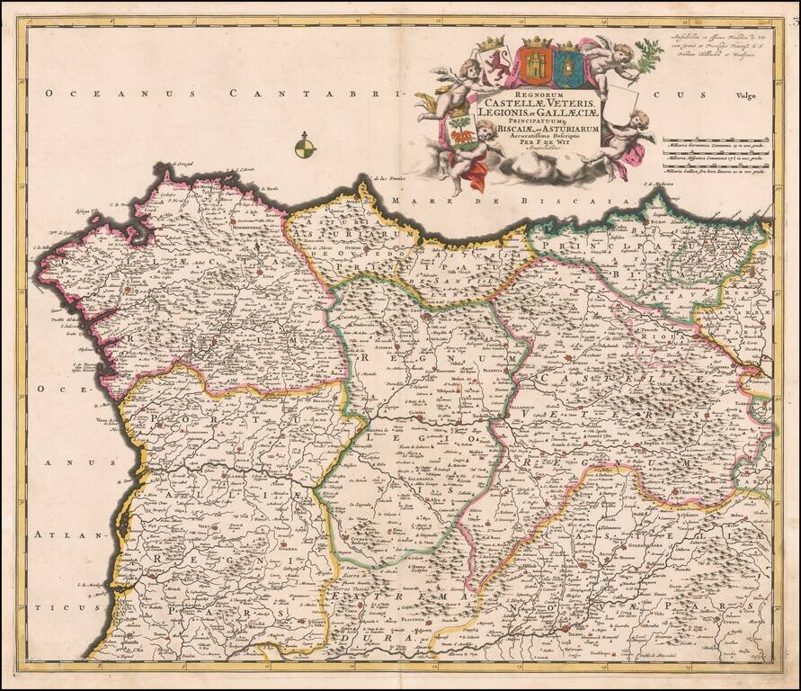
Decorative and highly detailed map of Northern Spain, extending from Galicia in the west to the Basque Country in the east.
Major cities include Bilbao, San Sebastian, Santiago di Compstella, Pontevedra, Finisterre, Coruña, Ferrol, Aviles, Oviedo, Leon, Astorga, Palencia, Burgos, Madrid, Toledo, etc.
Cartouche includes multiple coats of arms.
De Wit (1629 ca.-1706) was a mapmaker and mapseller who was born in Gouda but who worked and died in Amsterdam. He moved to the city in 1648, where he opened a printing operation under the name of The Three Crabs; later, he changed the name of his shop to The White Chart. From the 1660s onward, he published atlases with a variety of maps; he is best known for these atlases and his Dutch town maps. After Frederik’s death in 1706, his wife Maria ran the shop for four years before selling it. Their son, Franciscus, was a stockfish merchant and had no interest in the map shop. At the auction to liquidate the de Wit stock, most of the plates went to Pieter Mortier, whose firm eventually became Covens & Mortier, one of the biggest cartography houses of the eighteenth century.
If you are a student, write to us in telegram: @antiquemaps and indicate what material you need and for what work you need a map in high detail. We are ready to provide material on special terms. For students only!
![(Pro-Spanish Republic Political Broadside) [Lift The Embargo Against The Spanish Republic] President Roosevelt says . . .](/map/small/50218.jpg)

