Map size in jpg-format: 5.22955MiB
Click to open in high resolution (open in new tab).
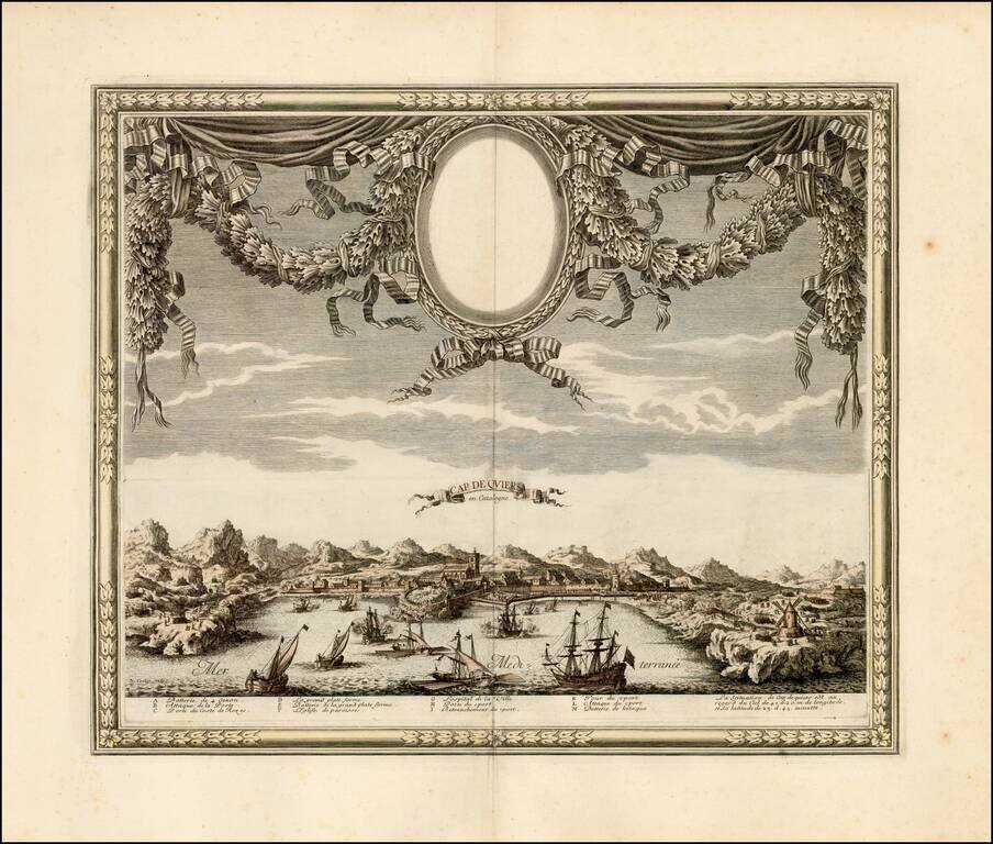
A rare view of Cadaqués by Sébastien Pontault de Beaulieu, depicting the action around the fortress of Cap de Quiers in Catalonia during the Franco-Spanish War.
Cadaqués is today one of the northernmost natural habors on the Catalan Coastline, just to the south of the border with France. It is one of the prime tourist sites of Catalonia, made famous as an artists colony in the early 19th Century. Salvador Dalí, Pablo Picasso, Joan Miró and Marcel Duchamp all spent significant amounts of time there.
During the Franco-Spanish War (1635-59), Spain and France contested their border along the Pyranees. Cadaqués, while only a small fishing port, occupied a strategic location just south of Cap de Creus, which lay between the southern end of the Gulf of Lions and the Costa Brava. As shown on this view, the French navy tried on several occasions to take the town, always unsuccessfully. While Spain was forced to concede significant amounts of territory in Northern Catalonia to France at the Treaty of the Pyranees (1659), Cadaqués remained a part of Spain.
The present view is by Sébastien Pontault de Beaulieu (c.1612-74), a prominent military engineer in the service of Louis XIV and highly talented artist of topographical views. His view of Salces was drafted while he served on the Catalan front during the war against Spain. Many of his views were engraved by Adam Perelle (1640-95), both before and after Beaulieu's death.
This view is from Beaulieu's Les plans et profils des principales villes et lieux considérables de la principauté de Catalogne…du comté de Roussillon, Conflant & Cerdagne (Paris, undated, but circa 1670), a rare work focusing on the Franco-Spanish War. Further views were posthumously published as part of Beaulieu's Les glorieuses Conquêtes de Louis-le-Grand, 2 vols. (1694).
Beaulieu's work is finely executed and is one of only the very few early views of Cadaqués.
If you are a student, write to us in telegram: @antiquemaps and indicate what material you need and for what work you need a map in high detail. We are ready to provide material on special terms. For students only!
![(Pro-Spanish Republic Political Broadside) [Lift The Embargo Against The Spanish Republic] President Roosevelt says . . .](/map/small/50218.jpg)

