logo

1587. Argentoratensis Agri Descriptio

  • Argentoratensis Agri Descriptio

Argentoratensis Agri Descriptio information:

Year of creation: 
Resolution size (pixels): 
 6470x7904 px
Disk Size: 
 15.142MiB
Number of pages: 
 1
Place: 
 Antwerp
Author: 

Print information. Print size (Width x height in inches):
Printing at 72 dpi 
  89.86 х 109.78
Printing at 150 dpi 
 43.13 х 52.69
Printing at 300 dpi 
 21.57 х 26.35

An example of detailing the file of this map of in a printable high-resolution:

Click to open in high resolution (open in new tab).
Attention! this is just the central piece (central area 960x960 px) of the map file!
This is an example, so that you can see and study the level of detail of a given map. The entire Map will be fully available after payment!

Argentoratensis Agri Descriptio

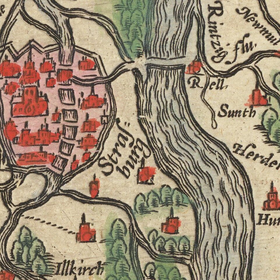
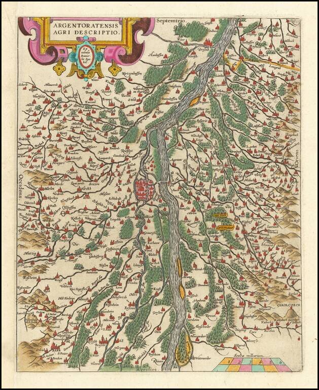
Fine old color example of this map of the Rhine, both south and north of Strasbourg, based on Daniel Specklin's three-sheet map of the Elzas of 1576.

From edition of Ortelius' Theatrum Orbis Terrarum, the first modern atlas of the World.

Van Den Broecke 112.

Special conditions for students!

If you are a student, write to us in telegram: @antiquemaps and indicate what material you need and for what work you need a map in high detail. We are ready to provide material on special terms. For students only!

Item information:

Year of creation:
Size:
6470x7904 px
Disk:
15.142MiB
Number of pages:
1
Place:
Antwerp
Author:
Abraham Ortelius.
$14.99

Related item